 New York
Noonmark Mountain
Introduction
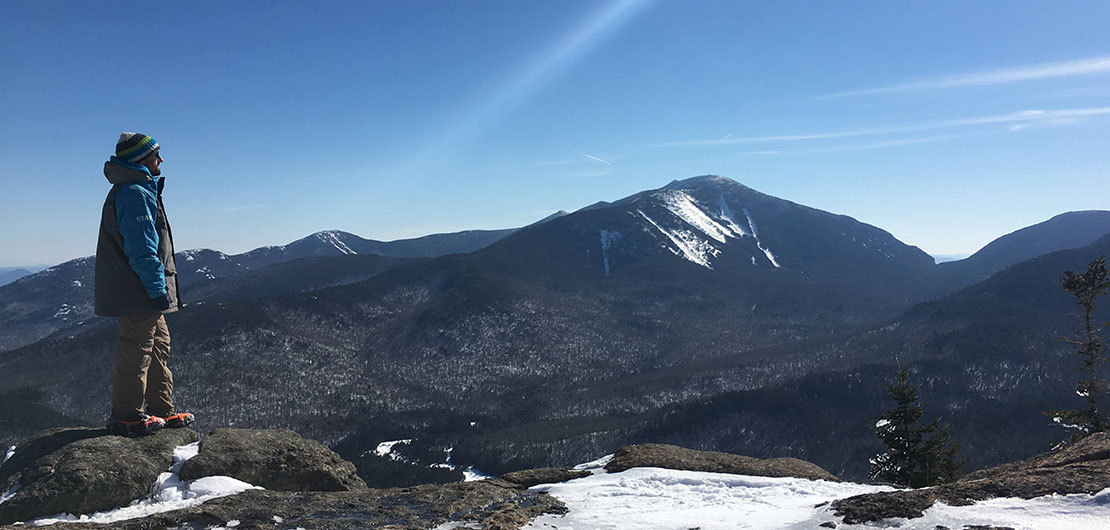
The summit of Noonmark Mountain offers a breathtaking view of the highest peaks of the Adirondacks. This little-known mountain has everything to please hikers: a well-marked trail, a reasonable distance and elevation, and superb views of the surrounding valleys and peaks. The name “Noonmark” is fitting, because sunlight hits the peak at midday.
C’est Notre Monde invites you to climb this 1084-meter-high (3556 ft) mountain to discover its rocky summit and 360-degree views of the most beautiful mountains in the region. This hike was a wonderful experience for us, so let’s get to the top!
3D interactive map
Things to Know
To enjoy your hike:
Be equipped: This hike requires sustained effort, so we advise you to take good hiking shoes. In winter, crampons and snowshoes will help you to reach the summit without much difficulty.
Be informed: There is no information office located at the start of the hike, just a register for hikers at the start of the trail. Find out about the weather and your itinerary in advance on the links we offer below.
Parking: The Ausable Club of the Adirondack Mountain Reserve is the starting point for many hikes in the valley and parking is free. While, this is a large parking lot, we arrived late in the day and had to wait for a vacancy. We advise you to arrive early!
The Hike
Once parked, go up the road to the Ausable club, about 600 meters (0.37 miles). On your left, you will see a sign indicating Noonmark Mountain as well as the hiker register. Take the path called “Old Dix Trail”. You will pass charming mountain chalets before quickly sinking into the woods. The trail is very well marked and will climb quickly. After about 850 meters (0.53 miles), you will find yourself at an intersection indicating Noonmark on the right and Dix Mountain on the left. Follow the right path for Henry Stimson Trail.
During your ascent, there are many openings in the trees that offer fantastic views of the surrounding landscapes, especially the superb Giant Mountain. In 1.5 km (0.93 miles) you will find yourself walking along a cliff, with a grand view of the neighboring peaks including Upper and Lower Wolfjaw. Once you reach the summit of Noonmark, you can enjoy a 360-degree panorama of the High Peaks region that includes, Giant, Dix Mountain, Nippletop and Gothics.
Tip: Arrive early to secure a parking space (summer and winter). If you are looking for a short, uncrowded and unique hike, Noonmark is for you. Definitely a favourite for C’est Notre Monde
Take the time to enjoy this impressive and unique view before starting your descent, you’ve earned it! For the descent, we would suggest that you make the loop by the Félix Adler Trail. The descent is quite steep on certain passages so take your time. After 1.4 km (0,87 miles) you will find yourself at an intersection with 3 trails. Take the one on the left (Old Dix Trail) indicating the parking lot, 3.3 km (2 miles) further. This final stretch is rather flat and can be covered quickly before finding yourself back to where we started.
TO KNOW
Interest
Difficulty
Distance
8.9 km / 5.5 miles (loop)
Duration
4 h
Elevation
1084 meters / 3556 feet
Height difference
750 meters / 2460 feet (loop)
Useful informations
The hike in 3D
See on Caltopo (detailed)
See on Google Maps (basic)
Useful links
Website: https://www.dec.ny.gov/lands/98402.html
Parking: https://goo.gl/maps/bKNSuHpv6hDkpv1j6
Weather forecast: https://www.mountain-forecast.com/peaks/Noonmark-Mountain/forecasts/1084