 Alberta
Gap Peak
Introduction
Looking for an adventure at the doorstep of the Canadian Rockies? Explore the breathtaking summit of Gap Peak, towering at 2517 meters! Nestled in the Bow Valley Provincial Park, at the heart of Kananaskis Country, this mountain invites you to conquer its steep trails, rugged scree slopes, and dizzying ridge. With intermediate scrambling and a challenging hike, Gap Peak in the Canadian Rockies offers a unique experience. Discover all the essential tips to appreciate this unforgettable adventure at Gap Peak.
3D interactive map by our partner FATMAP – the outdoor adventure platform for web and mobile
Getting to Grotto Canyon trailhead
Parking access to Gap Peak hike: https://maps.app.goo.gl/GV3Z73Jf21vtucic8
From Calgary: 90 km – 1h driving time
Take the Trans-Canada hwy AB-1 West toward Banff until exit 114 toward Exshaw. Follow the AB-1X North for 3.5km until the road ends. Turn left toward the Rockies and follow the AB-1A for 10.8km. A sign will indicate the “Grotto Pond” parking area on your right.
Helpful information
To enjoy your hike, you must:
Be Equipped: Hiking boots are a necessity. A steep section of this hike (easy scramble) requires ankle protection. Hiking poles are also recommended on your way down. Bears are present in the area, therefore bear spray should be easily accessible in the case of unexpected encounters. Finally, always bring water and food in sufficient quantities.
Parking: Parking is located at “Grotto Pond” on the AB-1A. The parking lot is large and free.
Information: Access to Kananaskis Country is not free. You will need to register your vehicle(s) online on the Kananaskis Park website and purchase a daily or annual pass. Note that the fees are per vehicle and not per hiker, so carpooling is an option. Be mindful of the forecast and visit the park’s website before your hike to find up-to-date information such as last seen wildlife, trail conditions, etc.
The Hike
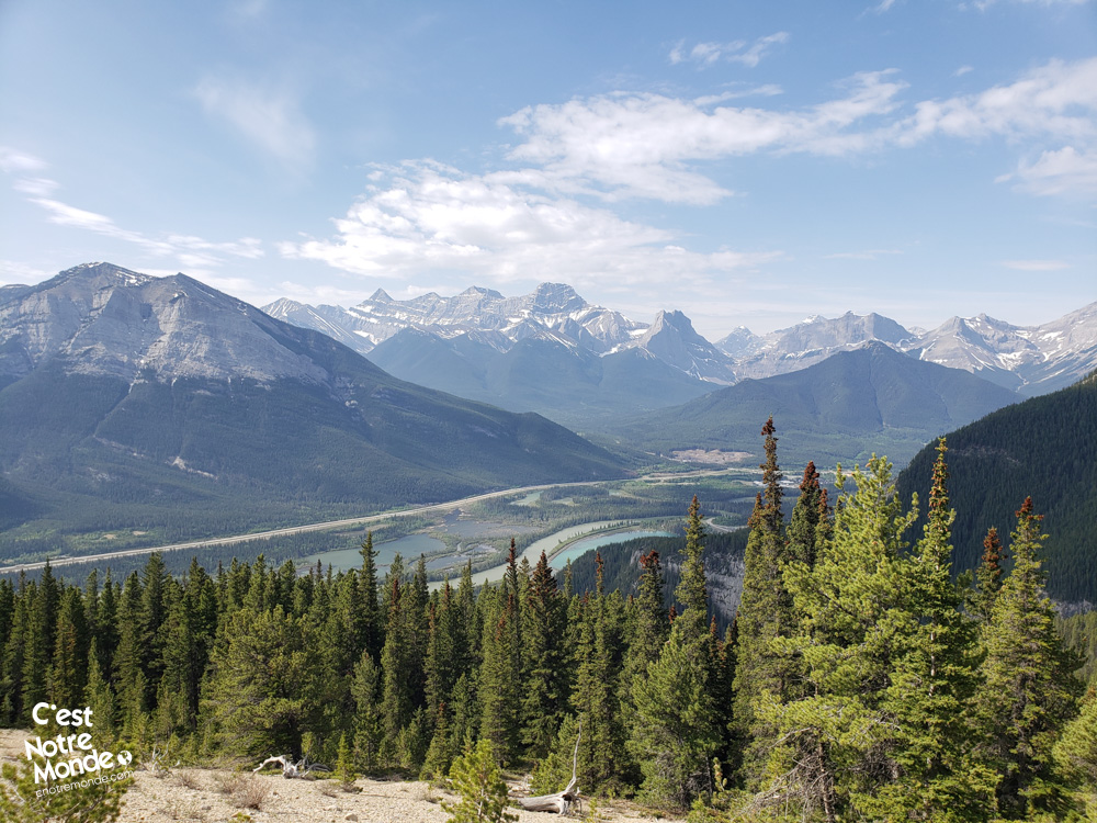
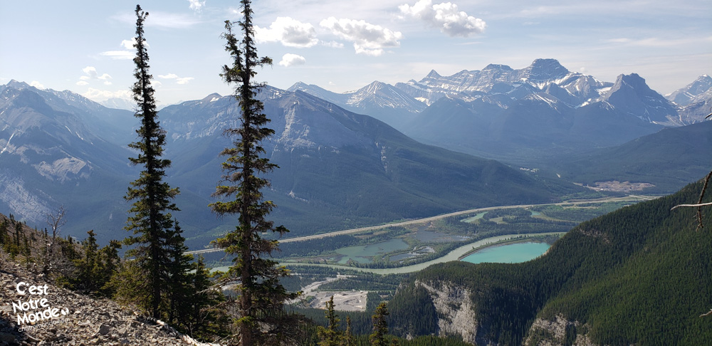
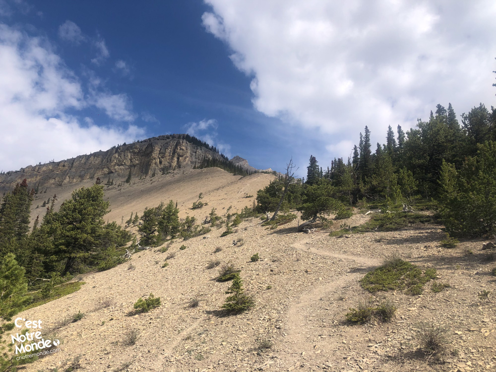
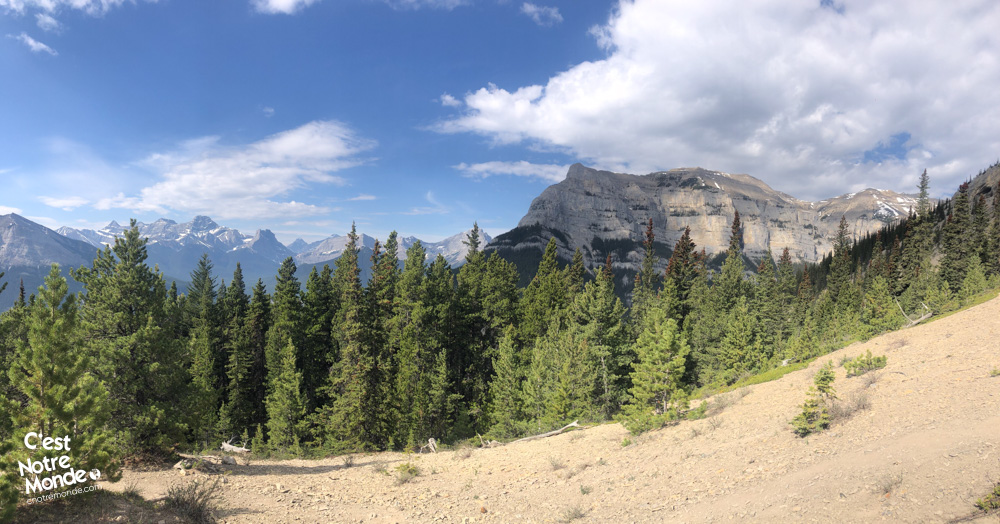
Embark on the Gap Peak hike by starting on the Grotto Canyon trail leading to the Baymag plant, a magnesium oxide extraction site. After 450 meters (0.3 mi), a large open space appears on your right; pass the access barrier and move closer to the forest. The trail to the summit of Gap Peak is identifiable by a rock marked “GP” at its beginning! Follow this well-marked forest trail for about 2 km (1.2 mi) with an elevation gain of 600 meters (1971 ft). Although the noise from the plant briefly disrupts the immersion in nature, it quickly dissipates. Upon exiting the forest, you’ll discover the first panoramic view of the Bow Valley and the surrounding peaks.
Gap Peak is a 2517-meter-high mountain located in Bow Valley Provincial Park in Kananaskis Country (Alberta).
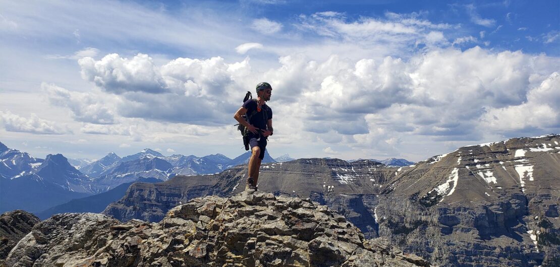
Continue along the trail, gradually approaching a cliff. Wear a helmet from this point onward. Follow the cliff for about 100 meters, then re-enter the forest. Next, traverse a very steep section to reach a promontory with a beautiful view of the valley. Proceed along another cliff to reach a section of steep scree, challenging due to the instability of the rocks. Take your time, and watch for rock falls.
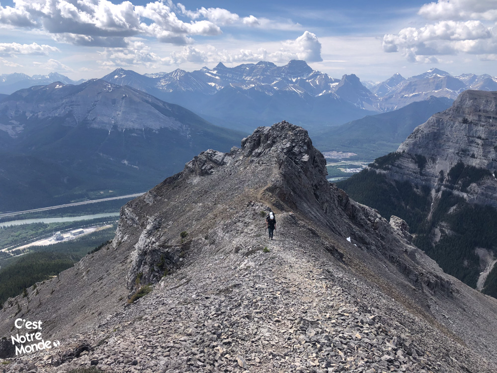
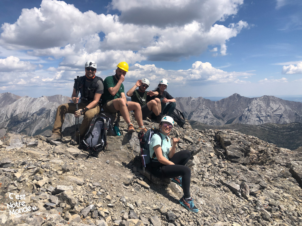
Hiking Gap Peak involves some scrambling and a slightly exposed ridge.
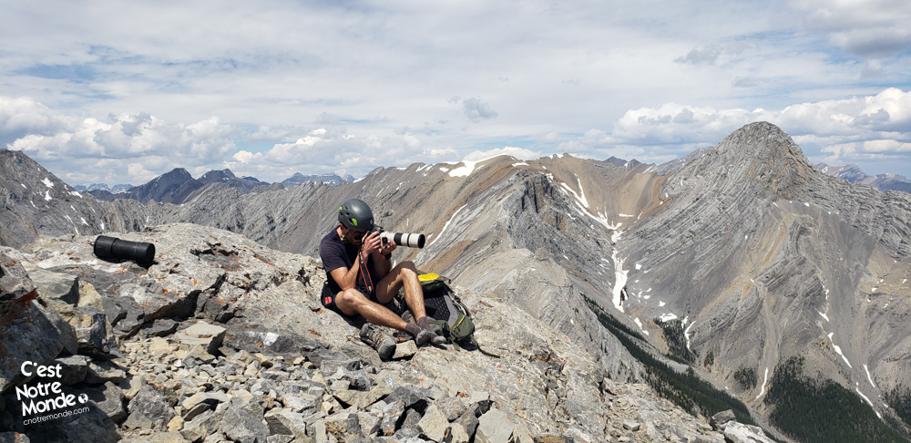
At the top of this long and strenuous scree section (visible from the Trans-Canada Highway), engage in an easy scrambling (where you need to use your hands) to reach the ridge of Gap Peak. At this point, you’ve already climbed 1000 meters in elevation over about 3 km. All that’s left now is to walk along the ridge to the summit (approximately 650 meters – 0.4 miles). This ridge may be intimidating for those afraid of heights, so take your time and enjoy the views!
Gap Peak is an easy scramble but a difficult hike. Do not underestimate it!
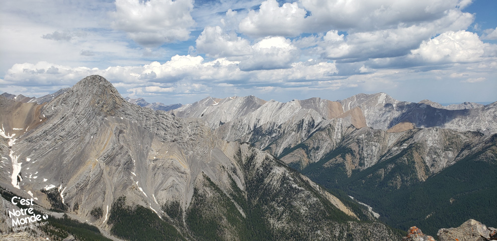
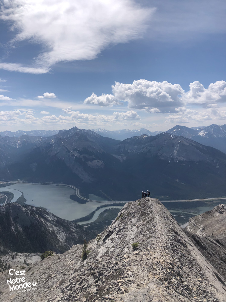
At 2517 meters, reach the summit of Gap Peak with a panoramic view, including Grotto Mountain, Heart Mountain, Big Sister, and much more. Bid farewell to the factory, hidden behind the ridge, and finally embrace the true feeling of Nature!
Gap Peak summit offers a panoramic view on the region and surrounding mountains such as Grotto Mountain, Big Sister and Heart Mountain.
For the return, retrace your steps. Avoid venturing east of the summit, as it leads to difficult terrain off the beaten track. C’est Notre Monde took that path, requiring bushwhacking to find the official route—strongly not recommended despite appearances on several online maps.
TO KNOW
Interest
Difficulty
Distance
Approximately 8.3 km / 5.2 miles
Duration
Around 5 or 7 hours
Elevation
2517 meters / 8258 feet
Elevation gain
Around 1160 meters / 3805 feet
Useful informations
See on Caltopo (detailed)
See on Google Maps (basic)
Useful links
Website: https://www.albertaparks.ca/parks/kananaskis/kananaskis-country/
Parking: https://maps.app.goo.gl/GV3Z73Jf21vtucic8
Weather forecast: https://www.mountain-forecast.com/peaks/Mount-Fable/forecasts/2702
Download GPX: https://www.cnotremonde.com/gpx/Gap-Peak-AB-cestnotremonde.gpx