 Alberta
Mount Allan
Introduction
Considered one of the most beautiful hikes in the Kananaskis Region of Alberta, Mount Allan via Centennial Ridge has many surprises. To reach the 2819-meter-high summit of Mount Allan, you will make your way up Olympic Summit, walk a panoramic ridge, explore an unusual rocky environment inhabited by furry creatures, and finally scramble to the top of a breathtaking viewpoint. This extraordinary hike is difficult but its beauty is worth all the effort. Don’t wait any longer and go explore one of the most stunning hikes this region has to offer.
3D interactive map
Getting to Evan-Thomas Provincial Recreation Area
Parking access to Mount Allan hike: https://goo.gl/maps/uRQouDcE2jErjw1d6
From Calgary: 100 km – 1h15 driving time
Take the Trans-Canada hwy AB-1 West toward Banff for 50 km until the 118 exit toward Kananaskis Country. Follow the AB-40 South for 25 km. Turn right toward Kananaskis village or Nakiska Ski Station. Turn left on Centennial Drive and then a quick right on Ribbon Creek Road. The parking lot is located 600 meters further on, at the end of the road.
Helpful information
To enjoy your hike, you must:
Be Equipped: Hiking boots are a necessity. A steep section of this hike (easy scramble) requires ankle protection. Hiking poles are also recommended on your way down. Bears are present in the area, therefore bear spray should be easily accessible in the case of unexpected encounters. Finally, always bring water and food in sufficient quantities. The parking lot is quite large and located at the Ribbon Creek Day Use Area, which is the departure point for many hikes.
Parking: Mount Allan trailhead
Information: Access to Kananaskis Country is not free. You will need to register your vehicle(s) online on the Kananaskis park website and purchase a daily or annual pass. Note that the fees are per vehicle and not per hiker, so carpooling is an option. Be mindful of the forecast and visit the park’s website before your hike to find up-to-date information such as last seen wildlife, trail conditions, etc.
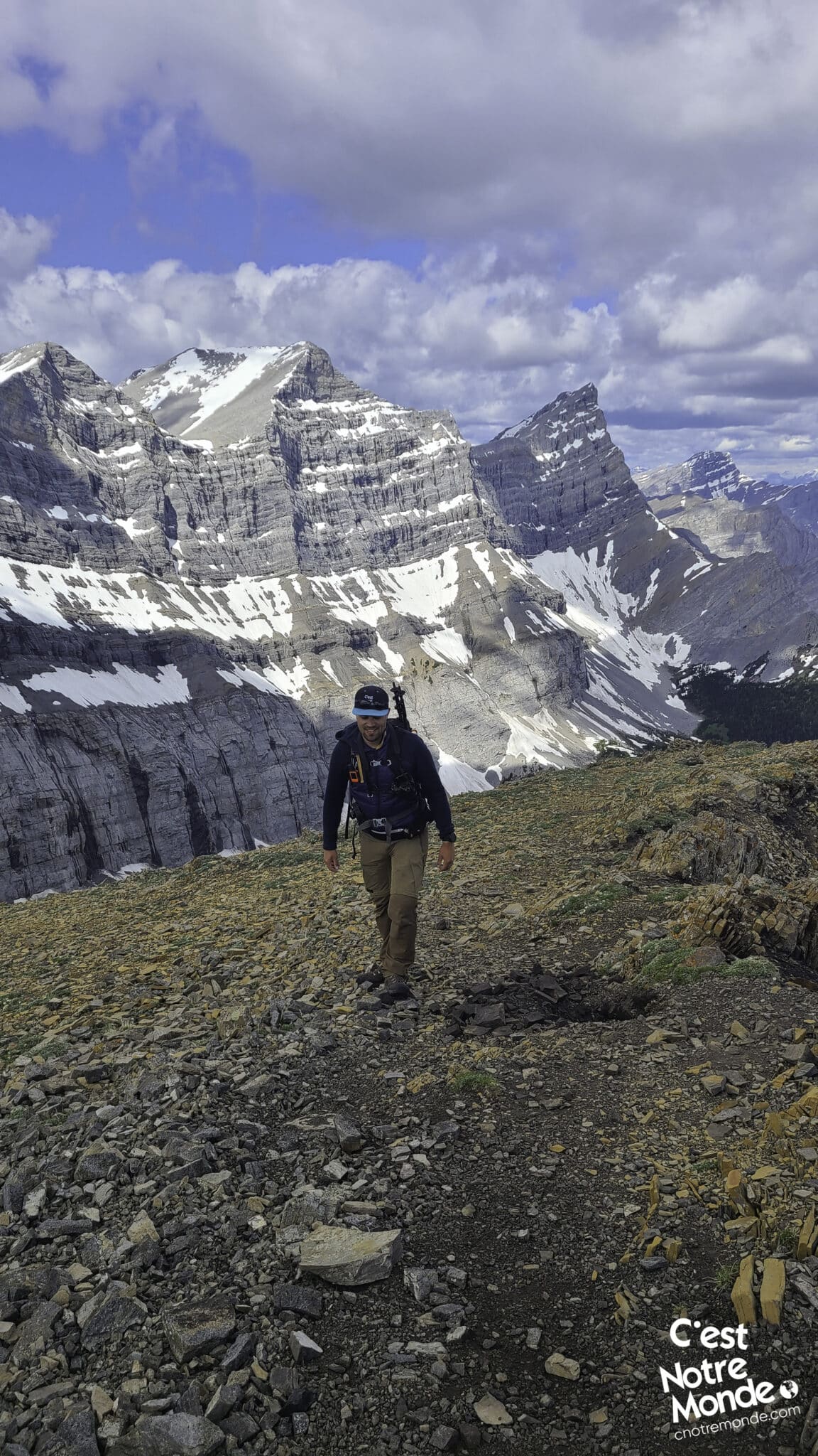
The Hike
When you enter the parking lot the trail head for Mount Allan is located on the right hand side not to be confused with the trail head at the end of the parking lot which is the departure point for many other hikes. You will take this forestry road and turn left in about 400 m, at the first intersection. At the second intersection continue straight (a sign will indicate “Centennial Ridge”). This trail will begin to climb and continue that way until you reach Olympic Summit, 4km (2.6 mi) further.
Mount Allan is a difficult but popular hiking experience located in the Kananaskis region, in Alberta.
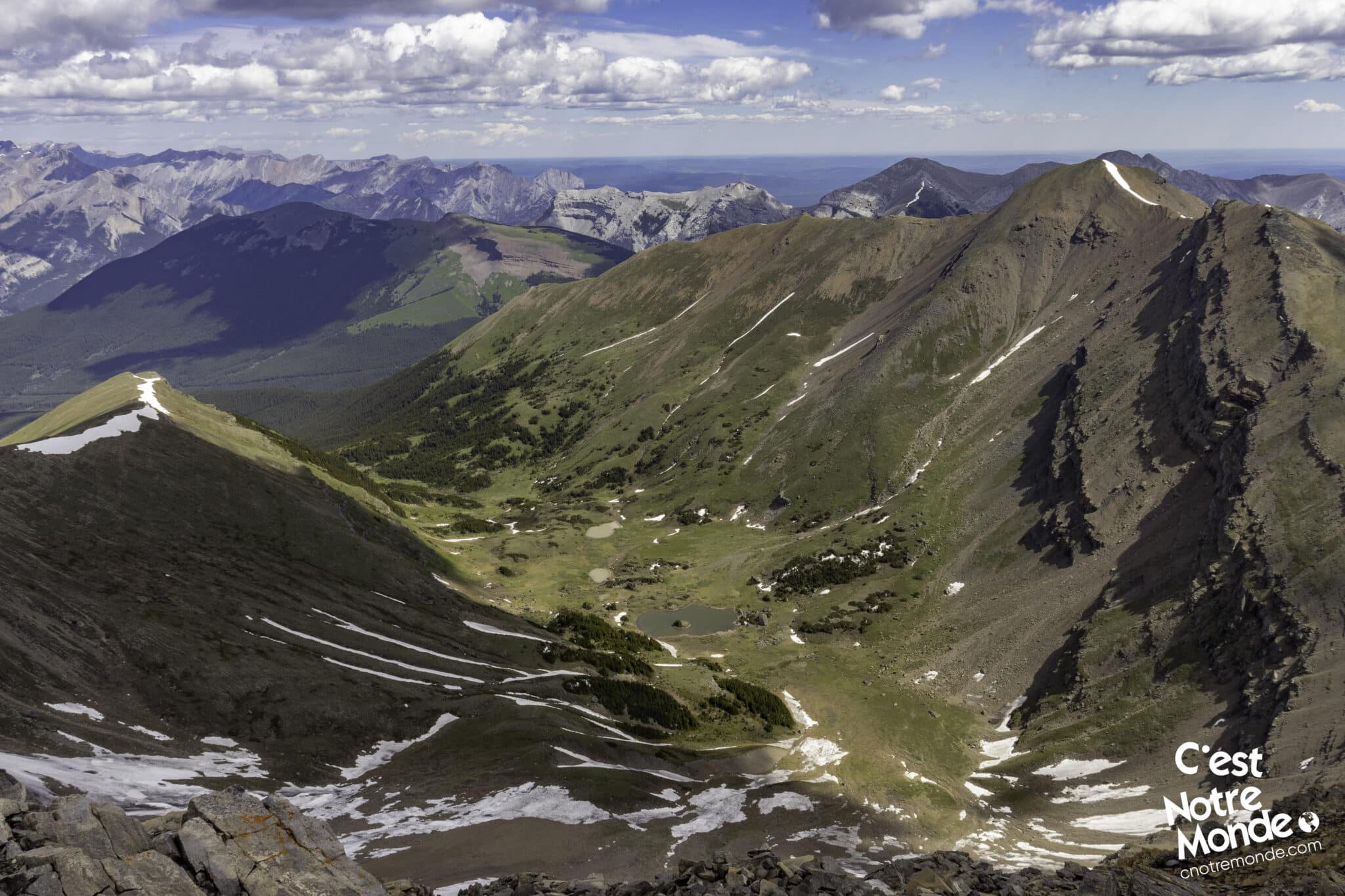
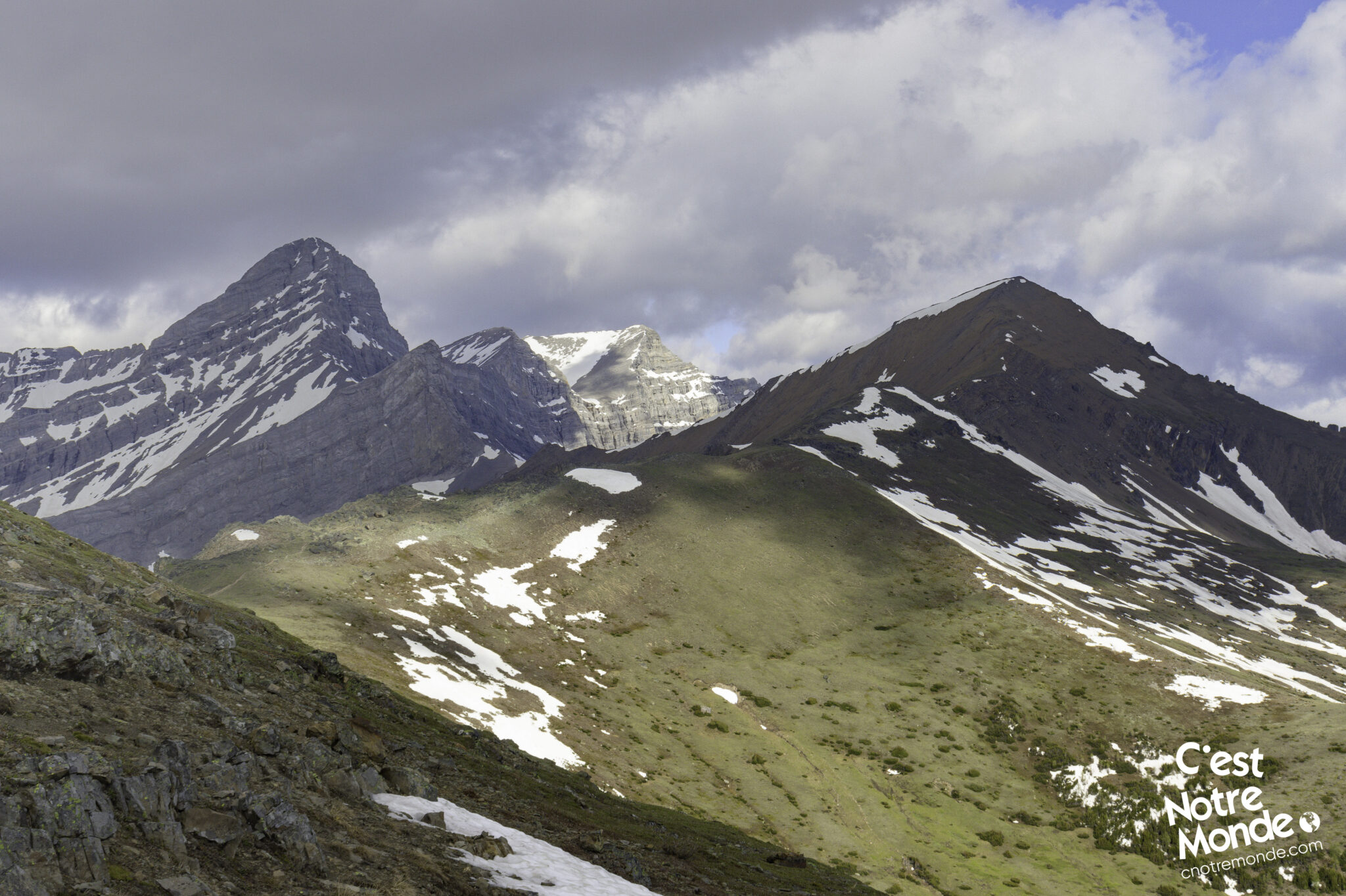
Little by little, you will pass the tree line and begin to appreciate the view. In spring and summer, the trail is surrounded by Prairie grass and colourful wild flowers. A beautiful sight! After 920 m of hiking on a well maintained trail, you will finally reach Centenial Ridge and the Olympic Summit (2470 meters-high). A big part of the ascent is now complete but you still have 2.7km to go and 400 meters to climb to reach the summit of Mount Allan.
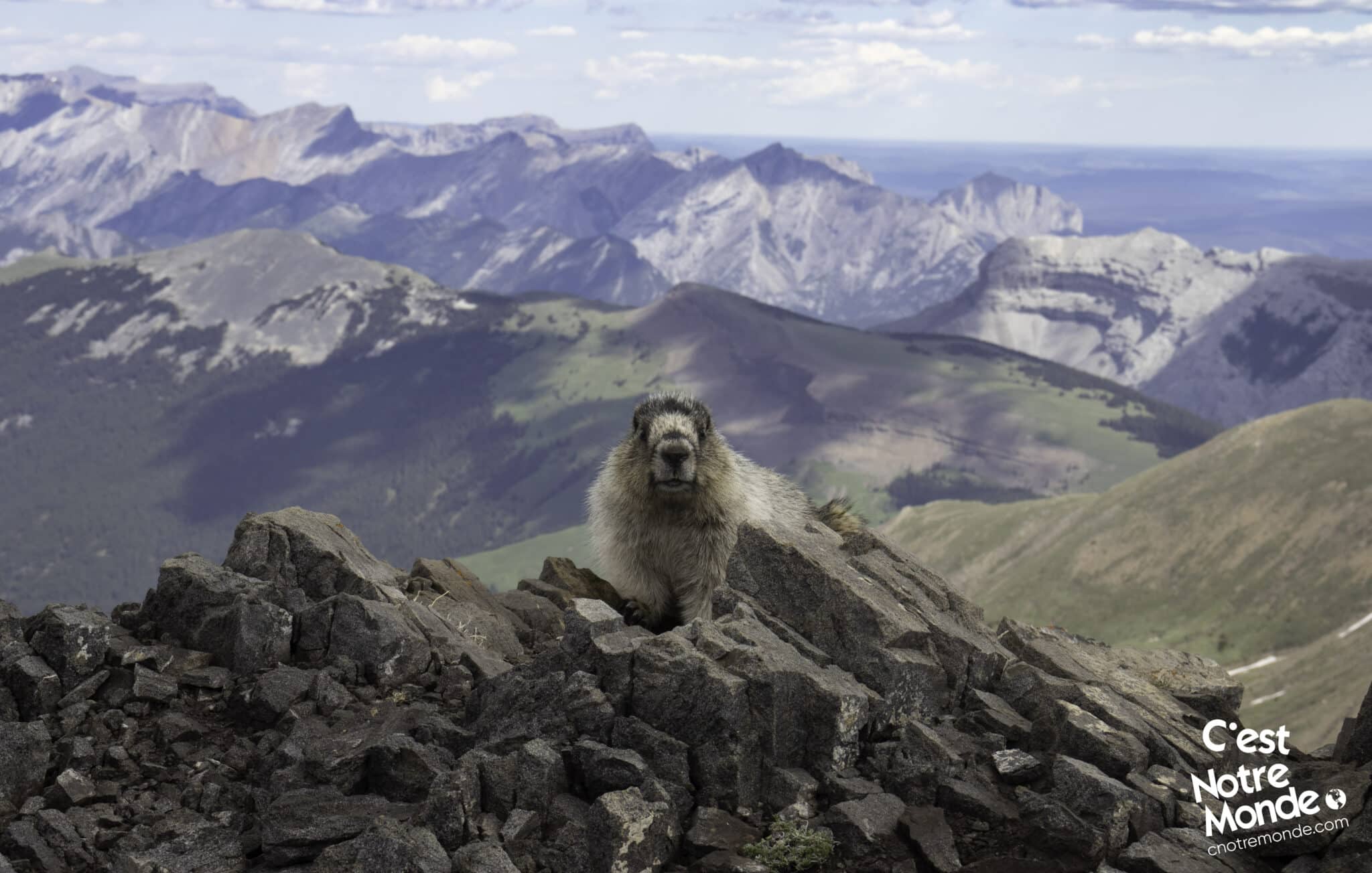
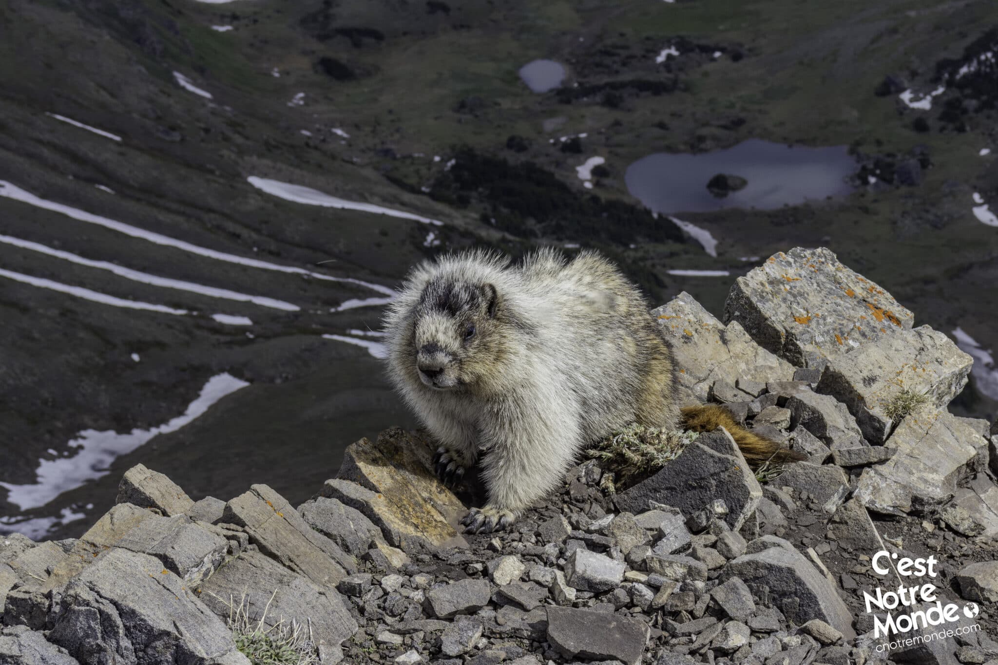
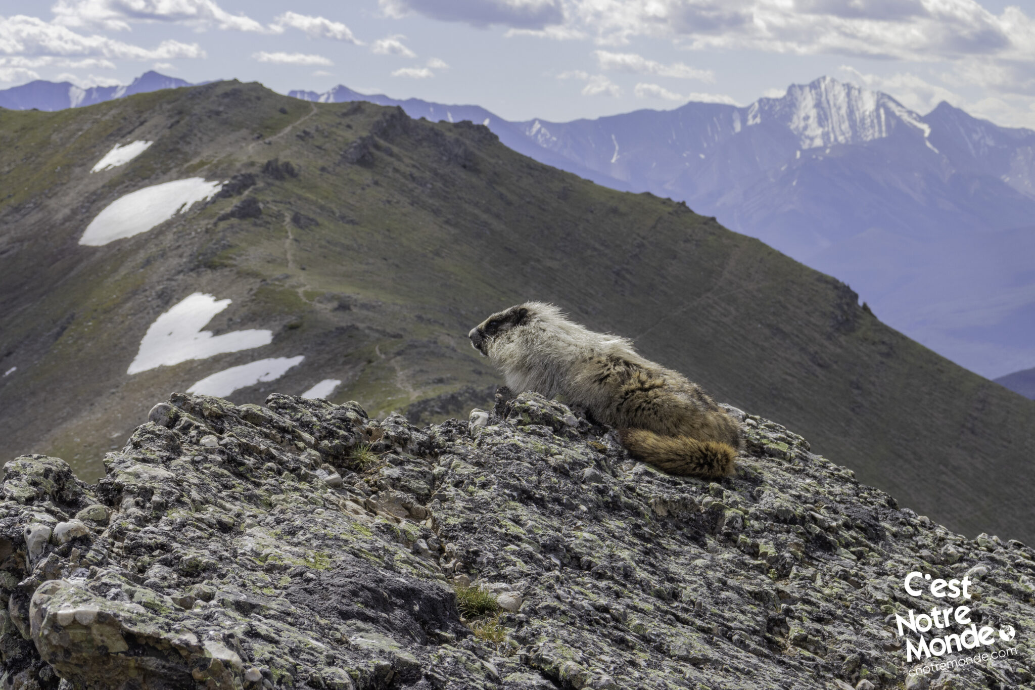
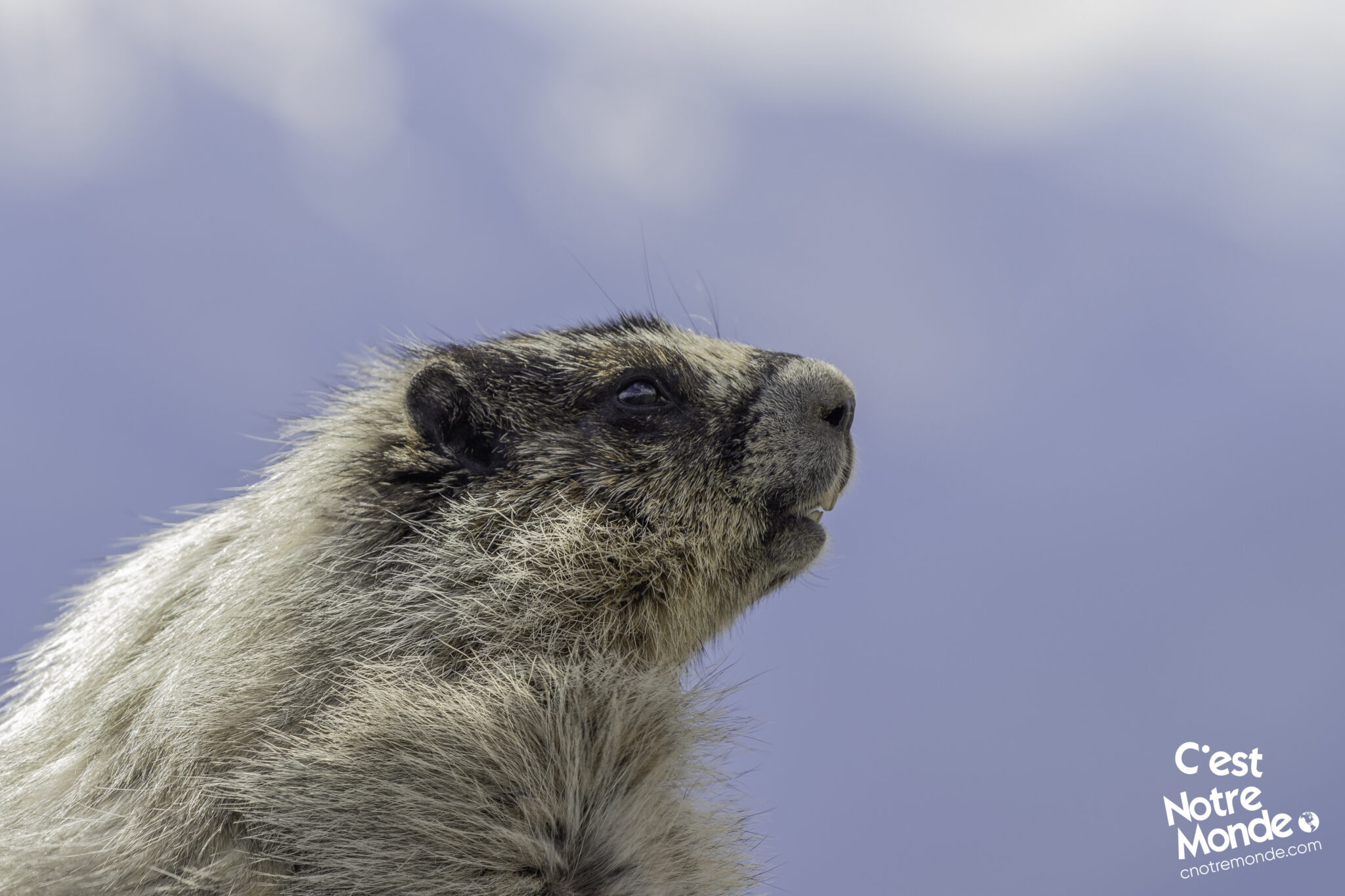
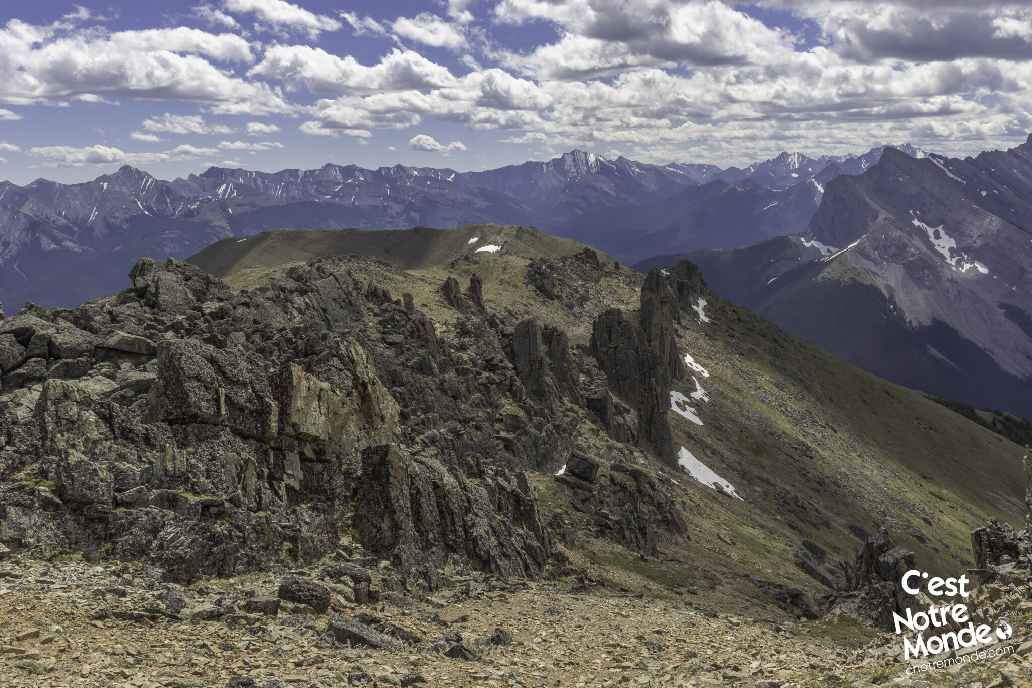
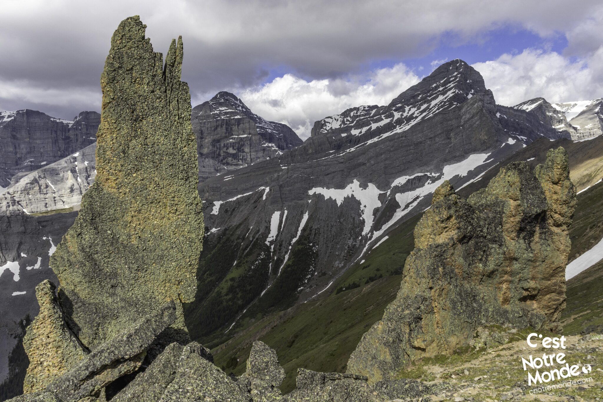
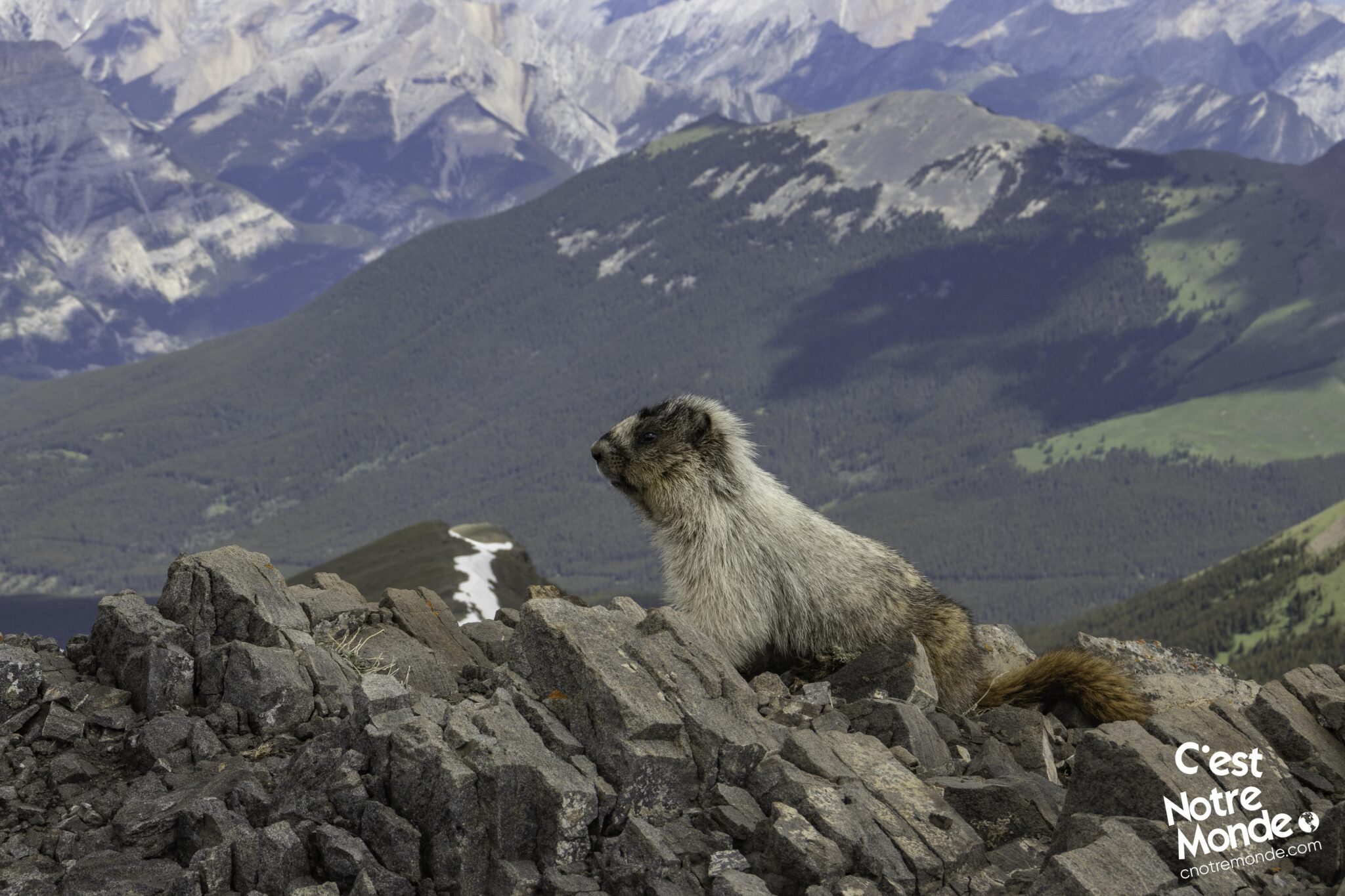
You will start a small descent while following the ridge and will arrive at a very unique and surprising area called the “Mushroom Garden”. An area with large rock formations jutting out of the ground, giving the impression of a natural wall. This section is a smooth part of the hike and will require a short and easy scrambling toward its end. You will also note that this place is inhabited by many marmots. Do not feed them! We were surprised how comfortable these little guys were with humans. They approached very closely to ask for food. This unnatural behavior should not be encouraged.
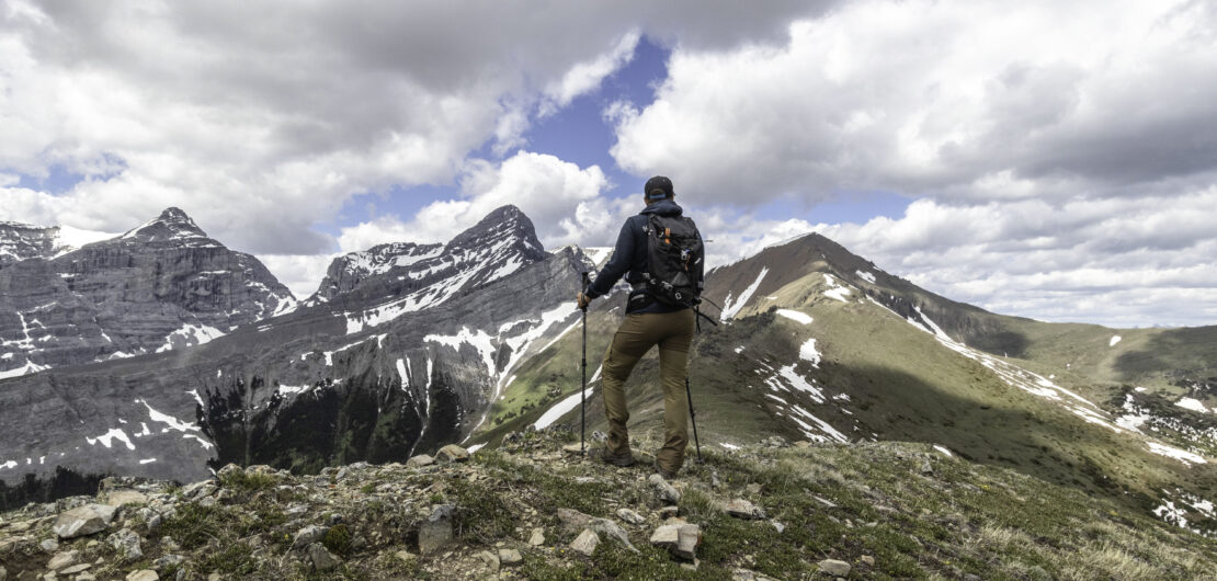
Mount Allan is a unique hike taking you across a panoramic ridge all the way to a breathtaking summit.
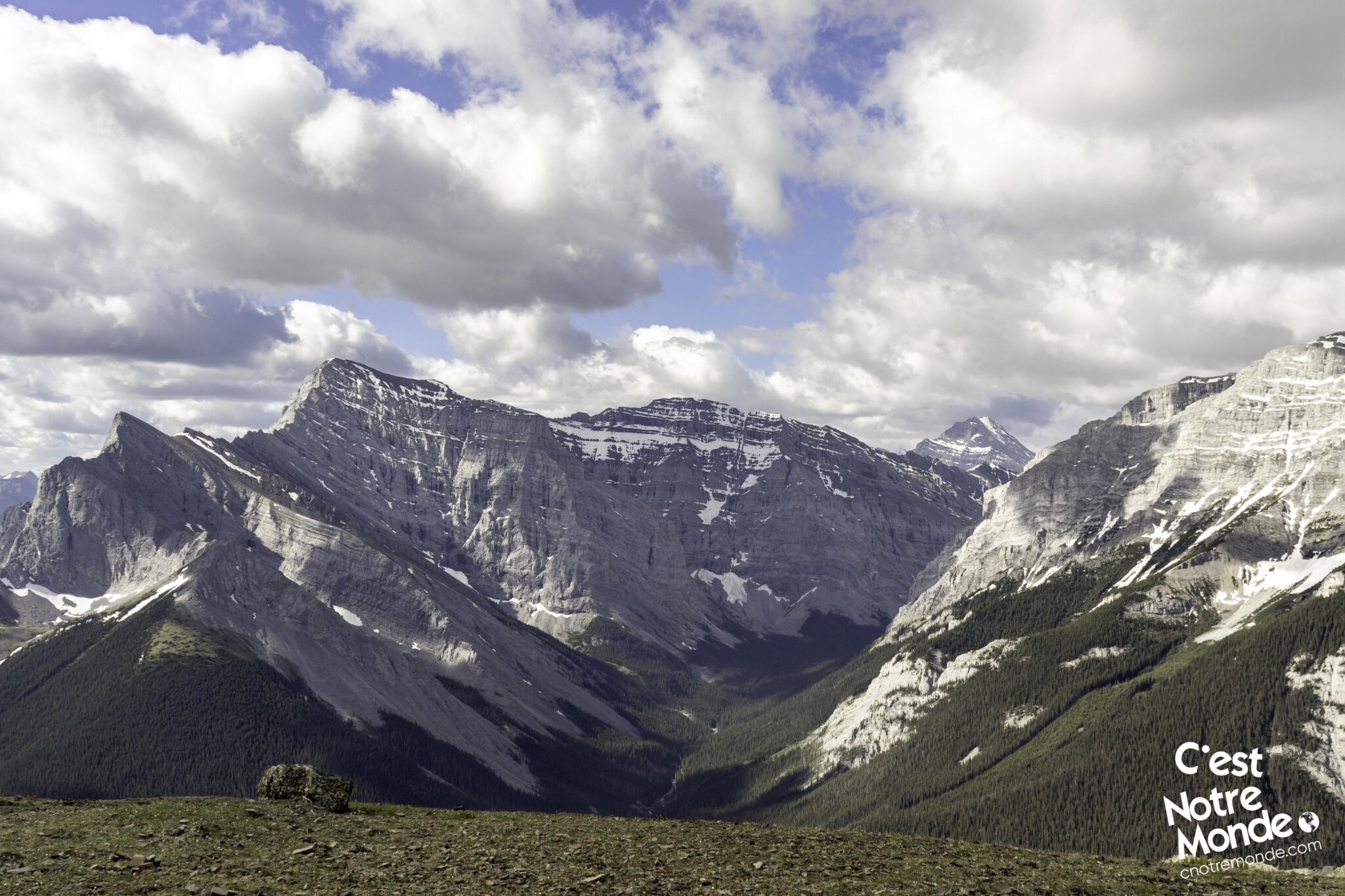
After the Mushroom Garden, your final objective will be just in front of you. This last section is made up of scree and while it is not technically difficult it can be tiring. Your effort will be rewarded, however, at the summit of Mount Allan, 2819 meters-high! With a 360° view, you can see Wasootch Peak, Big Sister, Sparrowhawk, Mount Kidd and even the city of Canmore. A real balcony view of the region.
TO KNOW
Interest
Difficulty
Distance
Approximately 17 km / 10.5 miles
Duration
Around 6 or 8 hours
Elevation
2819 meters / 9249 feet
Elevation gain
Around 1420 meters / 4658 feet
Useful informations
See on Caltopo (detailed)
See on Google Maps (basic)
Useful links
Website: https://www.albertaparks.ca/parks/kananaskis/kananaskis-country/
Parking: https://goo.gl/maps/uRQouDcE2jErjw1d6
Weather forecast: https://www.mountain-forecast.com/peaks/Mount-Allan/forecasts/2819
Download GPX: https://cnotremonde.com/gpx/Mount-Allan-AB-cestnotremonde.gpx