 Alberta
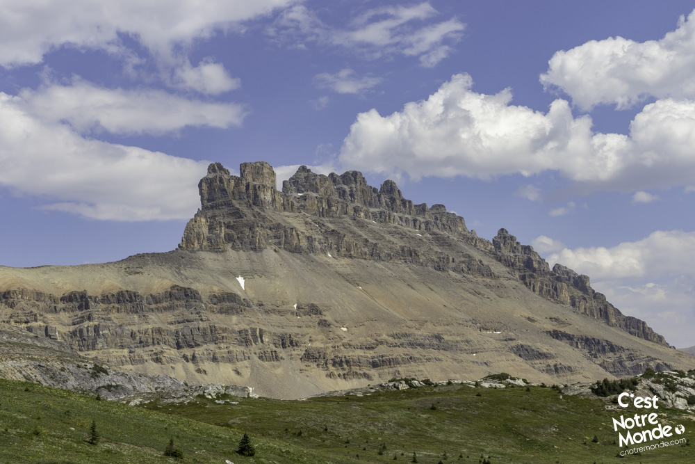
Cirque Peak
Introduction
Cirque Peak is a 2993-meter-high mountain located on the Icefields Parkway in Banff National Park, Alberta. On the way to the top, you will discover the magnificent Helen Lake, worth the hike on its own. Beware, this adventure in meadows full of wild flowers is quite long, but promises unique landscapes and breathtaking views. C’est Notre Monde has once again fallen in love with a mountain, right in the heart of the Canadian Rockies. So continue reading to enjoy this hike to the fullest!
3D interactive map
Getting to Helen Lake trailhead
Parking access to Cirque Peak hike: https://goo.gl/maps/TLk4kzAWvgCH93896
From Calgary: 220 km – 2h20 driving time
Take the Trans-Canada hwy AB-1 West toward Banff for 176 km until the AB-93N exit toward Jasper. You will pass through the Icefield Parkway gate (there is a toll). You do not have to pay if you have already purchased a National Park permit (yearly or daily). Follow the Icefield Parkway for 33 km until you reach the Helen Lake parking lot (there is a sign), right in front of Bow Lake.
Helpful information
To enjoy your hike, you must:
Be Equipped: Hiking boots are a necessity. A steep section of this hike (easy scramble) requires ankle protection. Hiking poles are also recommended on your way down. Bears are present in the area, therefore bear spray should be easily accessible in the case of unexpected encounters. Finally, always bring water and food in sufficient quantities.
Information: Access to Canadian National Parks is not free. You can either take a daily or annual pass. At the entrance to Banff National Park, there will be a toll on the highway where you can purchase a pass, if you do not have one already.
The Hike
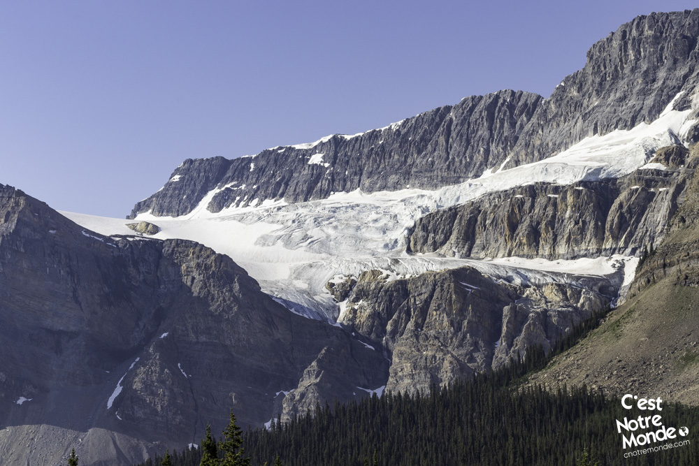
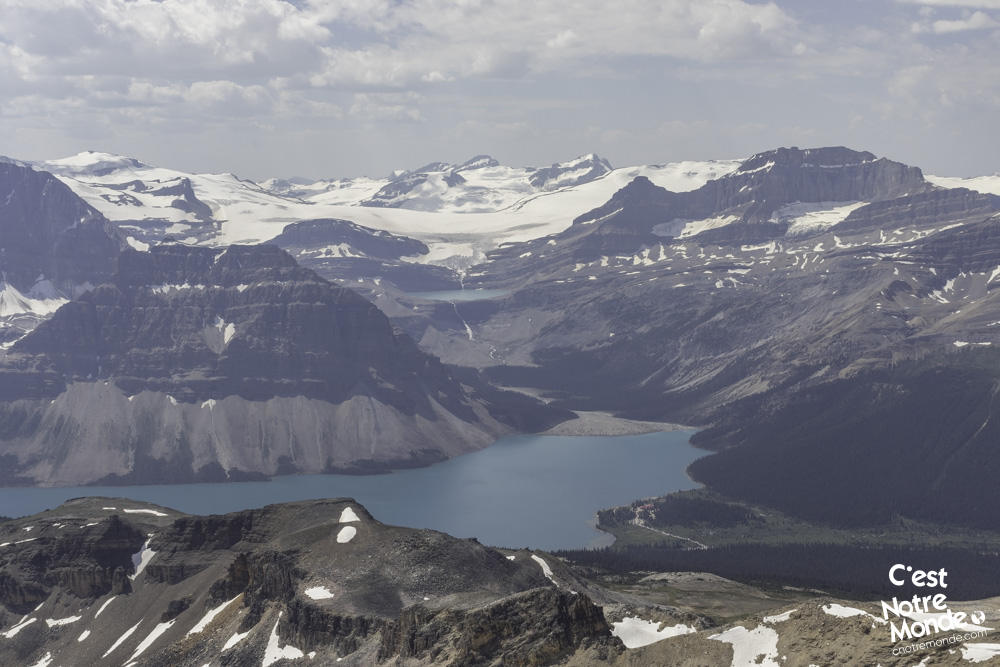
Follow the path into the forest and continue on this trail for 3.2km (2 mi) as it takes you around Crystal Ridge mountain. You will gain about 320 m of elevation (1040 ft) and enjoy some great openings through the trees with views of Bow Lake and the famous glaciers overlooking it. A gradual but constant slope will allow you to quickly cover this section.
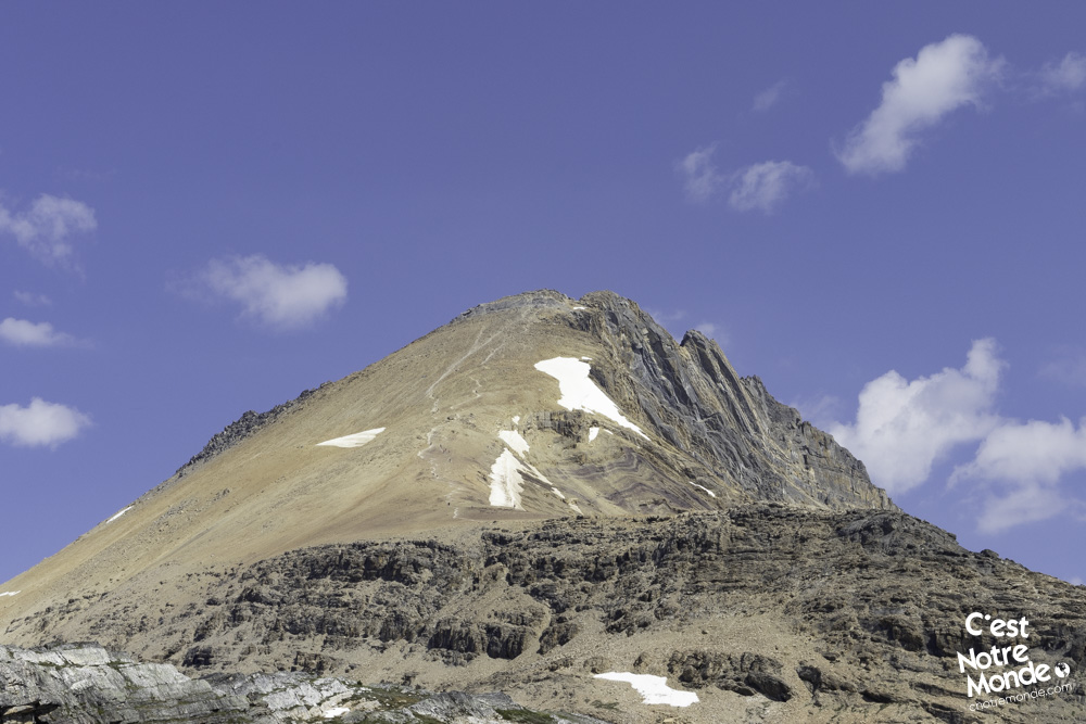
Cirque Peak is a 2993-meter-high mountain located in Banff National Park, Alberta.
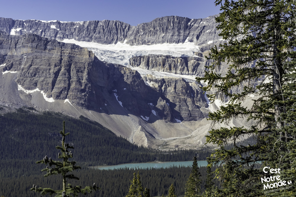
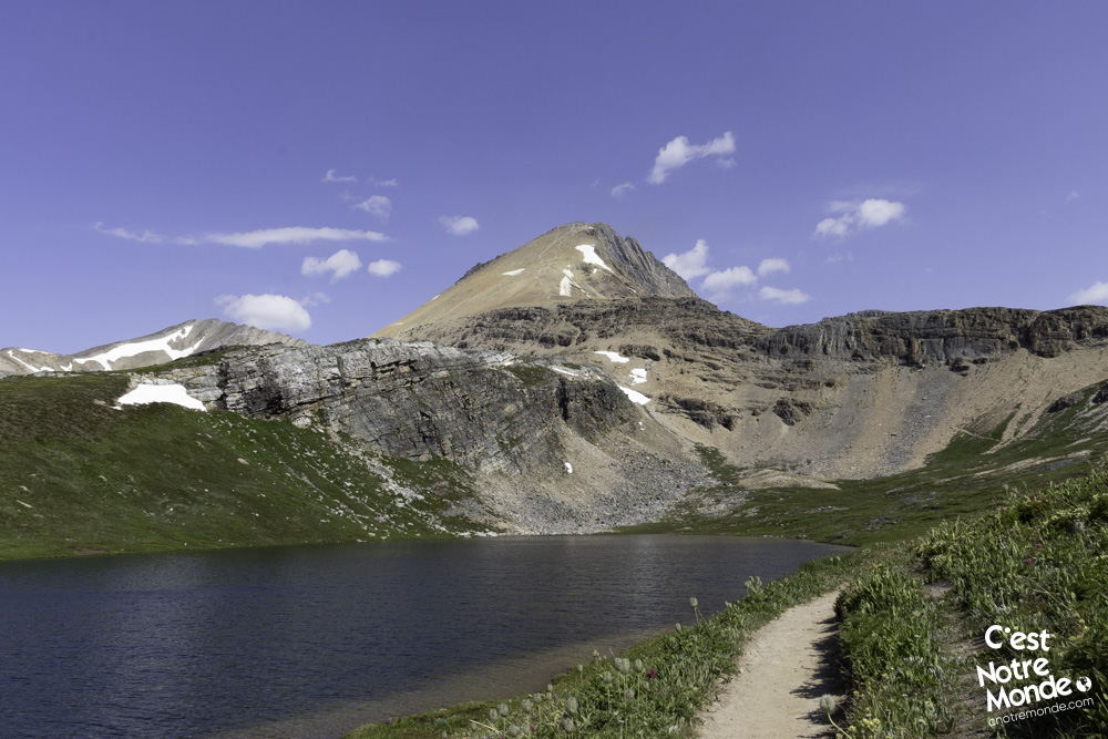
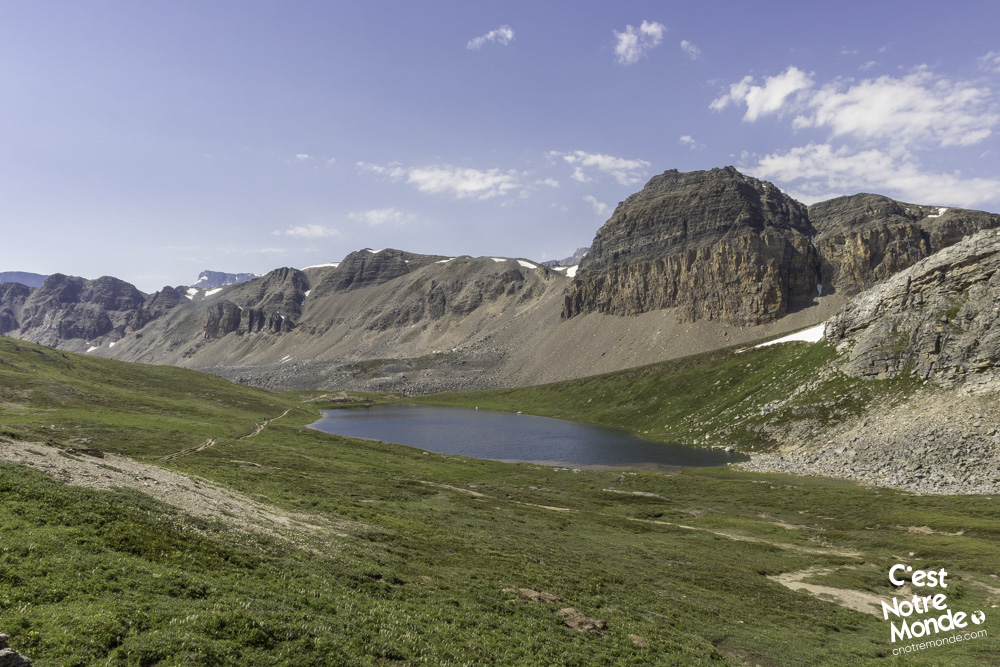
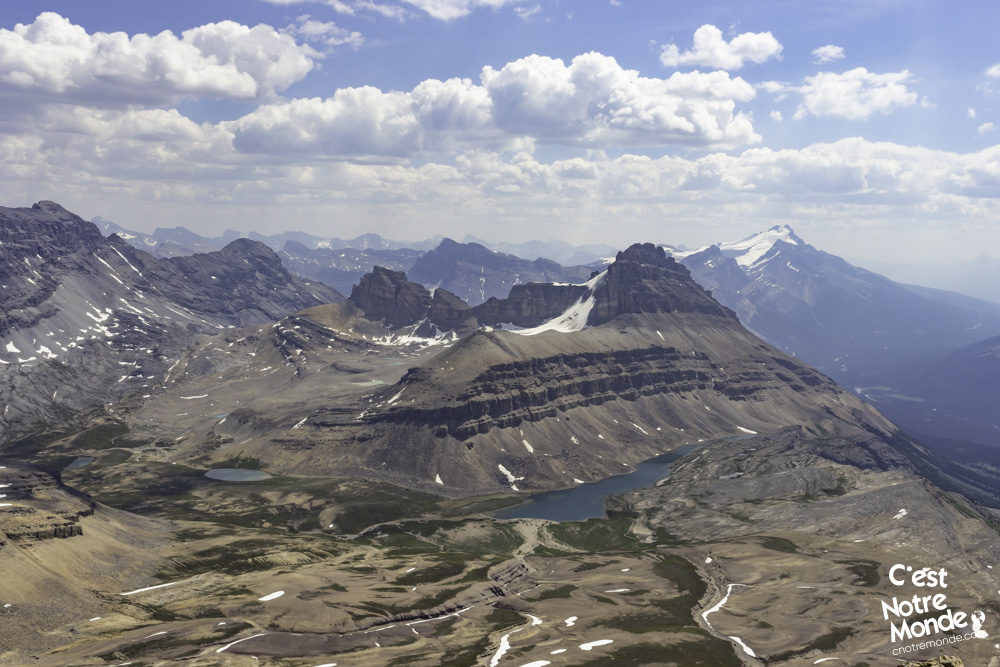
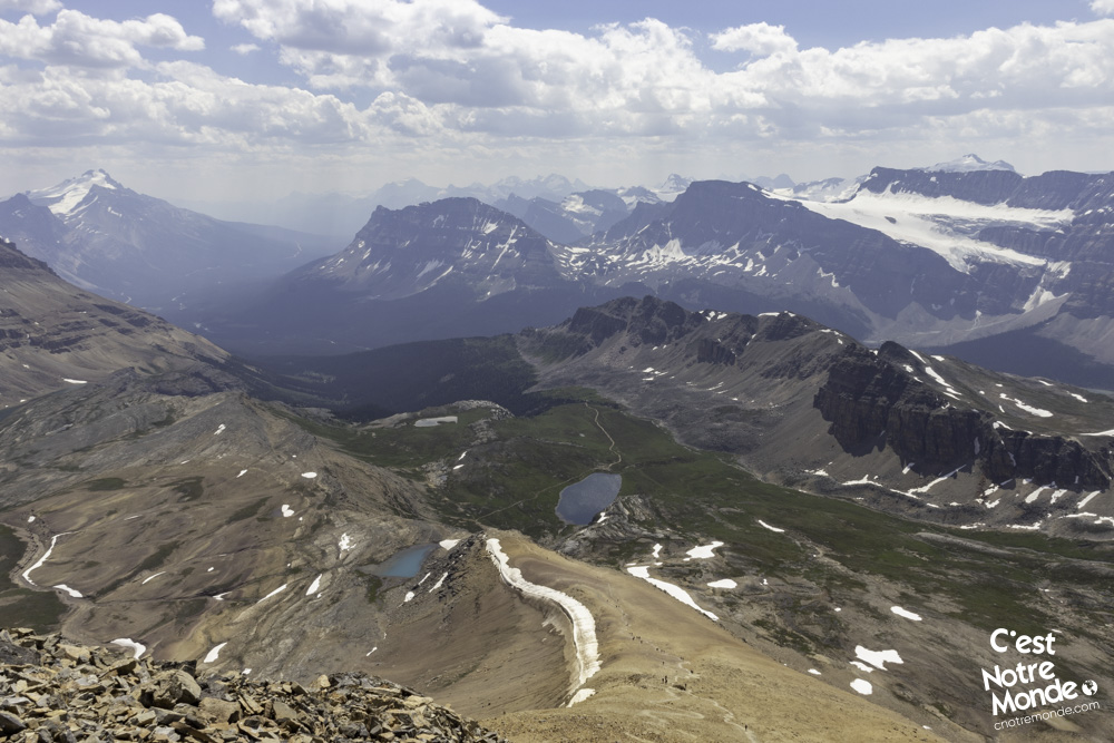
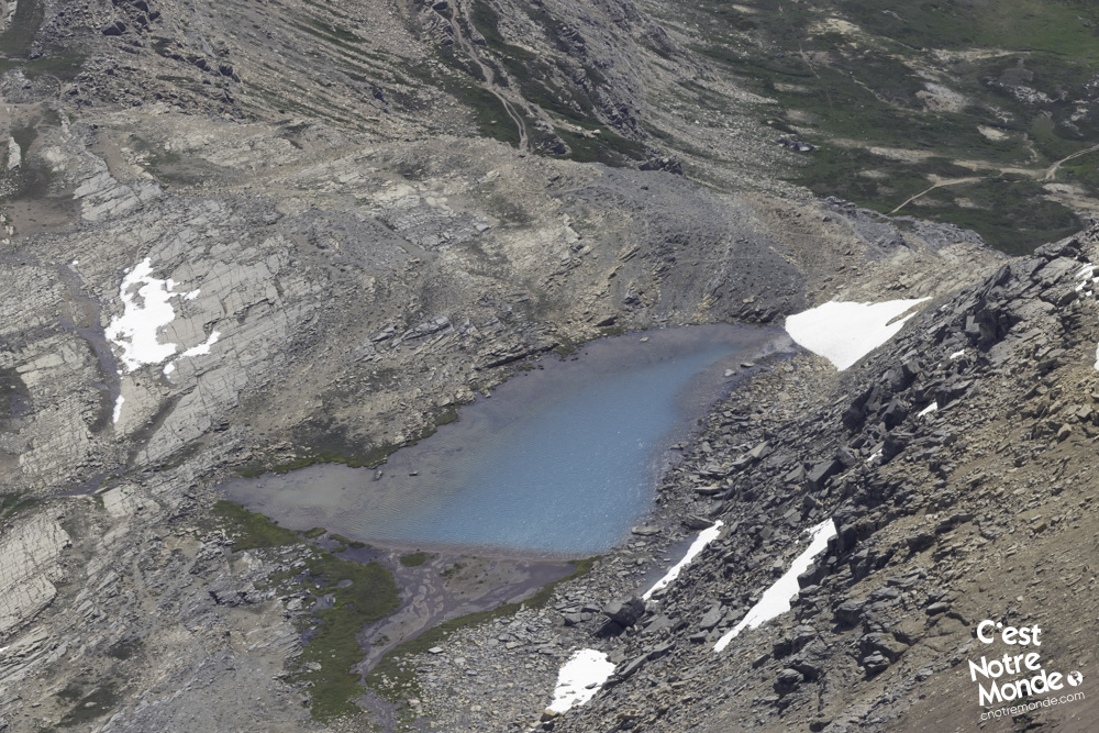
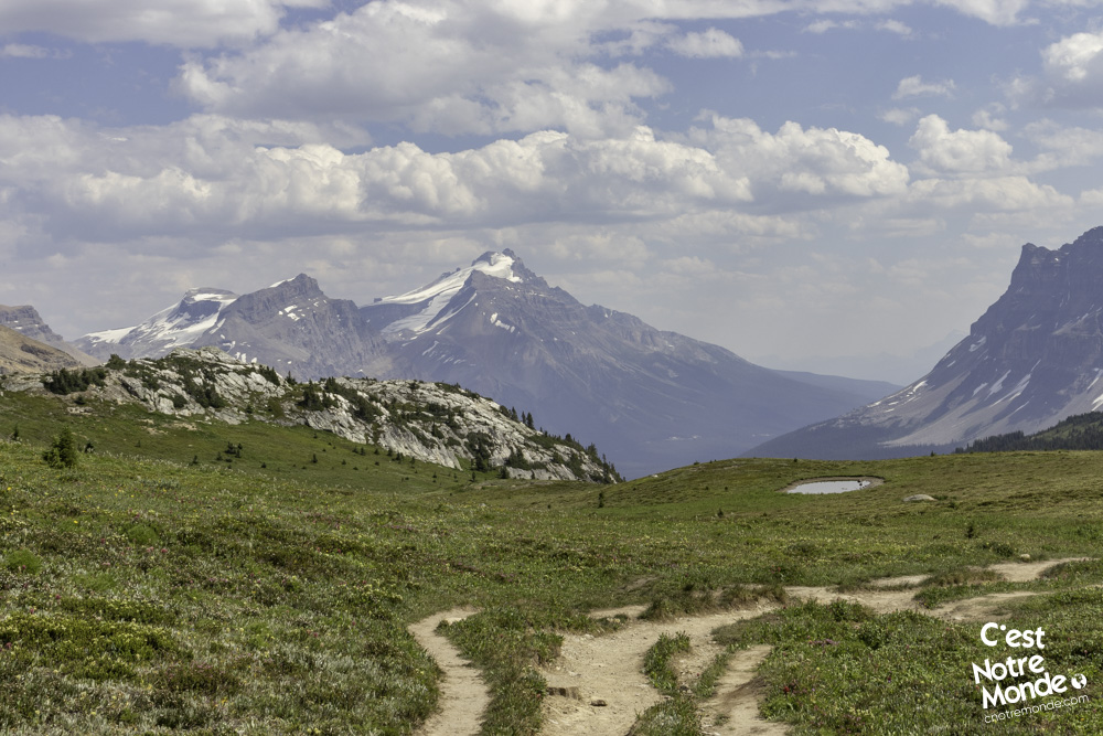
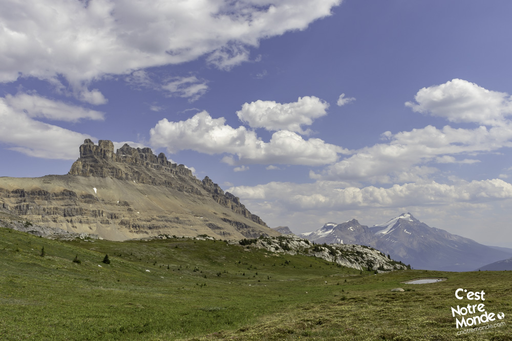
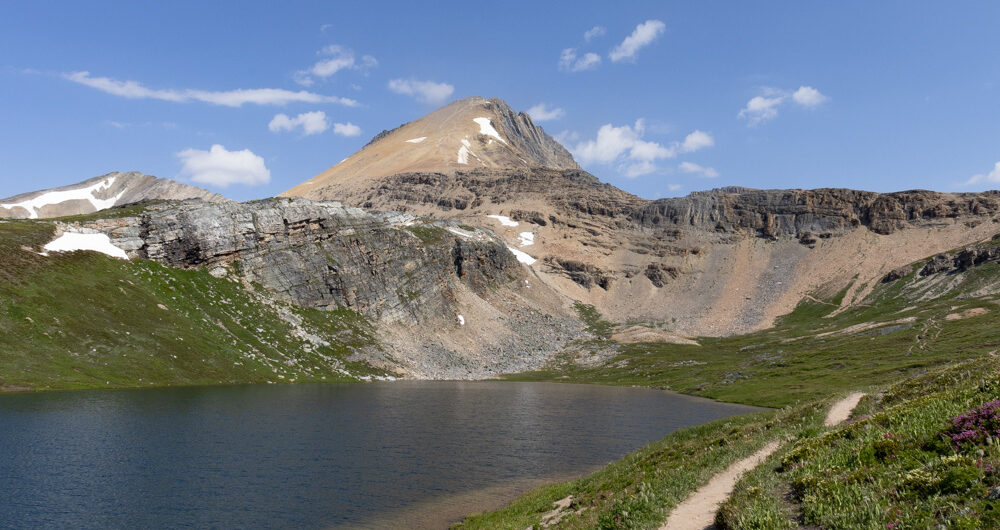
You will then reach a valley covered with meadows, small trees, and wildflowers as the panorama changes drastically. On the right side, you will appreciate the magnificent Canadian Dolomites, a range of peaks of all shapes and sizes. At the far end of the valley, is your final objective: Cirque Peak. The 2.6 km (1.6 mi) walk in this stunning valley takes you to Lake Helen (2390 m), a magnificent high-altitude lake surrounded by tall mountains. Take a well-deserved break, the hardest part is yet to come.
Cirque Peak via Helen Lake is a challenging hike located on the Icefield Parkway.
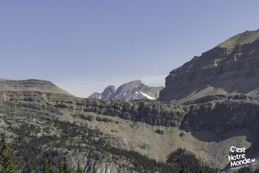
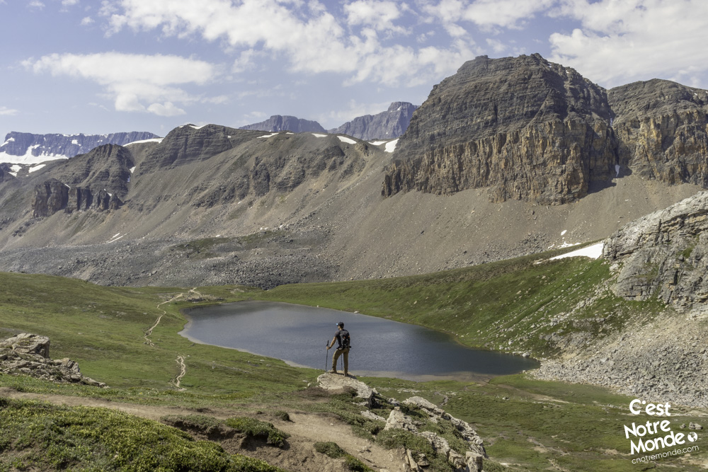
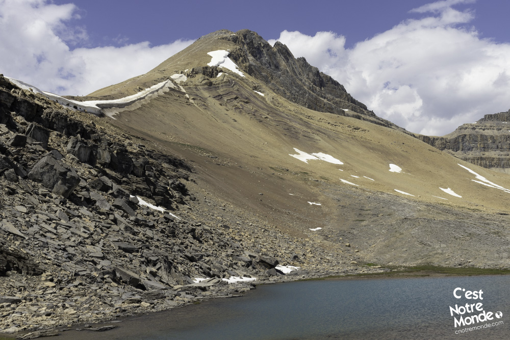
Go around Helen lake (on its right) following the trail and start the ascent of a small cliff overlooking the lake. This section involves some easy and unexposed scrambling. Once at the top of the cliff, a new plateau stretches out in front of you with more lakes and meadows. Truly gorgeous. On your left, is your final objective: Cirque Peak. Here, you have a view of the fairly steep route that will take you to the top through a scree terrain.
Helen Lake is a high-Altitude lake at the foot of Cirque Peak. Reaching it is by itself an amazing hike for those who do not feel like going further.
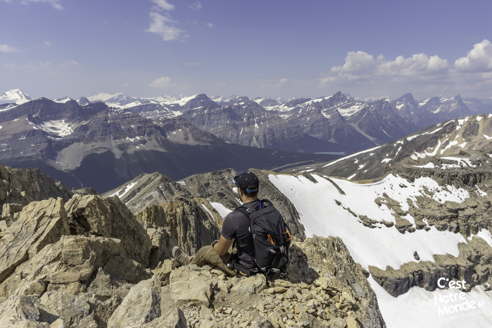
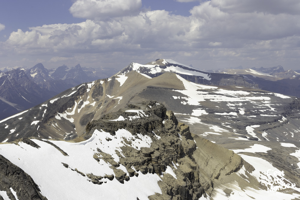
Begin the final push following a very direct route to the summit. You will hike 1.6 km (1 mi) and climb 450 m of elevation (1482 ft) to get there. Some segments are unstable due to the scree and be cautious of falling rocks, especially when it’s crowded. The summit is divided into 2 peaks: the one on the right is the true summit. Both are very narrow, and can be difficult to appreciate with a crowd. The view, however, is spectacular. Glaciers, lakes, and peaks over 3000m as far as our eyes could see. It offers a unique viewpoint of the region.
Retrace your steps to get back to the parking lot.
TO KNOW
Interest
Difficulty
Distance
Approximately 16.4 km / 10.2 miles
Duration
Around 6 or 8 hours
Elevation
2993 meters / 9820 feet
Elevation gain
Around 1050 meters / 3445 feet
Useful informations
See on Caltopo (detailed)
See on Google Maps (basic)
Useful links
Website: https://parks.canada.ca/pn-np/ab/banff
Parking: https://goo.gl/maps/TLk4kzAWvgCH93896
Weather forecast: https://www.mountain-forecast.com/peaks/Cirque-Peak/forecasts/2993
Download GPX: https://www.cnotremonde.com/gpx/Cirque-Peak-AB-cestnotremonde.gpx