 Alberta
South Lawson Peak
Introduction
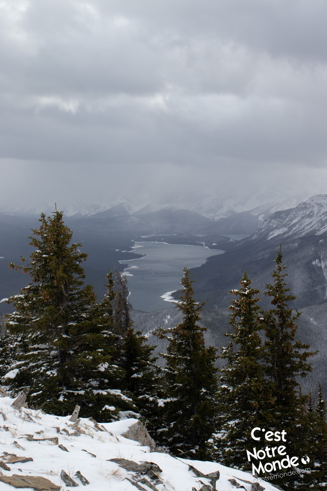
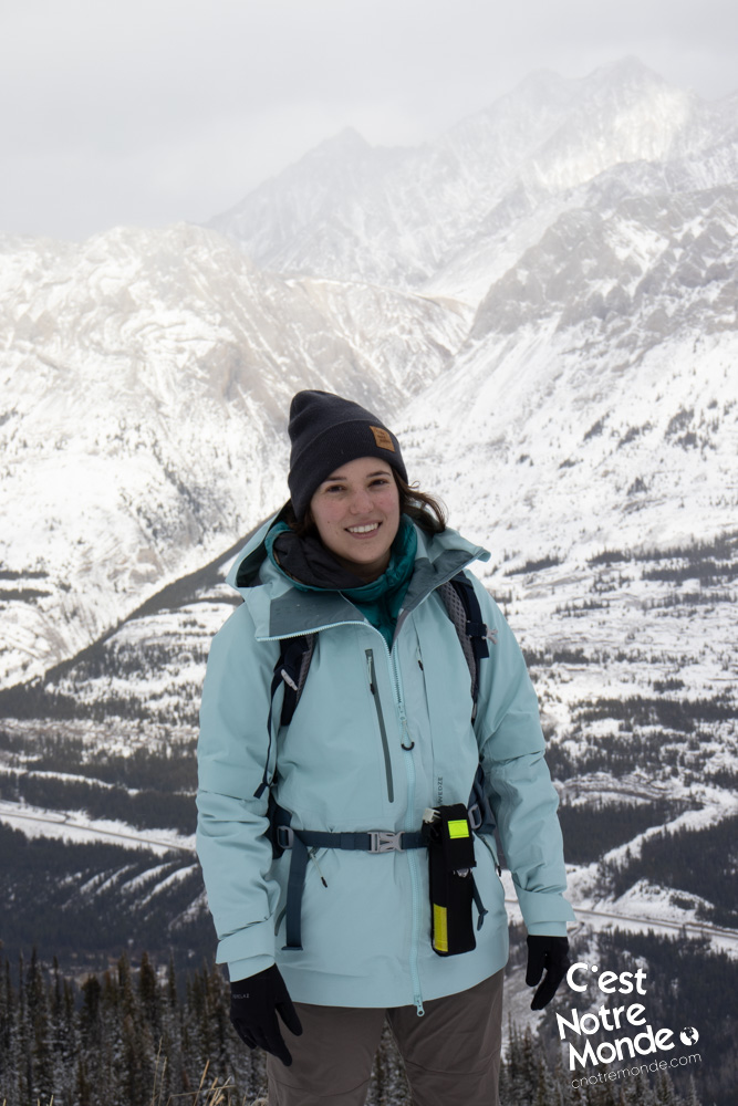
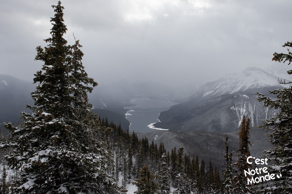
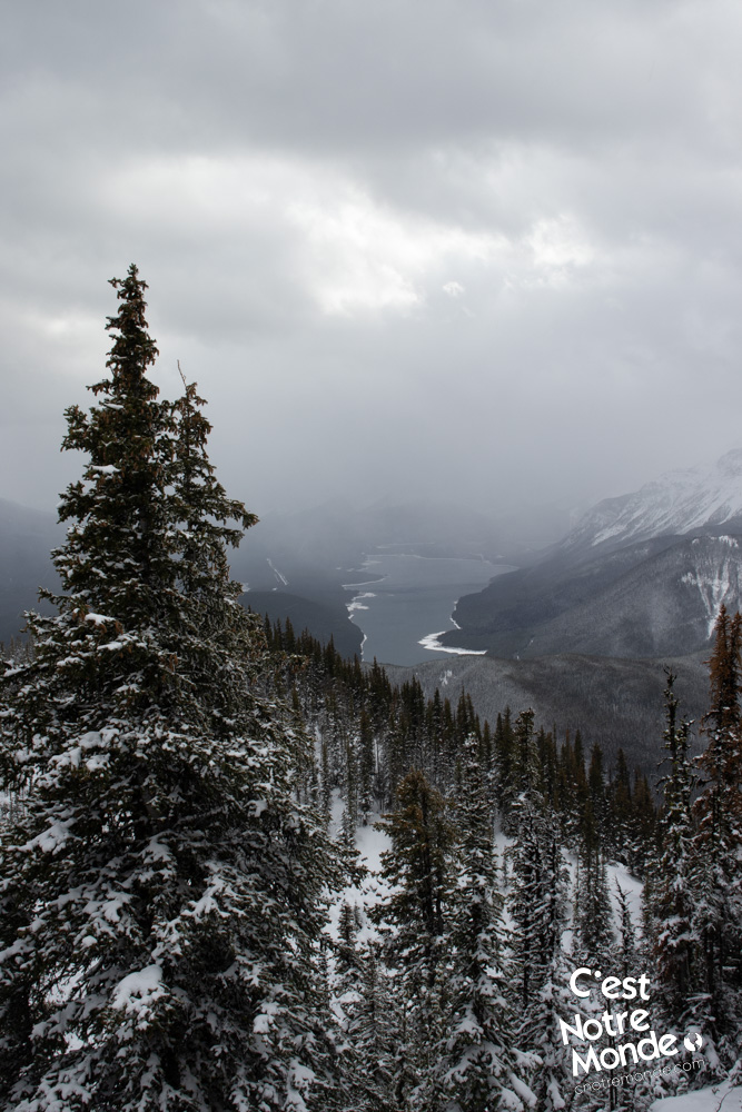
Looking for one of those stunning views of the Rockies? South Lawson Peak is a good candidate! At 2386 meters-high, this summit (also called “Little” Lawson Peak) offers a breathtaking view of the nearby mountains and lakes of Kananaskis. This mountain and its big brother (Mount Lawson – 2795m) are named after Major W. E. Lawson, an employee of the Geological Survey of Canada, killed in France during WWI. Located in Peter Lougheed Provincial Park, Alberta, it can be climbed in winter and without technical difficulty. Although, good hiking conditions are always recommended. C’est Notre Monde will share the route to this beautiful summit of the Canadian Rockies.
3D interactive map
Getting to Peter Lougheed Provincial Park:
Parking access to South Lawson Peak hike: https://goo.gl/maps/YU7foFTb5ChB2DuW7
From Calgary: 140 km – 1h45 driving time
Take the Trans-Canada hwy AB-1 West toward Banff for 66 km until the 118 exit toward Kananaskis Country. Follow the AB-40 South for 55km and turn right on AB-742 toward Kananaskis Lakes. After 2.5km, take another turn right toward Spray Lakes Reservoir. Your destination will be on your right, 3 km further.
Helpful information
To enjoy your hike, you must:
Be Equipped: Hiking boots are a necessity. A steep section of the hike requires ankle protection. Hiking poles are also recommended on your way down. Grizzlies are usually present in the area, therefore bear spray should be easily accessible in the case of unexpected encounters. Finally, always bring water and food in sufficient quantities.
Parking: Parking is located on the right side of the road, in front of a gate preventing vehicle access to a service road. Be mindful not to block access to this gate, so that local services can access the road.
Information: Access to Kananaskis Country is not free. You will need to register your vehicle(s) online on the Kananaskis park website and purchase a daily or annual pass. Note that the fees are per vehicle and not per hiker, so carpooling is an option. Be mindful of the forecast and visit the park’s website before your hike to find up to date information such as last seen wildlife, trail conditions, etc.
The Hike
The hike starts on a large, flat service road for 1.2km (0.72mi). At the end of this road, you will find yourself in front of a wooden aqueduct at the base of South Lawson Peak. Turn right and cross a small creek, followed by a sharp and steep left turn to start your climb into the forest. The trail is not always easily identifiable but you can follow the few orange flagging tape markers attached to the trees. The route will climb consistently, excluding the false peak, until the summit 2.6km (1.6mi) further.
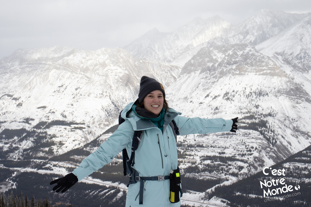
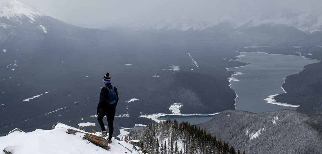
At 2386 meters-high, South Lawson Peak also called “Little” Lawson Peak offers a breathtaking view of the nearby mountains and lakes of Kananaskis.
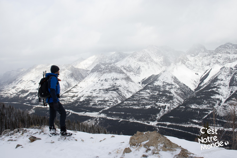
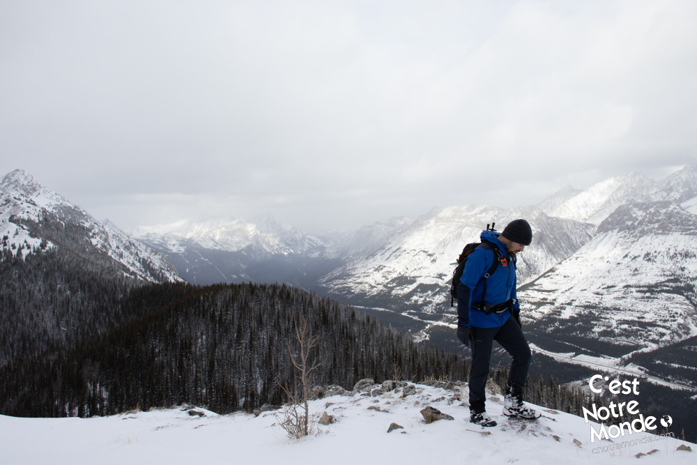
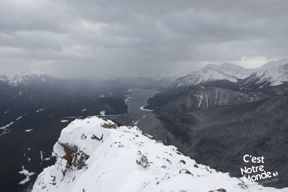
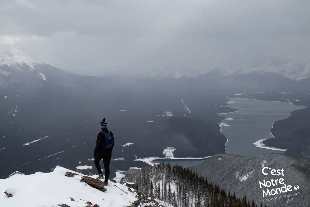
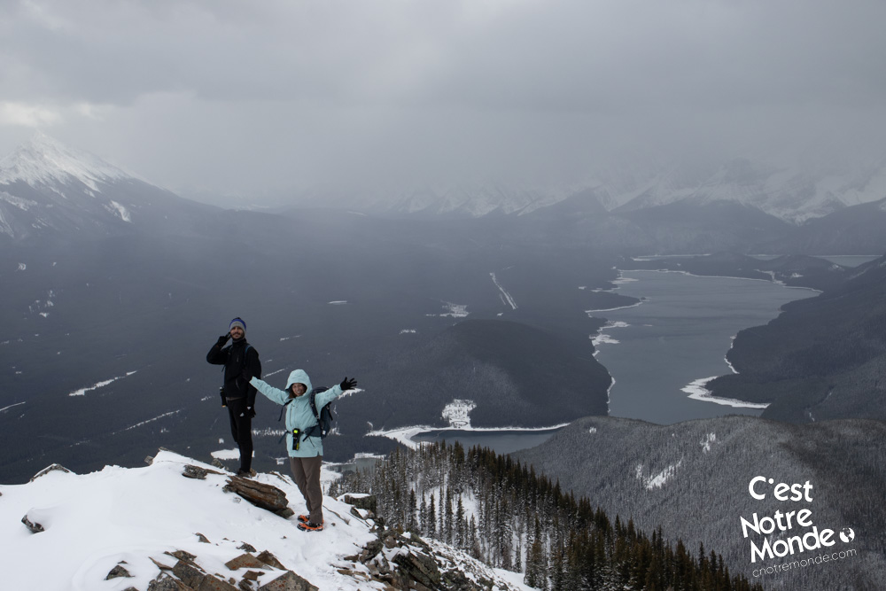
Approximately 600m (0.37mi) before the summit, you will reach a false summit with a beautiful view of the valley. To reach the true summit you will have to descend a few meters before starting the final climb. This last part is steep but does not involve technical difficulties. In winter conditions, crampons are highly recommended. Finally, you will leave the forest and reach the summit ridge. A short exposed section will likely require you to use your hands. Be careful in winter, many corniches are present on this ridge. Make sure to keep your distance from the edge and stay on the rocky parts. Finally, you will reach the summit at 2386 meters-high, identifiable with a cairn (pile of rocks).
Be careful in winter, many corniches are present on the summit ridge. Make sure to keep your distance from the edge and stay on the rocky parts.
The summit offers a breathtaking view of Grizzly Peak, Opal Ridge, King Creek Ridge and Kent South Peak. But the real attraction is the stunning view of the Kananaskis Lakes.
Retrace your steps to get back to the parking lot.
TO KNOW
Interest
Difficulty
Distance
Approximately 7,5 km / 4.7 miles
Duration
4 hours
Elevation
2386 meters / 7828 feet
Height difference
Around 740 meters / 2427 feet
Useful informations
See on Caltopo (detailed)
See on Google Maps (basic)
Useful links
Website: https://www.albertaparks.ca/parks/kananaskis/kananaskis-country/
Parking: https://goo.gl/maps/YU7foFTb5ChB2DuW7
Weather forecast: https://www.mountain-forecast.com/peaks/Mount-Lawson/forecasts/2795
Download GPX: https://www.cnotremonde.com/gpx/South-Lawson-Peak-AB-cestnotremonde.gpx