 Alberta
Cascade Mountain
Introduction
An epic hike on a mythical mountain! Hiking Cascade Mountain in Alberta, icon of the Canadian Rockies, is a real adventure. The pyramid-looking mountain is 2998 meters high (9836 ft) and is located in Banff National Park. It is the famous mountain overlooking the city of Banff (right in the perspective of Banff Ave). The trail that goes to the top is not to be underestimated: Long distance, major elevation gain and a scrambling section at the final push to the summit. This is a difficult hike offering a great variety of terrain (forest, scree…) and panorama that is worth all the effort. C’est Notre Monde explains to you how to climb this unique mountain overlooking the famous city of Banff.
3D interactive map
Getting to Cascade Mountain trailhead
Parking access to Cascade Mountain hike: https://goo.gl/maps/ToMwn33dcNf5xkXV7
From Calgary: 130 km – 1h30 driving time
Take the Trans-Canada hwy AB-1 West toward Banff for approximately 115 km, until the exit toward Banff. Turn left on Mount Norquay road and follow the road toward the ski station. The parking is ski station one.
Helpful information
To enjoy your hike, you must:
Be Equipped: Hiking boots are a necessity. A steep section of this hike (easy scramble) requires ankle protection. Hiking poles are also recommended on your way down. Bears are present in the area, therefore bear spray should be easily accessible in the case of unexpected encounters. Finally, always bring water and food in sufficient quantities.
Parking: Use the ski station parking lot.
Information: Access to Canadian National Parks is not free. You can either take a daily or annual pass. At the entrance to Banff National Park, there will be a toll on the highway where you can purchase a pass, if you do not have one already. It is essential to consult the weather forecast before attempting to climb Cascade. You can also consult the “scramble guide” from Parks Canada for useful information on the route to the top and emergency contacts.
The Hike
The hike starts right at the parking lot. You will have to cross the ski station following a large gravel road and reach the river down the valley, where your climb will actually start. So follow the road until you reach the last ski lift, around 1.13km (0.7 mi) from the parking lot. Then, take the small trail going in the forest on your right and follow it until you reach a wooden bridge crossing Forty Mile Creek. Do not be surprised, at this point, the trail was either flat or going down.
Cascade Mountain is located in the famous Banff National Park in Alberta.
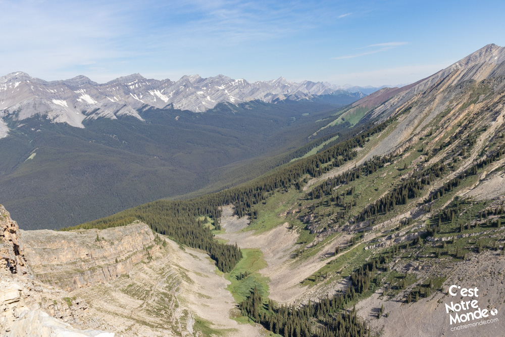
Things are finally getting serious. Once the bridge is crossed, the trail will start climbing gradually and will not stop until you reach the summit. The climb within the forest is 3.7km long (2.3 mi), until you reach Cascade Cirque at around 2140m high. The Cirque is a beautiful opening in the center of the mountain, marking the transition between the hiking and the scrambling parts. From there, you will be able to see your final objective, Cascade’s summit, 860m (2822 ft) higher. At the Cirque, you will have already gained 615 meters (2019 ft) of elevation.
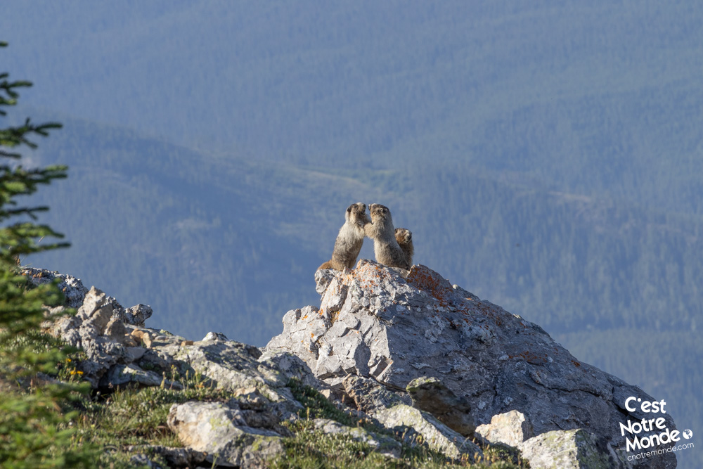
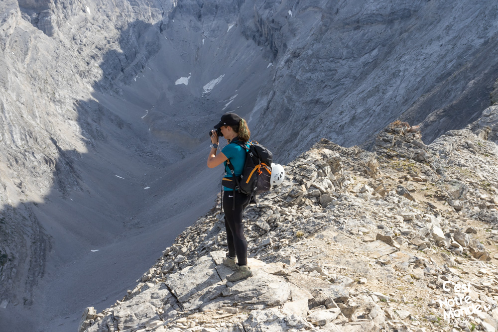
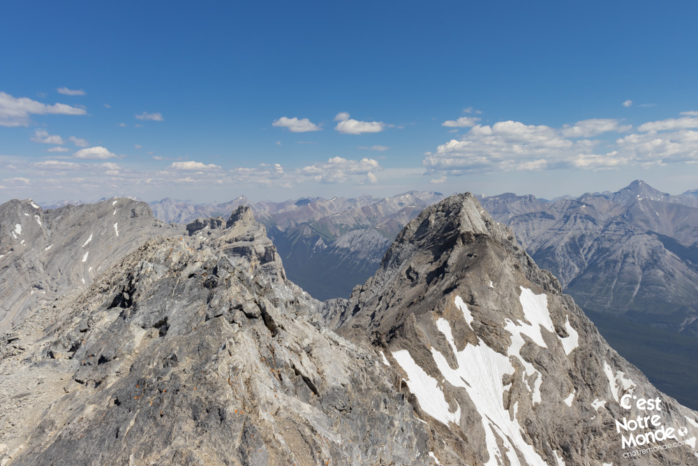
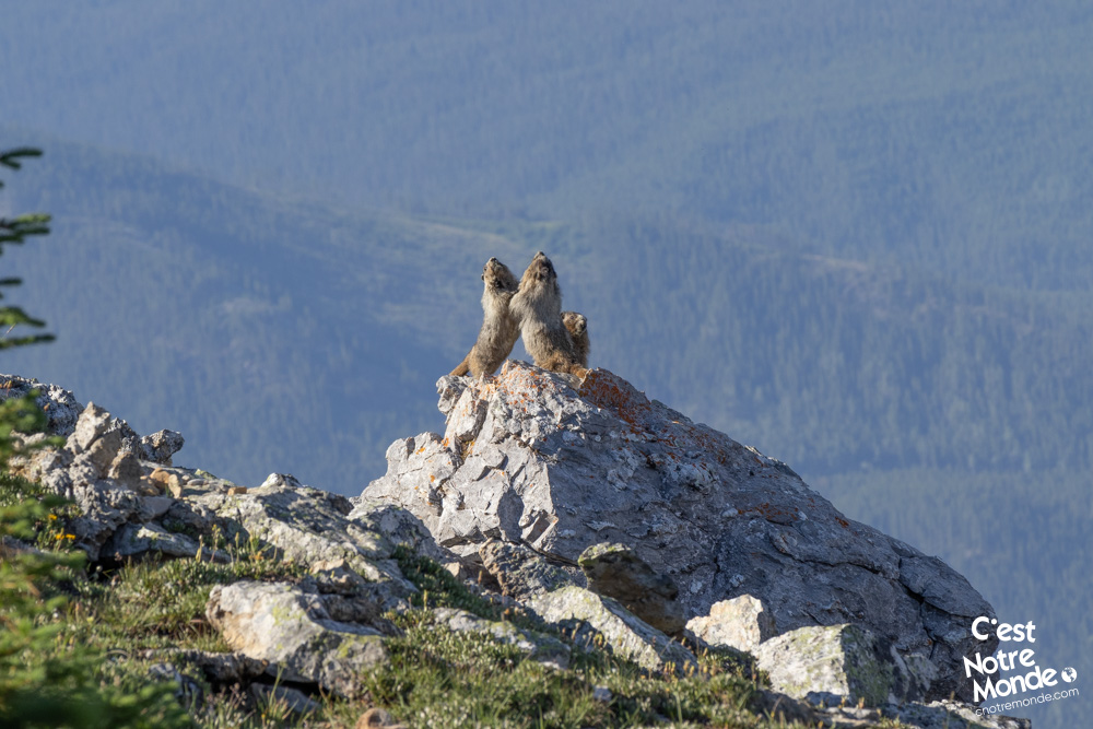
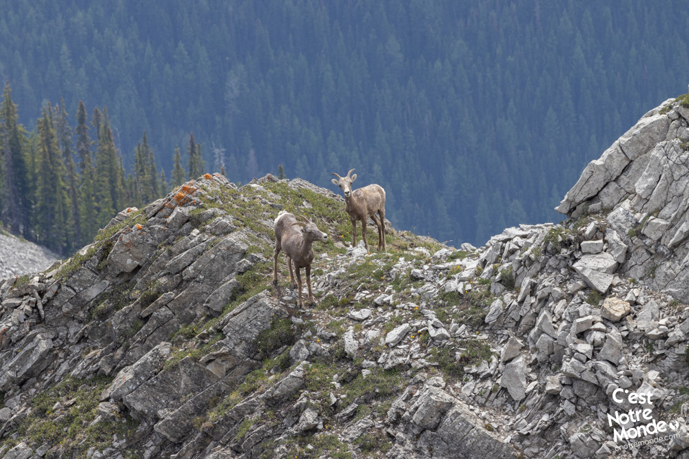
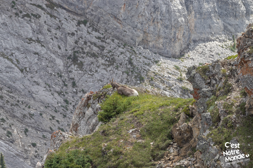
Take the trail on the right of the Cirque and start the second part of your ascent. The trail is already steeper and the terrain more and more Rocky. You will quickly reach a large scree section that needs to be crossed. The trail is no longer clearly identifiable as you have to make your way through big Rocks. You can however use the small kairns to make sure you are on the right way. You will then reach a “flat” part allowing you to reach the summit ridge further away. The view from this part is beautiful: You are overlooking the Cirque on one side and seeing the city of Banff on the other. If you are lucky, you can also spot marmots and wild goats.
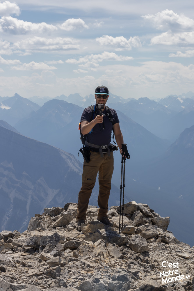
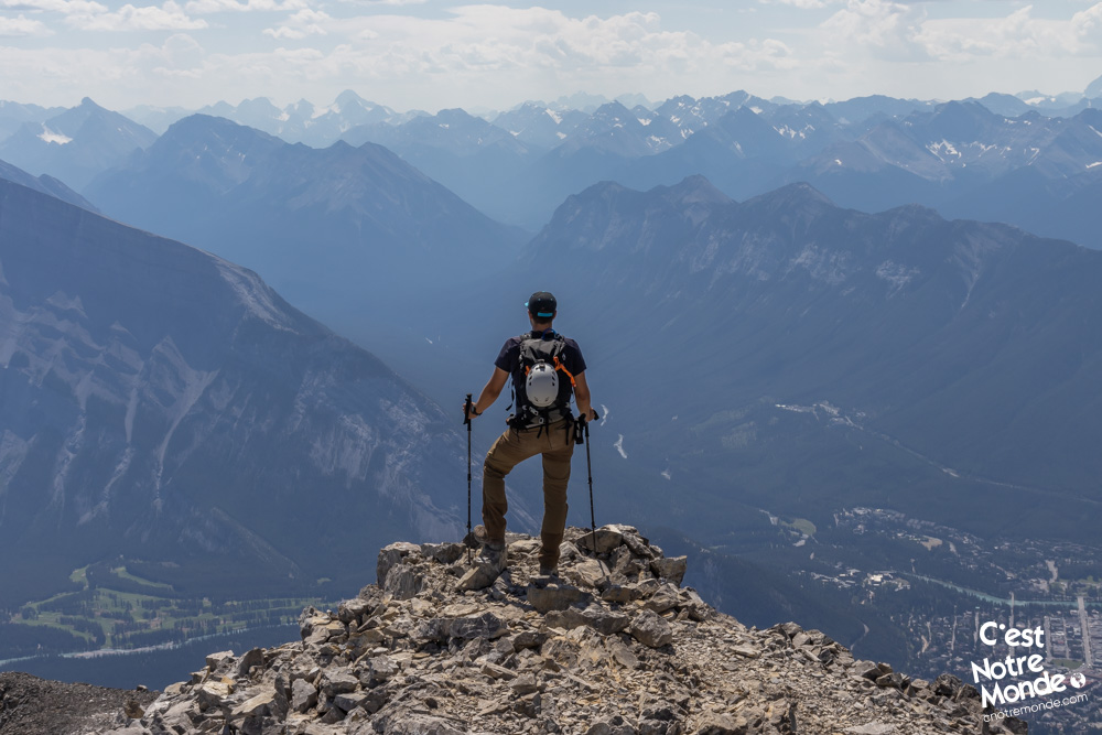
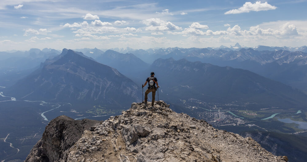
Cascade Mountain in Alberta is a difficult hike taking you to a 2998m summit with breathtaking views.
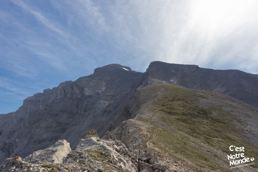
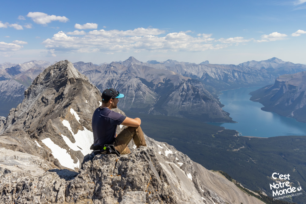
You will then start the final section of your climb, considered as an “intermediate scrambling” by Alan Kane in his famous guide book “Scrambling in the Canadian Rockies”. Continue on the trail and go around the false summit by stepping down a small rock step. Be careful and do not attempt to climb the false summit, the confusion is very easy. You will then reach a small section a little bit exposed to reach the bottom of the final climb. The summit is in front of you, 250 meters higher (822 ft). Take your time and climb this last steep section to reach the top of Cascade Mountain, at 2998 meters-high. The view of Banff and Lake Minewanka from the summit is breathtaking. You can also see Mounts Rundle, Temple, Assiniboine and Big Sister. All the iconing mountains of the region.
Retrace your steps to get back to the parking lot.
TO KNOW
Interest
Difficulty
Distance
Approximately 20 km / 12.4 miles
Duration
Around 6 or 8 hours
Elevation
2998 meters / 9836 feet
Elevation gain
Around 1650 meters / 5415 feet
Useful informations
See on Caltopo (detailed)
See on Google Maps (basic)
Useful links
Website: https://parks.canada.ca/pn-np/ab/banff
Parking: https://goo.gl/maps/ToMwn33dcNf5xkXV7
Weather forecast: https://www.mountain-forecast.com/peaks/Cascade-Mountain/forecasts/2998
Download GPX: https://www.cnotremonde.com/gpx/Cascade-mountain-AB-cestnotremonde.gpx