 New York
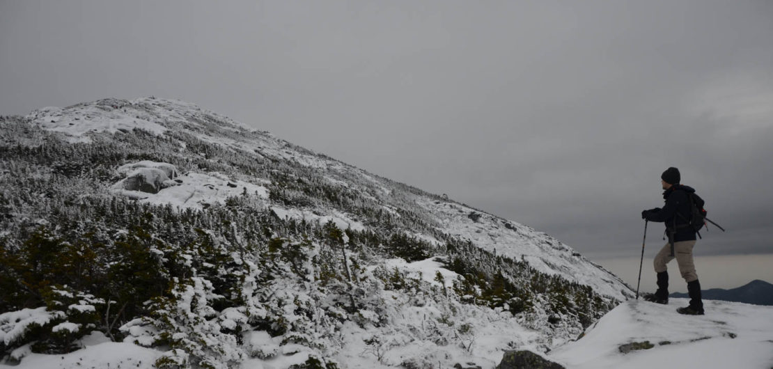
Mount Marcy
Introduction
Lying among the Adirondacks, the peak of Mount Marcy is the highest point in New York State. From the top of its 1629 meters, you are provided a striking panorama on the highest peaks of the massif. The mythical summits of Algonquin, Gothics and Whiteface surround you. You feel at the very heart of the Adirondacks.
This ascent, nevertheless, requires a lot of endurance and willpower. The summit is more than 11 kilometers from the parking lot, but you will not regret having undertaken this adventure. Sublime landscapes and a complete immersion into nature awaits you. C’est Notre Monde will show you the way!
3D interactive map
Things to know
To enjoy your hike, you must:
Be equipped: For the ascent of Mount Marcy, you will need waterproof and comfortable hiking shoes. The trail is well worn so we recommend you carry hiking poles; they will help you keep pace and minimize fatigue. A windbreaker is also recommended, the higher you climb the higher chance of strong and cold winds. Due to the length of this hike, we recommend a headlamp. On average, hikers complete the loop of Mount Marcy in about 11 to 12 hours, so do not be surprised by the sunset! Finally, you need plenty of water (3L per person), energy bars and a first aid kit. In winter, crampons and/or snowshoes will be necessary. You can rent both at the Information Center located in the parking lot.
Be informed : Before you depart, speak with the Rangers at the Information Center (located in the parking lot) and share your route. They will inform you of the weather conditions and the state of the trails. You can also purchase or rent equipment you may need.
Parking: There is a parking fee. Only cash accepted.
The Hike
First step, register at the trailhead kiosk before beginning the Van Hoevenberg Trail. This trail will take you to the top of Mount Marcy some 11 kilometers away, through dense forest with some openings and beautiful views. About 1.6 km (1 mi.) in, you will find yourself at the first intersection with a sign that indicates the direction of many peaks. Turn left following the signs for Mount Marcy. About 2 km (1.2 mi.) further, you will leave the forest and come across a river running through a charming valley. You are at Marcy Dam. Enjoy the view! The bridge to cross the river is on the left, follow the path and on the other side, you will meet a new intersection. There will be another kiosk for hikers where you must register. Follow the indications of Mount Marcy (left) while staying on the same path. Until this point, the trail is relatively flat. Now the climb begins.
The next 3.2 km (1.86 mi.) runs along the Phelps Brook river that includes nearly 385 meters (1263 ft) of elevation. You will come across two additional trails that lead to the summits of Phelps Mountain and Table Top Mountain, respectively. A break is required at the charming “Indian Falls” just before the final climb. The path is rocky until the summit. The final 4.3 km (2.7 mi.) are quite steep (520 meters/1706 ft of added elevation). Around 1 km (0.62 mi.) from your destination you will see the summit of Mount Marcy. The vegetation grows sparse with the altitude while the magnificent surrounding landscape comes into view.
The summit offers a breathtaking view of the highest peaks in the region. In good weather, you’ll even see Lake Champlain marking the Vermont border. A commemorative plaque tells the story of the mountain and its first recorded ascent. Take the time to relax and enjoy this panorama, before tackling the hike down!
Tip: To avoid crowds we advise that you camp or stay in the surrounding area the night before your hike to ensure an early start. The parking lot is extremely busy on weekends (summer and winter) for it is the starting point for many popular hikes in the area. Arriving early in the morning is highly recommended, before sunrise is best
For the descent, follow the Mount Marcy Trail. Take care, the first 1 km (0.62 mi.) is very steep. You will quickly arrive at an intersection. If you are up to it, you can continue straight ahead and achieve a second summit: Skylight Mountain (round trip distance from where you stand: 1.6km or 1 mi. / Elevation: 177 meters or 580 ft). Otherwise, continue on the Mount Marcy Trail by turning right. The trail continues down 2.2 km (1.4 mi.) to Lake Arnold Trail. Continue on Lake Arnold Trail (turning right) and follow it for 4.7 km (2.48 mi.) to the junction with the Avalanche Pass Trail. Again, turn right and continue to Marcy Dam (1.8 km / 1.1 mi.) where you can sign out from the register. Retrace your steps on the Van Hoevenberg Trail until you reach the parking lot (3.7 km / 2.3 mi.). Do not forget to sign out for the last time at the register.
TO KNOW
Interest
Difficulty
Distance
24.6 km / 15.3 miles
Elevation
1629 meters / 5344 feet
Height difference
1238 meters / 4061 feet
Useful informations
See on Caltopo (detailed)
See on Google Maps (basic)
Useful links
Website: http://www.lakeplacid.com/do/hiking/mount-marcy
Parking: https://goo.gl/maps/8dXU8ypqjs92
Weather forecast: https://www.mountain-forecast.com/peaks/Mount-Marcy/forecasts/1629