 Alberta
Mount Rundle
Introduction
Mount Rundle, a mythical summit in the Canadian Rockies! This 2949 meter high mountain is located near the city of Banff and is easily recognizable with its “wavy” look. Before planning your trip, be aware that this is a challenging climb with steep drops that require good fitness and some light technical skills. This beautiful scramble will reward you with an impressive 360 degree view of the Rockies. Follow C’est Notre Monde for useful details to make this adventure a safe and unforgettable experience.
3D interactive map
Access to Banff National Park
Access to the parking lot of the Mount Rundle Hike : https://goo.gl/maps/4gtJk7r77DYN5Ro48
From Calgary: Approximately 130 km – 1h30 driving time
Take the Trans-Canada hwy AB-1 West toward Banff for approximately 115 km, until the exit toward Banff. Pass through the town towards the “Fairmont Banff Spring” hotel, and turn left on Bow Falls Ave then left again on River Ave towards Banff golf course. The parking lot is located close to a small bridge crossing the Bow River.
Helpful information
To enjoy your hike, you must:
Be Equipped: Hiking boots and hiking poles are a necessity. The steep section of the hike (scramble) requires good ankle protection and hiking poles will be helpful to keep your balance. We also recommend that you bring a rock climbing helmet due to the potential for loose and falling rocks. This risk increases with more people on the trail. Ensure to take lots of water and food, you will need it on this demanding hike. Finally, bring additional clothes for layering. As you climb, the weather at the top can be significantly different from the bottom.
Parking: The parking lot is free and located close to a small bridge crossing the Bow river (towards the golf course). Spots are limited, especially since tourists also park here to visit the town. We suggest starting early like us (6am!) to increase your chances of getting a spot.
Information: Access to Canadian National Parks is not free. You can either take a daily or annual pass. At the entrance to Banff National Park, there will be a toll on the highway where you can purchase a pass, if you do not have one already. It is essential to consult the weather forecast before attempting to climb Rundle. You can also consult the “scramble guide” from Parks Canada for useful information on the route to the top and emergency contacts.
The Hike
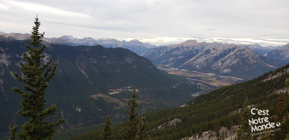
Start by crossing the bridge over the Bow river following along the edge of the golf course. There will be an information panel with a trail on your right that will lead you into the forest. After 800m (0.5 miles), you will reach another panel indicating the trail to Mount Rundle. Here, at 1400 meters of altitude, the climb begins and it will continue to climb until you reach 2949 meters. Ensure that you pace yourself!
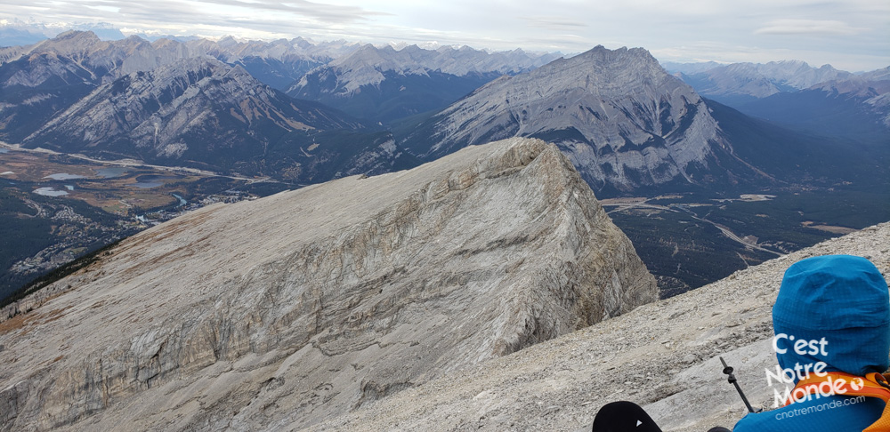
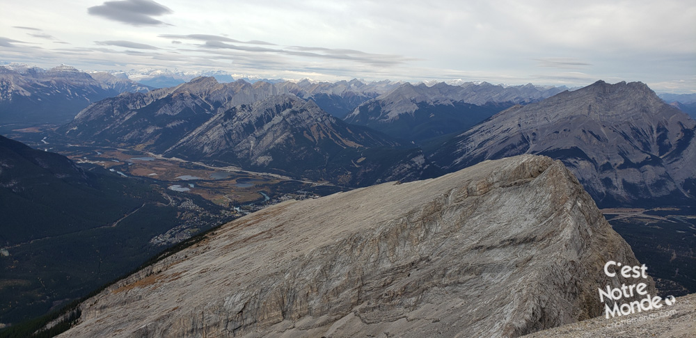
Mount Rundle, a dizzying summit from Banff!
The first 2.4km (1.5 mi) is a progressive, straightforward incline followed by a zig-zag section. 1km (0.6 mi) further, you will reach a small canyon you must descend before continuing. At this point, you are 1.7 km (1.1 mi) from the top with 800 meters (2600 ft) of elevation left to go. Just to be clear, it’s quite steep!
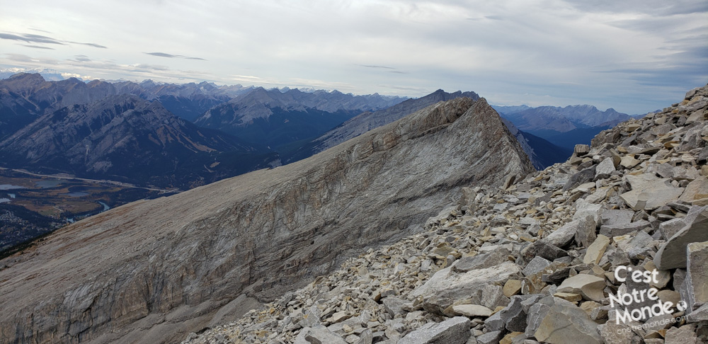
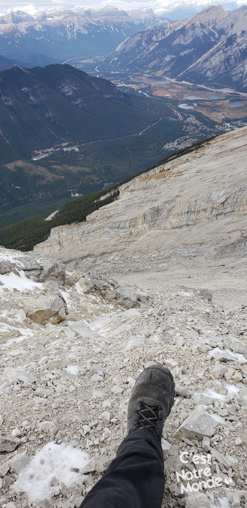
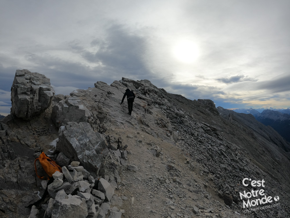
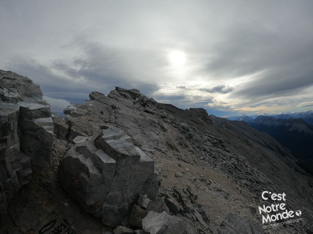
You will quickly leave the forest and begin your scramble. Kairns are indicating the route across the scree. Here, you will cross an exposed section, fittingly named “Dragon’s back” before the final push to the top. Make sure you follow the route that keeps to the left of the mountain. If you have any doubts, use a GPS (phone apps work well) to confirm your itinerary. Accidents happen every year when hikers go off trail.
Tip: This hike is not recommended for beginners. Be sure of your abilities before attempting this magnificent climb.
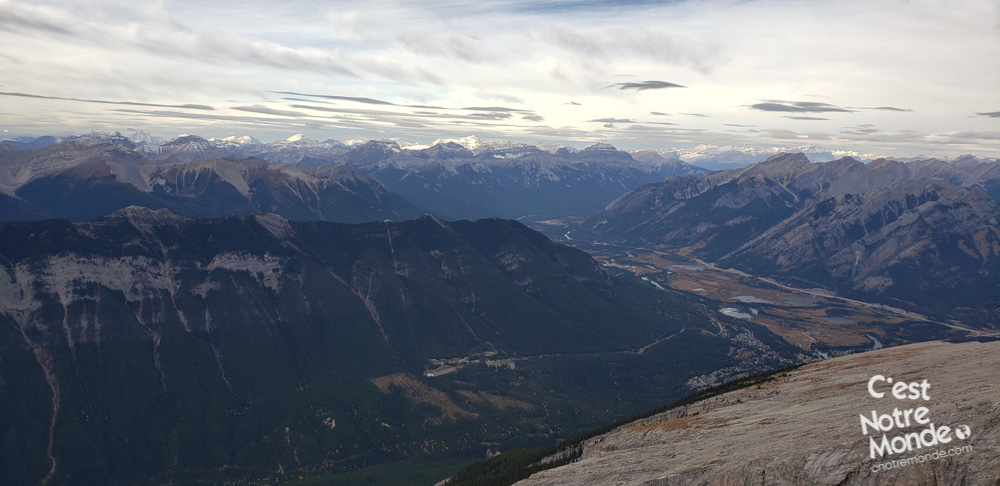
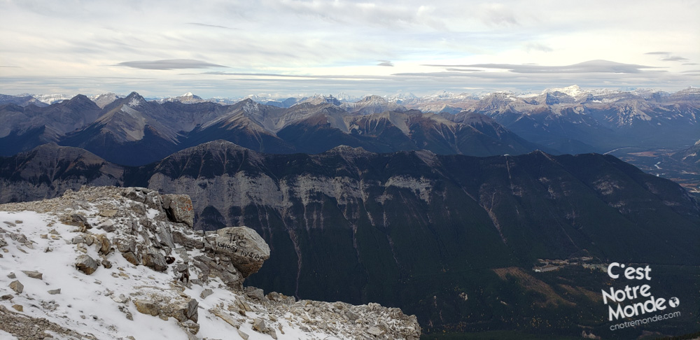
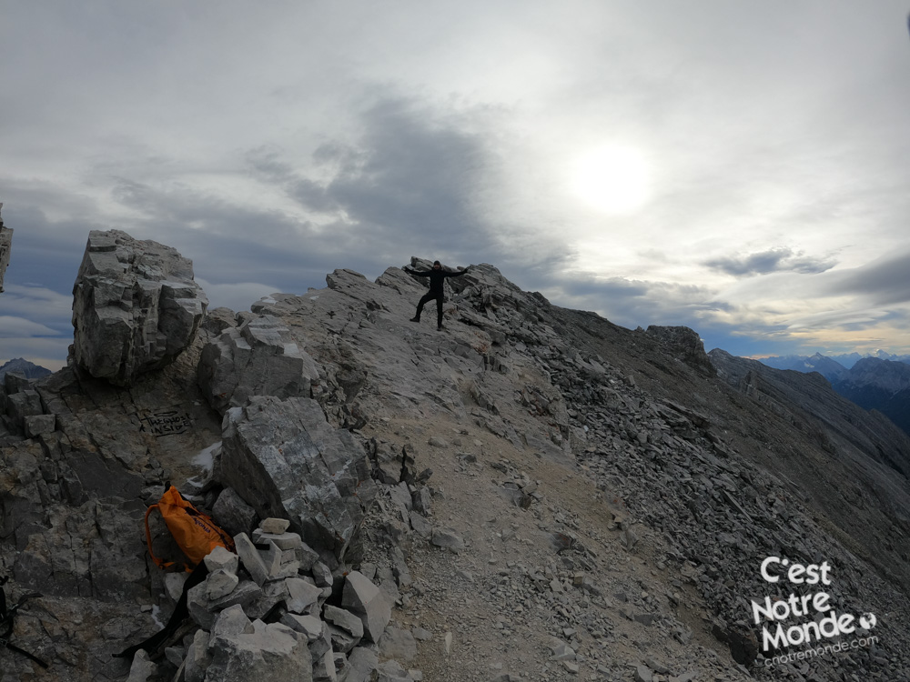
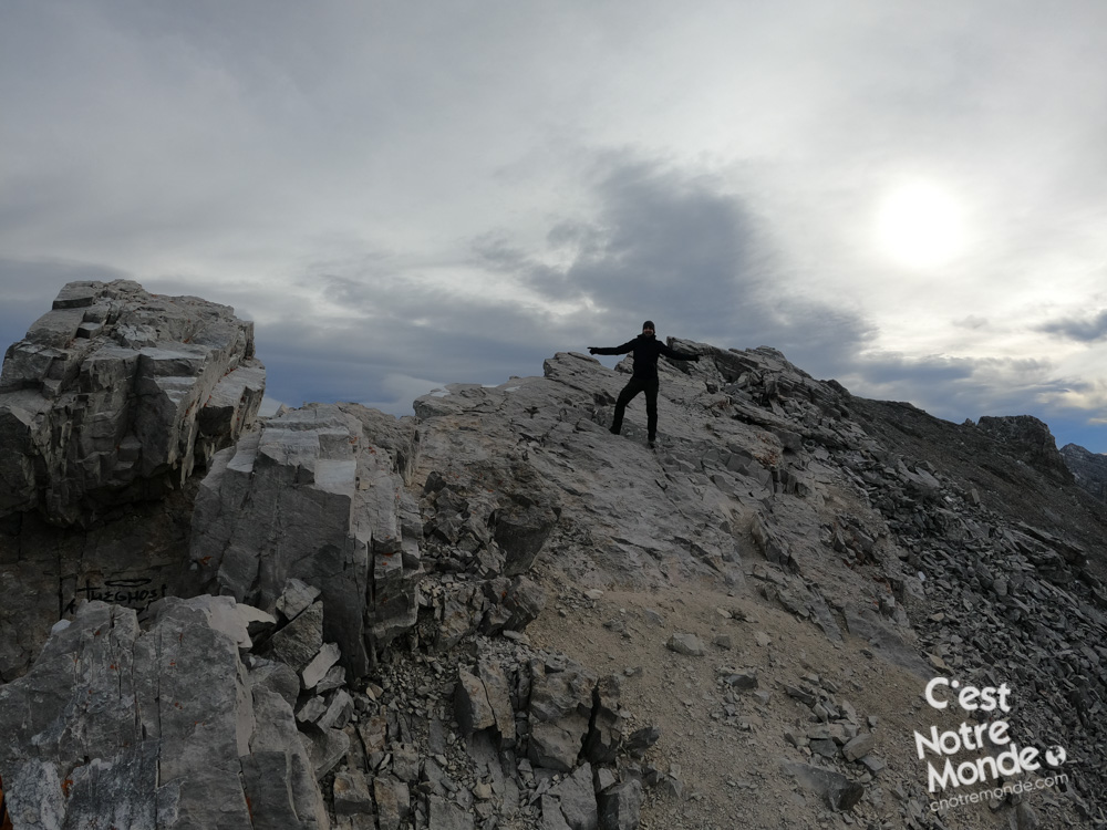
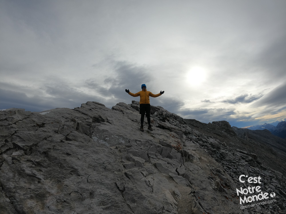
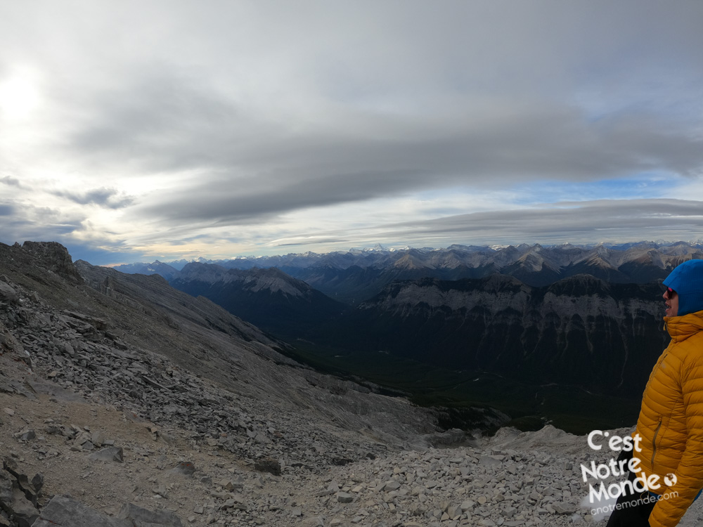
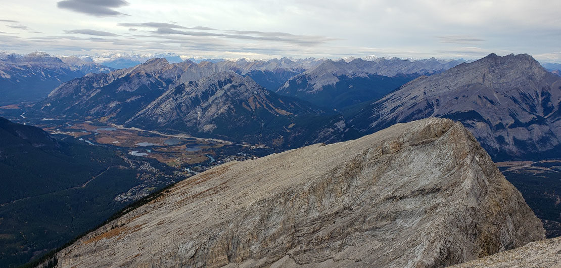
The summit view is breathtaking. The reward for all the effort it took to get up there! The mythical summits of the Rockies are in full view: Assiniboine, Temple, Cascade… Then, beyond them, infinite summits as far as your eyes can see.
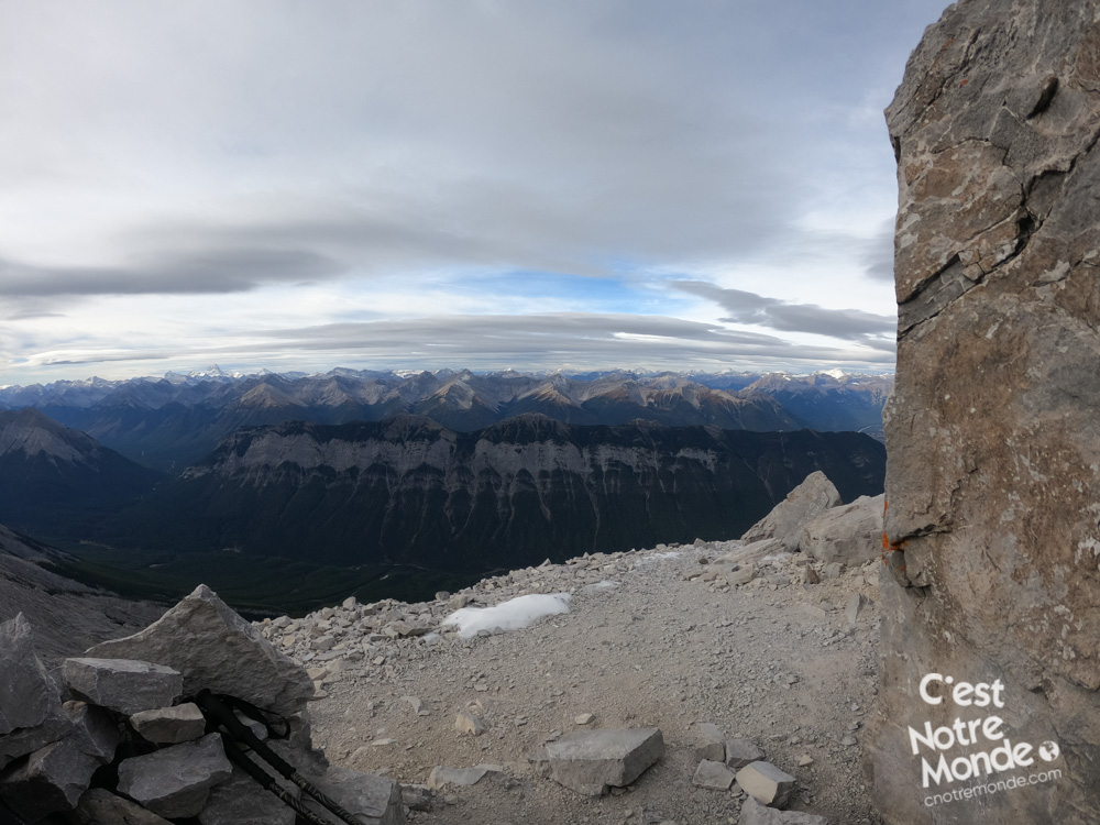
Mount Rundle, a thrilling hike!
The descent is challenging. The route is very steep which requires a slow and steady pace to cross the scree. Be mindful of your footing to avoid slipping and/or creating a rock fall. Descending the scramble section can take as much time as the ascent. Once at the tree line, the worst is behind you, for the remaining 6km (3.6 mi) to the parking lot.
TO KNOW
Interest
Difficulty
Distance
Approximately 15 km (9.3 miles)
Duration
9 hours
Elevation
2949 meters / 9675 feet
Height difference
Approximately 1700 meters / 5577 feet
Useful informations
See on Caltopo (detailed)
See on Google Maps (basic)
Useful links
Website: https://www.pc.gc.ca/fr/pn-np/ab/banff/activ/escalade-scrambling/rundle
Parking: https://goo.gl/maps/4gtJk7r77DYN5Ro48
Weather forecast: https://www.mountain-forecast.com/peaks/Mount-Rundle/forecasts/2949
Download GPX: https://www.cnotremonde.com/gpx/mont-rundle-AB-cestnotremonde.gpx