 Alberta
Big Sister
Introduction
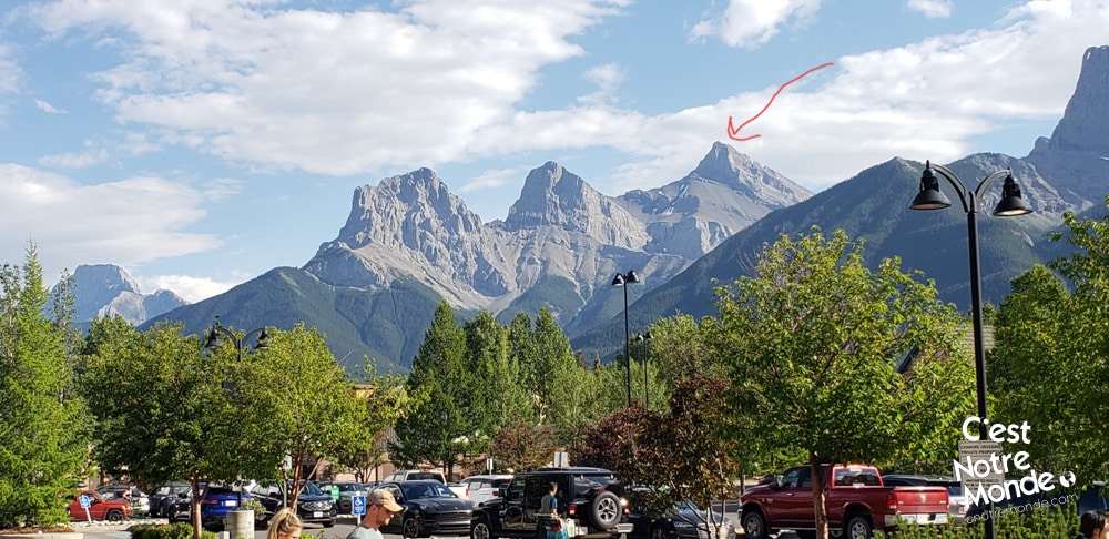
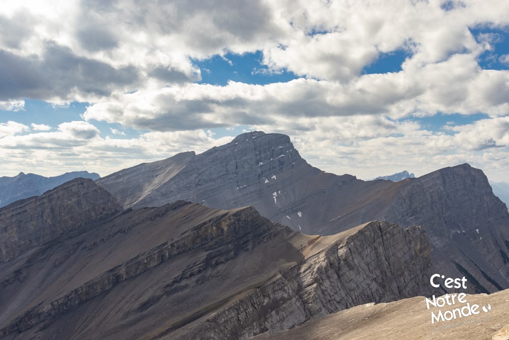
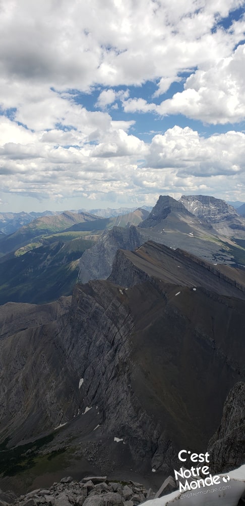
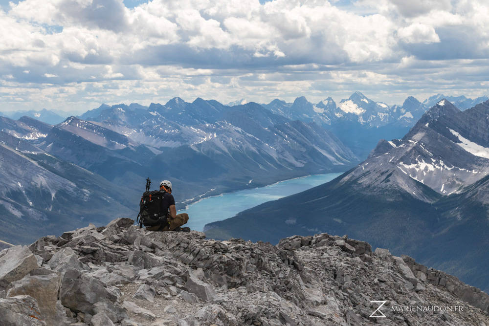
Big Sister (previously, Faith Peak) is the tallest of the famous Three Sisters trio in the Canadian Rockies. This 2936 meter-high mountain is located near Canmore in Kananaskis Country and is one of the most photographed summits in Alberta. Alongside, Middle Sister (2769m) and Little Sister (2694m) they are a symbol representing the region. Ascending Big Sister, however, is not easy. “Vertical” is the best adjective to describe the 1260m elevation gain within 2.7km. This is not a hike but a scramble qualified as “moderate” by Alan Kane in its famous scramble guide, Scrambles in the Canadian Rockies. Do not attempt this ascent without previous scrambling experience and safety gear.
3D interactive map
Getting to Bow Valley Wildland Provincial Park
Big Sister Hike Parking Access: https://goo.gl/maps/2Xeu3nLBVPkfgxzC8
From Calgary: 120 km – 1h30 driving time
Take the Trans-Canada hwy AB-1 West toward Banff until the 93 exit toward Canmore. Cross the bridge over the highway and turn right on Three Sister Parkway, towards Canmore Nordic Center. Follow this road until you reach the Rundle Forebay Reservoir. Paved road turns to gravel and will climb until you reach the Spray Lake Valley. You will need to follow this road for approximately 13km until you reach the starting point of the hike, located on the left side of the road, in front of the Spray Ranger Station.
Helpful information
To enjoy your hike, you must:
Be Equipped: Hiking boots are a necessity. The road to the summit is a moderate scramble and requires ankle protection. Hiking poles are recommended on your way down. A climbing helmet will help prevent head injuries in the event of a fall or if another hiker dislodges loose rocks above you. Grizzlies are present in the area, therefore bear spray should be easily accessible in the case of unexpected encounters. Finally, always bring water and food in sufficient quantities.
Parking: Free
Information: Access to Kananaskis Country is not free. You will need to register your vehicle(s) online on the Kananaskis park website and purchase a daily or annual pass. Note that the fees are per vehicle and not per hiker, so carpooling is an option. Be mindful of the forecast and visit the park’s website before your hike to find up to date information such as last seen wildlife, trail conditions, etc.
The Hike
From the parking lot, take the trail leading in the opposite direction of the lake. The first 200 meters climb moderately before reaching a dry river bed. Across the river bed, the starting point of a small trail leading up into the forest is marked with an orange ribbon. The following 1.1km is around 530 meters of elevation (1738 ft). Pretty steep! Once above the treeline, it becomes more serious.
Big Sister (previously, Faith Peak) is the tallest of the famous Three Sisters trio in the Canadian Rockies. This 2936 meter-high mountain is located near Canmore in Kananaskis Country and is one of the most photographed summits in Alberta.
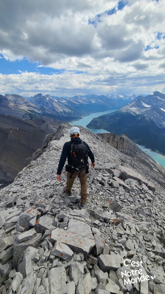
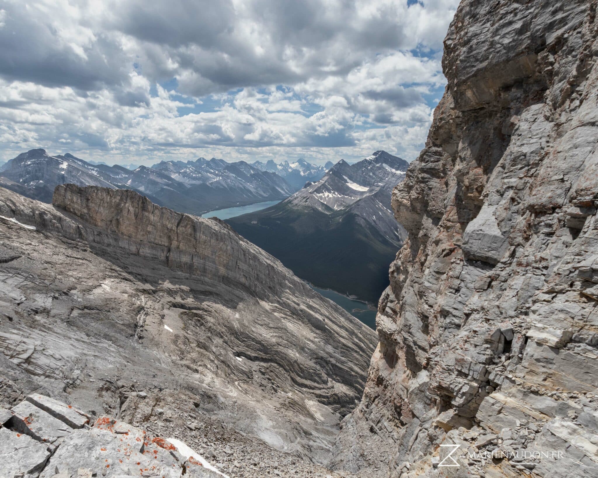
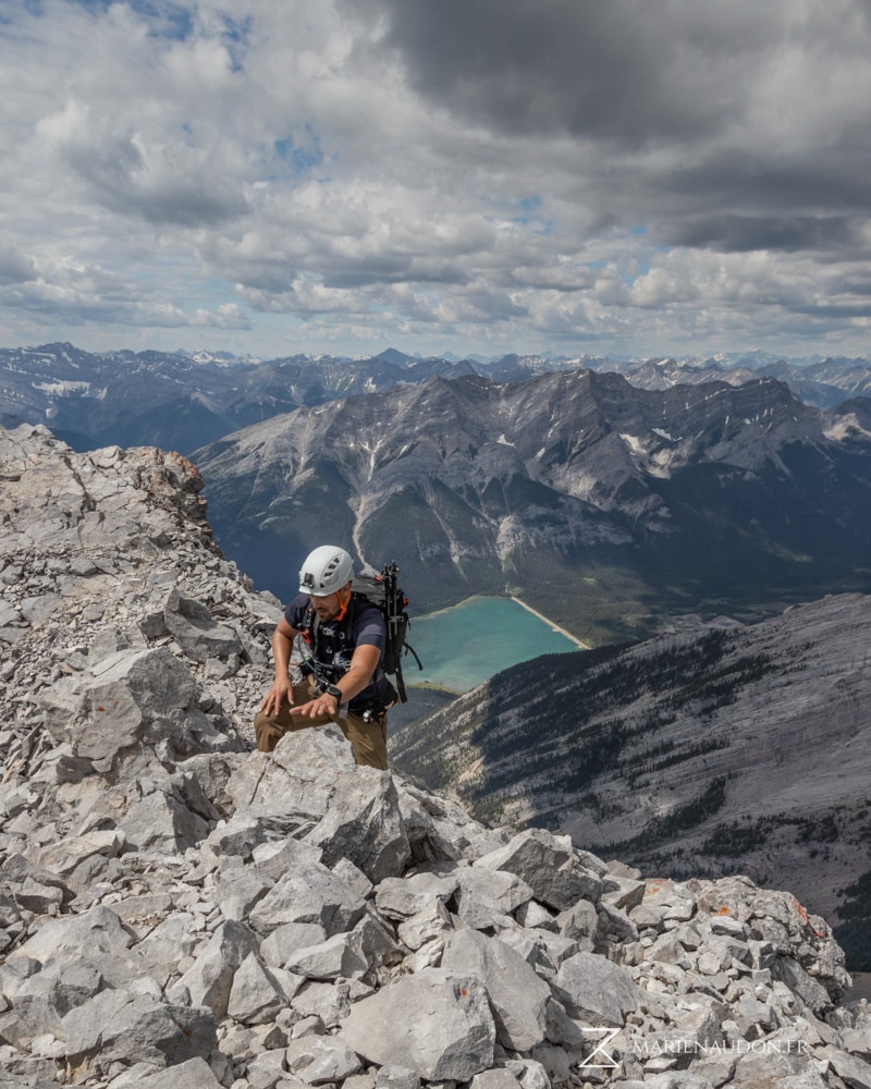
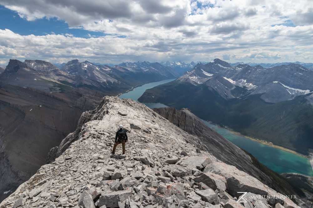
[At this point, we suggest wearing a helmet] Climb over a small vertical rock face (step) and follow a narrow ridge for 50 meters. On your right, an orange ribbon will indicate a way to get down from this ridge via a 3 meters-high vertical step. There are many holds available in the rockface to help you down. You will find yourself on a steep scree without a clear route or trail. You will have to make your way up this unstable terrain while gaining 650m of elevation.
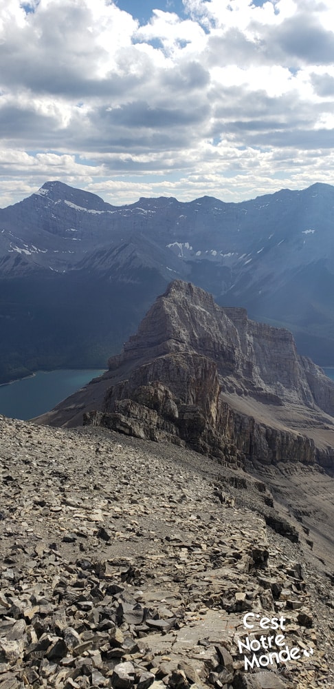
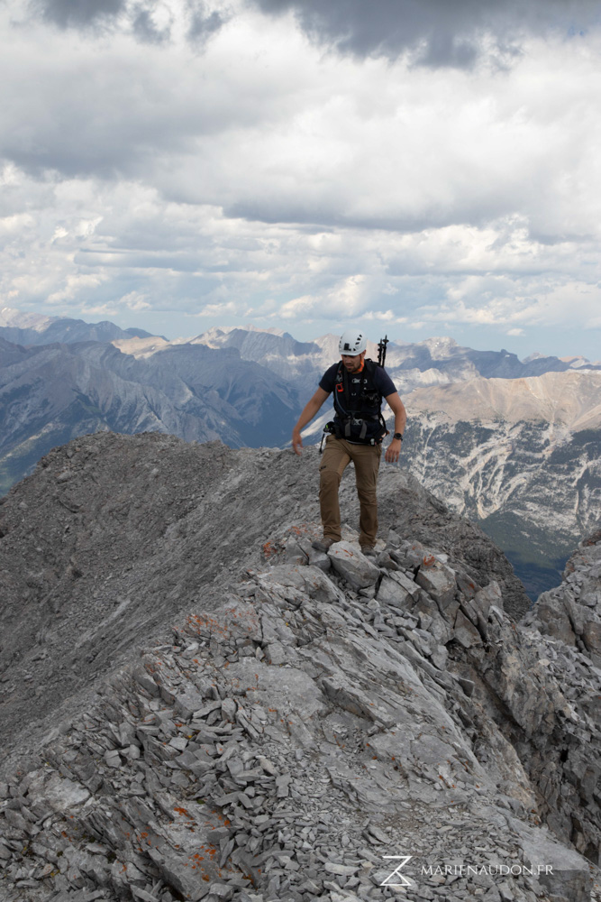
Be mindful of others scramblers on your way up. If you cause rocks to fall (and you will), make sure to warn anyone below by yelling “rocks!”. Try to follow the official route by using a GPS device or an app. C’est Notre Monde can provide the GPX file of the route we took upon request. After 1 km of tough climbing, you will see the summit and reach another step. This time, a 7 to 8 meters-high vertical rock face. Take your time getting down this one. Although it is not technically difficult it is exposed.
This is not a hike but a scramble qualified as “moderate” by Alan Kane in its famous scramble guide, Scrambles in the Canadian Rockies. Do not attempt this ascent without previous scrambling experience and safety gear.
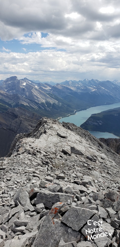
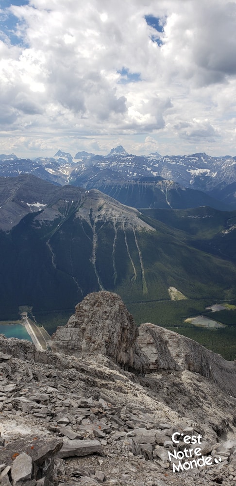
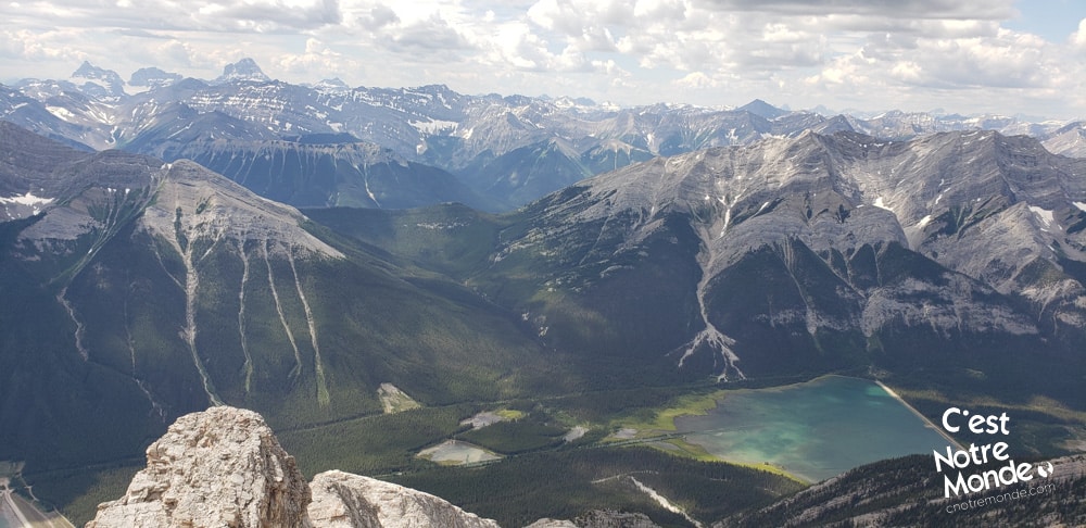
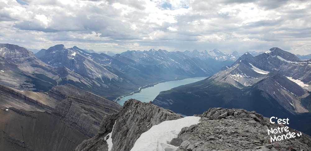
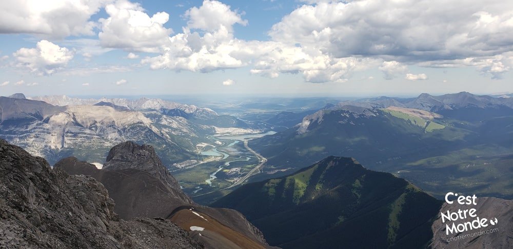
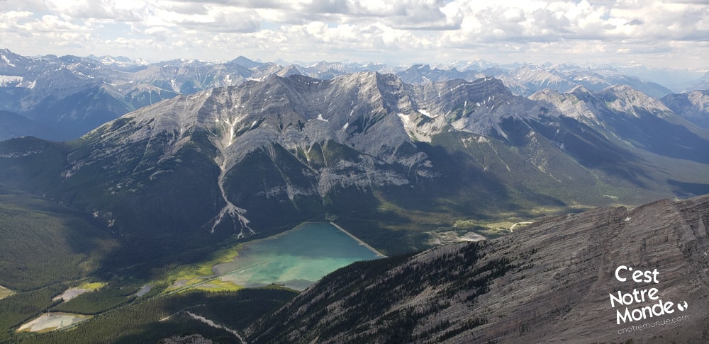
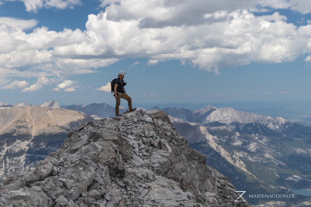
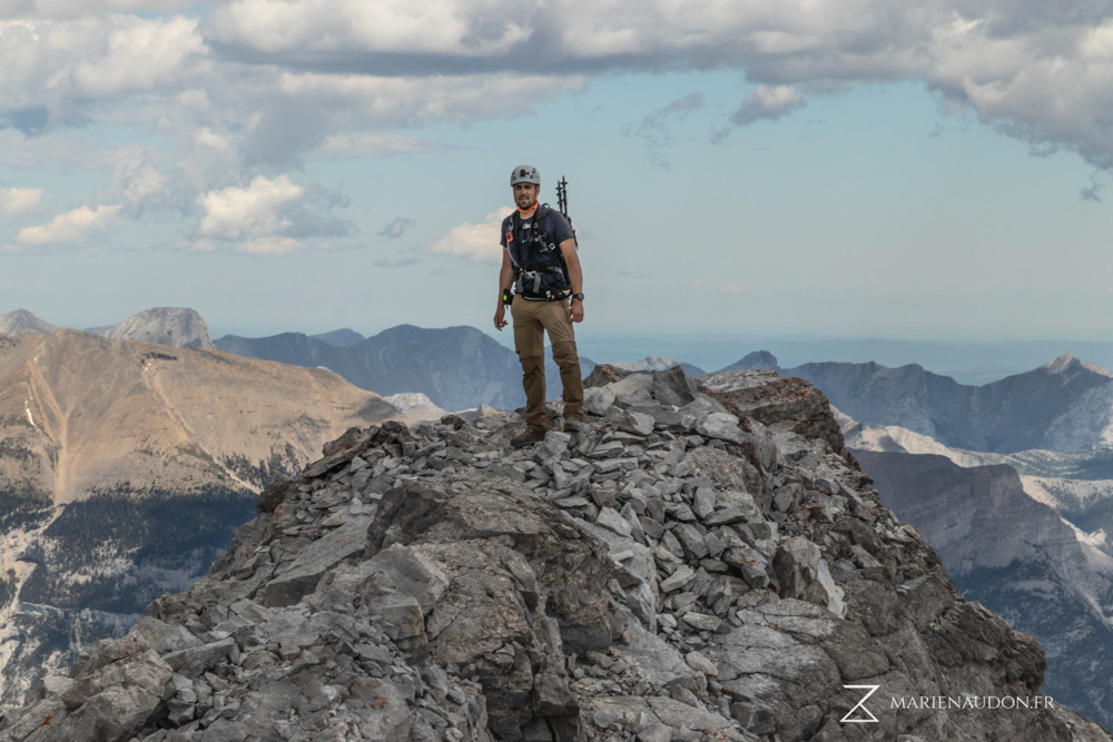
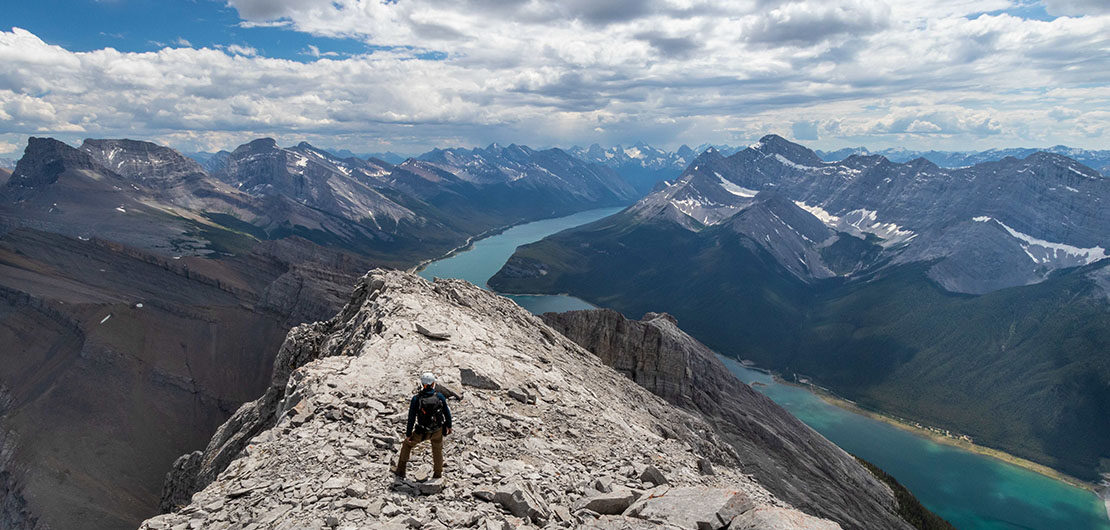
Once at the bottom of this step, there is one final push to the top, just 350m away with 150m of elevation. The summit ridge is wide and offers a 360-degree view of the region: Spay lake, Canmore, Banff National Park and even Mount Assiniboine (Canada’s Matterhorn) are in front of you. Truly magical!
Retrace your step to get back to the parking lot.
TO KNOW
Interest
Difficulty
Distance
Approximately 5,5 km / 3.4 miles
Duration
6 hours
Elevation
2936 meters / 9632 feet
Height difference
Around 1260 meters / 4134 feet
Useful informations
See on Caltopo (detailed)
See on Google Maps (basic)
Useful links
Website: https://www.albertaparks.ca/parks/kananaskis/kananaskis-country/
Parking: https://goo.gl/maps/2Xeu3nLBVPkfgxzC8
Weather forecast: https://www.mountain-forecast.com/peaks/Big-Sister/forecasts/2936
Download GPX: https://www.cnotremonde.com/gpx/Big-Sister-AB-cestnotremonde.gpx