 Alberta
Mount Sparrowhawk
Introduction
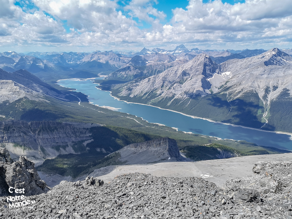
Discover our first ascent of over 3000m in the Canadian Rockies: Mount Sparrowhawk! This mountain holds a special place in our adventure. The climb to its 3121m (10,240ft) summit is a challenging yet achievable feat, requiring no advanced technical skills. Through forests and scree fields, the views are breathtaking, offering a stunning panorama of the Spray Lake Reservoir and the imposing peaks of Kananaskis Country. An experience of easy scrambling to add to your list of unforgettable hikes!
3D interactive map
Getting to Sparrowhawk Day Use Area
Parking access to Mount Sparrowhawk hike: https://maps.app.goo.gl/GV3Z73Jf21vtucic8
From Calgary: 130 km – 1h45 driving time
Take the Trans-Canada hwy AB-1 West toward Banff until exit 93 toward Canmore. Cross the bridge over the highway and turn right on Three Sisters Parkway, toward the Canmore Nordic Center. Follow this road until you reach the Rundle Forebay Reservoir. The paved road will turn to gravel and climb to reach the magnificent Spray Lake Valley. You’ll need to travel along the gravel road for approximately 22 km to reach the ‘Sparrowhawk Day Use Area’ parking lot, located on the right side of the road.
Helpful information
To enjoy your hike, you must:
Be Equipped: Hiking boots are a necessity. A steep section of this hike (easy scramble) requires ankle protection. Hiking poles are also recommended on your way down. Bears are present in the area, therefore bear spray should be easily accessible in the case of unexpected encounters. Finally, always bring water and food in sufficient quantities.
Information: Access to Kananaskis Country is not free. You will need to register your vehicle(s) online on the Kananaskis Park website and purchase a daily or annual pass. Note that the fees are per vehicle and not per hiker, so carpooling is an option. Be mindful of the forecast and visit the park’s website before your hike to find up-to-date information such as last seen wildlife, trail conditions, etc.
The Hike
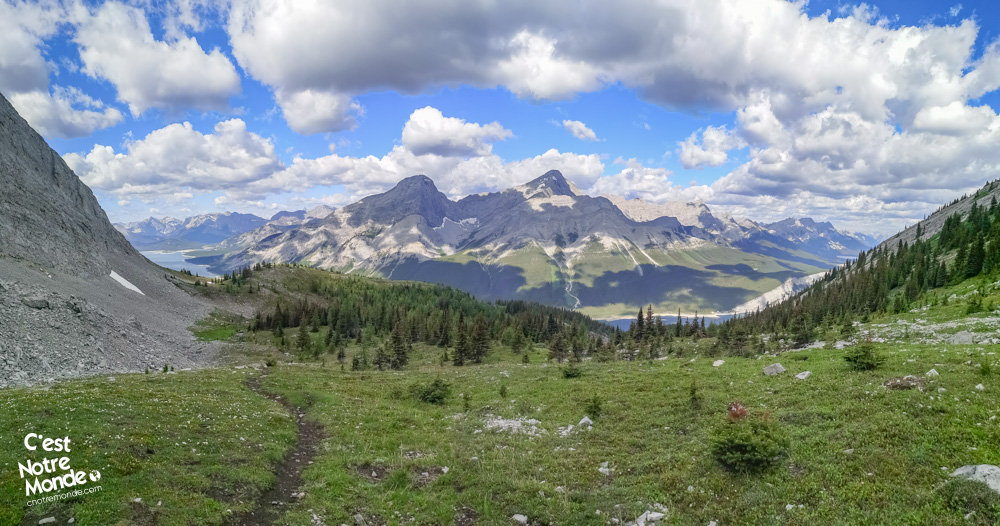
Embark on the exhilarating journey to summit Mount Sparrowhawk, starting from the “Sparrowhawk Day Use Area” parking lot. Access the prominent “Read’s Tower Route” trail, clearly marked across Highway 742. After a 400m (0.25mi) walk, turn left at the initial junction. The first 1.3km (0.8mi) of the trail winds through a forest, with varying terrain and some less defined sections. Navigate with ease by spotting the orange ribbons tied to trees.
Mount Sparrowhawk is a 3121m mountain located in the Spray Valley Provincial Park, in Kananaskis Country, Alberta.
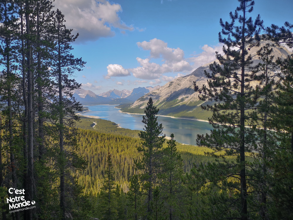
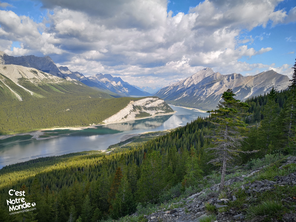
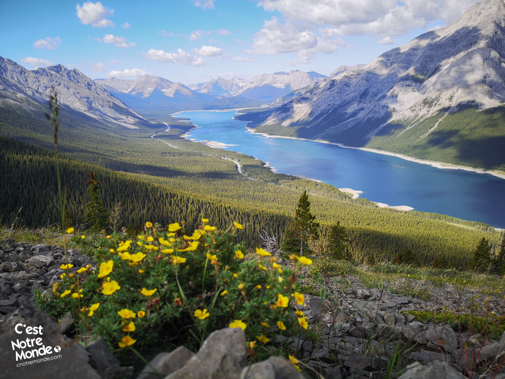
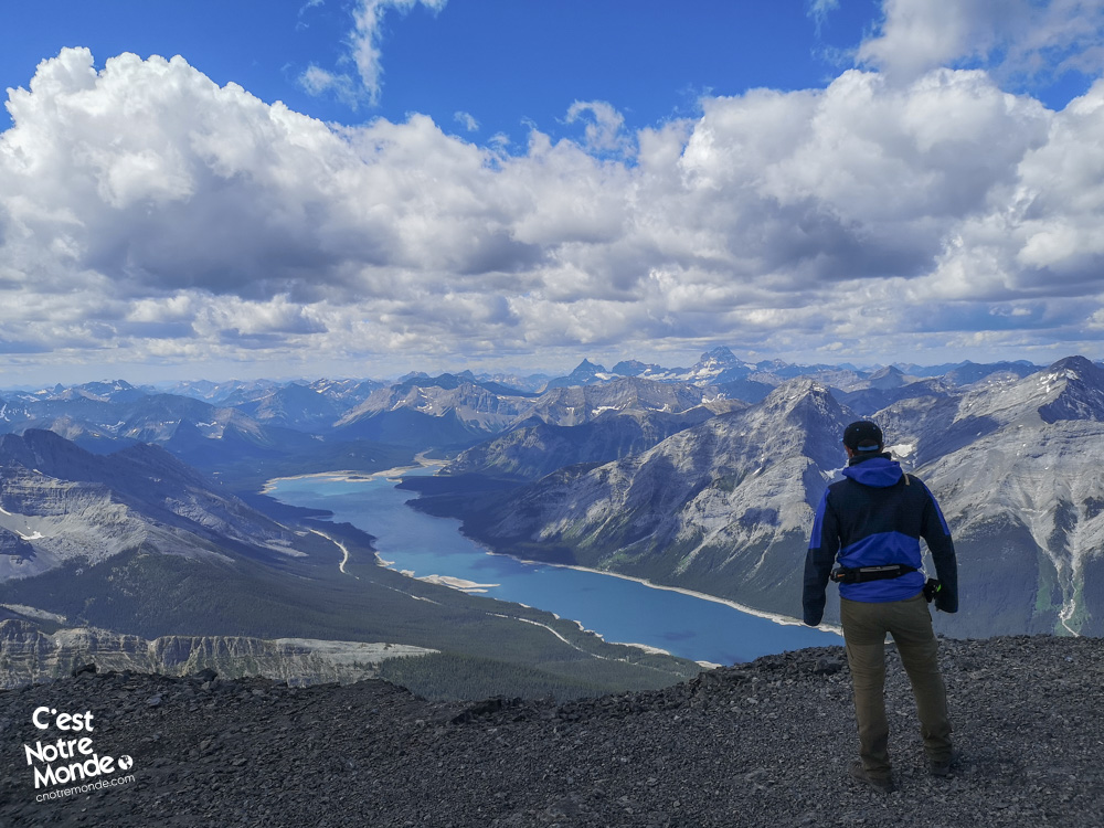
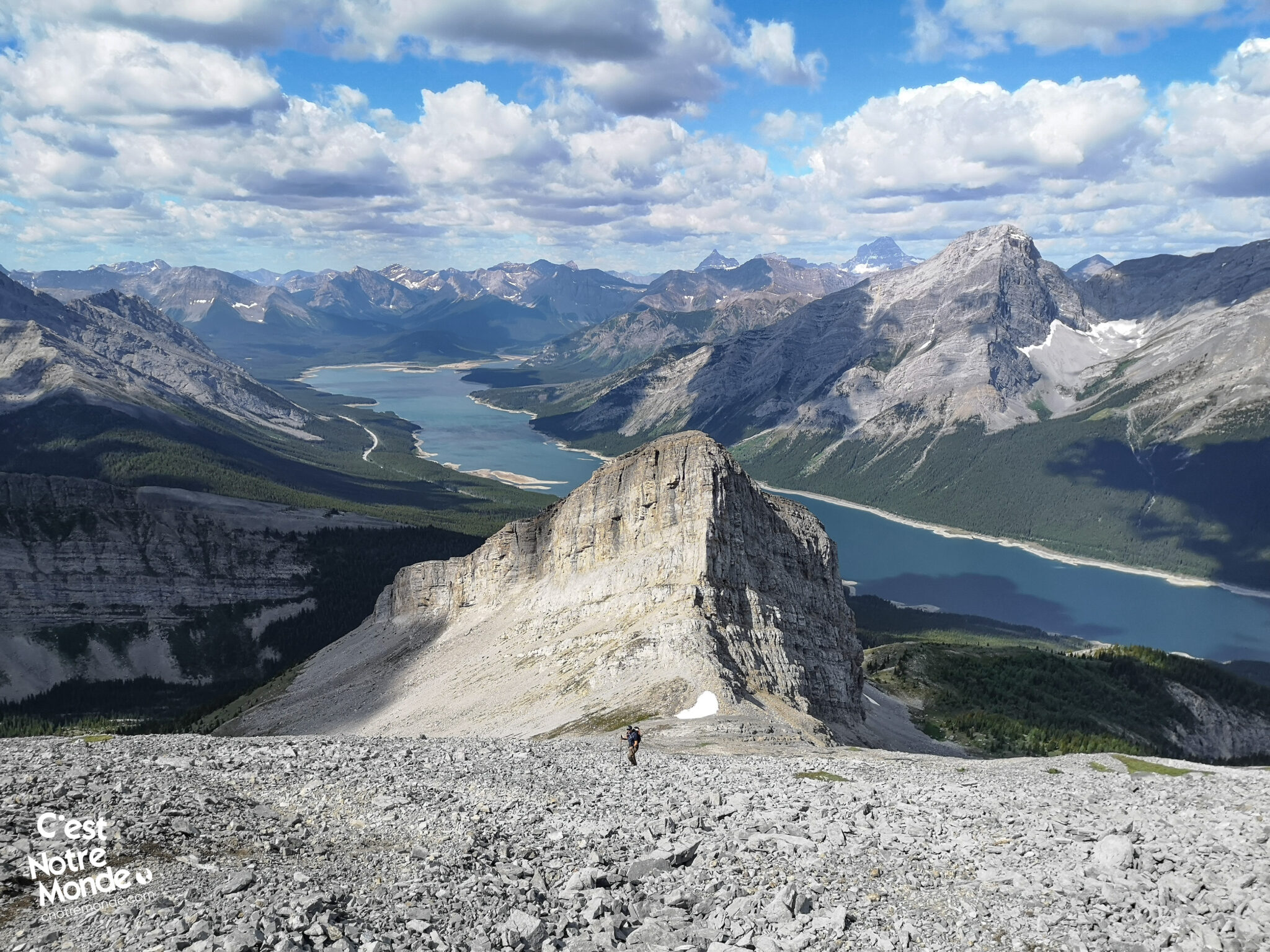
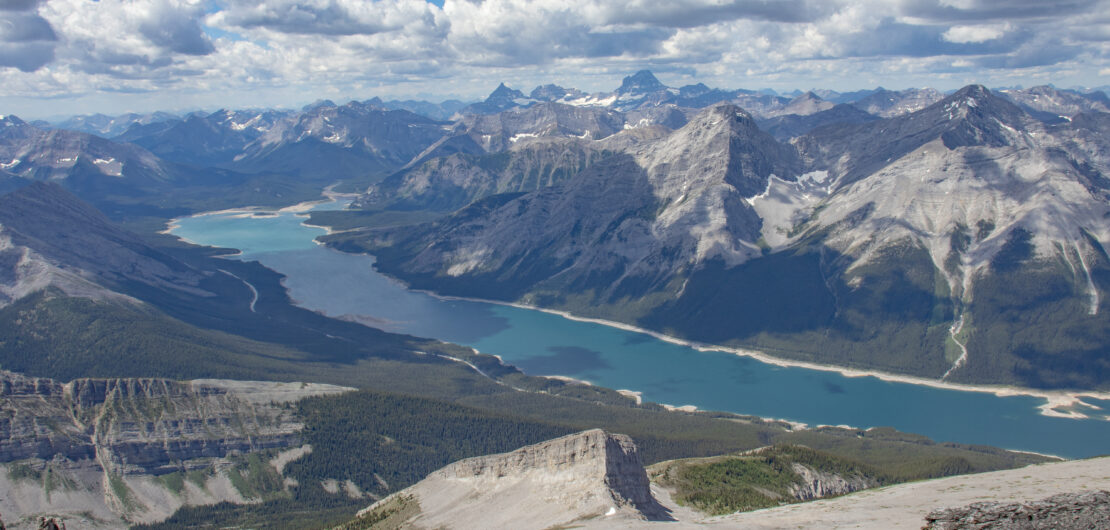
Exiting the forest reveals the breathtaking sight of the turquoise waters of Spray Lake. Follow the trail to a critical intersection. Opt to turn left, as the right path leads to the nearby summit of Read’s Tower (2657m / 2717ft). Look for a small cairn marking this intersection. The trail then skirts the imposing cliffs of Read’s Tower, eventually reaching a small cirque. Prepare for scrambling as you exit the cirque and ascend to a col with a stunning view of Mount Sparrowhawk.
The climb up Mount Sparrowhawk is lengthy and demanding, yet it does not entail highly technical sections.
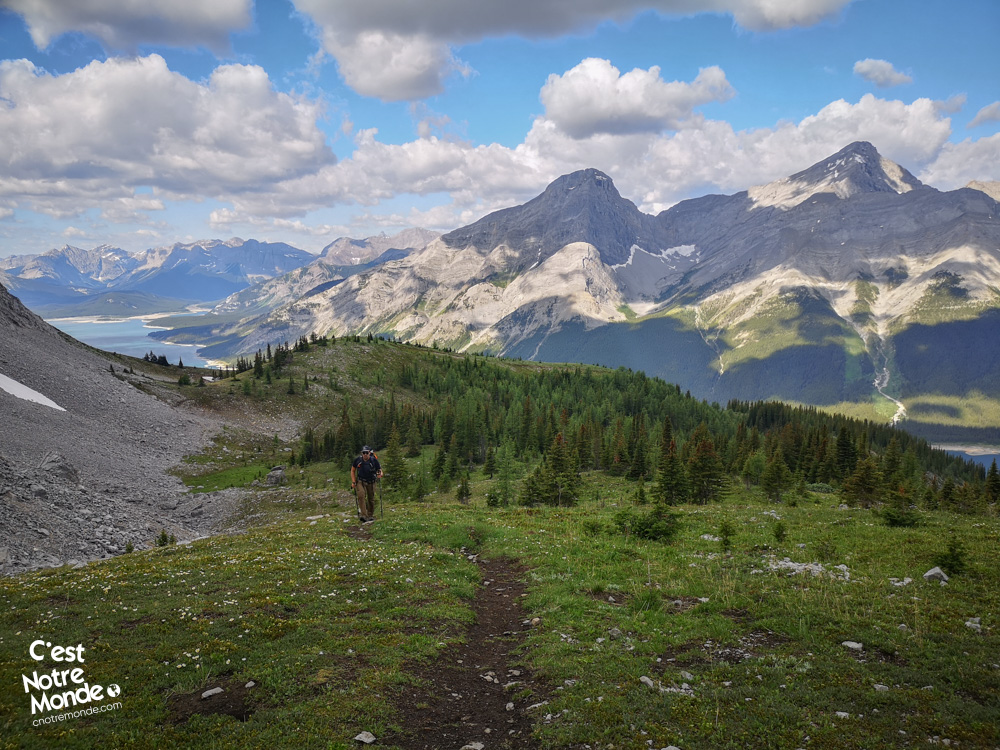
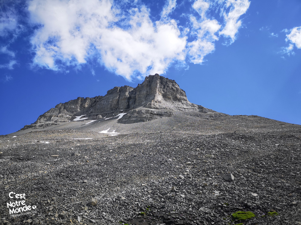
Continue onwards across a broad scree field to reach Sparrowhawk hut, nestled beneath the summit on the mountain ridge. A well-defined trail through this rocky terrain facilitates the challenging 1.2km (0.75mi) traverse with a 430m (1406ft) elevation gain. Upon reaching the shelter, you’ll have surpassed the 3000m mark, with only the final push to Mount Sparrowhawk’s summit remaining. In adverse weather, the hut provides a safe haven with basic survival gear.
The mountain was named ‘Sparrowhawk’ in honor of a warship from World War I.
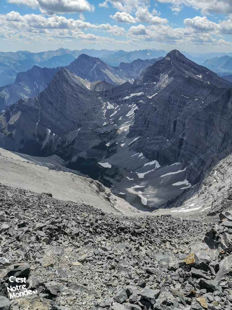
The last leg of the ascent, likely the most demanding (easy scrambling), involves navigating another steep scree slope prone to rockfall. Consider wearing a helmet if other hikers are present. Take your time to savor the awe-inspiring panoramic views from the summit ridge adorned with a prominent cairn. The vista encompasses the highest peaks of Kananaskis Country and Spray Lake, creating an unforgettable experience. Exercise caution as strong winds can prevail at the summit!
The slopes of Mount Sparrowhawk were under consideration for the ski events of the 1988 Olympic Games, but ultimately those of its neighbor, Mount Allan, were selected instead.
For the descent back to the parking lot, retrace your steps along the same trail. Exercise caution, particularly on the section leading to the hut, as the descent can be steep.
TO KNOW
Interest
Difficulty
Distance
Approximately 9.4 km / 5.8 miles
Duration
Around 6 or 8 hours
Elevation
3121 meters / 10,240 feet
Elevation gain
Around 1360 meters / 4462 feet
Useful informations
See on Caltopo (detailed)
See on Google Maps (basic)
Useful links
Website: https://www.albertaparks.ca/parks/kananaskis/kananaskis-country/
Parking: https://maps.app.goo.gl/jyFQPHREsKpXH8kT6
Weather forecast: https://www.mountain-forecast.com/peaks/Mount-Sparrowhawk/forecasts/3121
Download GPX: https://www.cnotremonde.com/gpx/Sparrowhawk-AB-cestnotremonde.gpx