 Alberta
Turtle Mountain
Introduction
April 29, 1903, 4:10am. 10 million tons of rock fell down Turtle Mountain and destroyed part of the town of Frank in Southern Alberta. Around 90 people lost their lives that morning in what Canada remembers as the most devastating rock slide of its history.
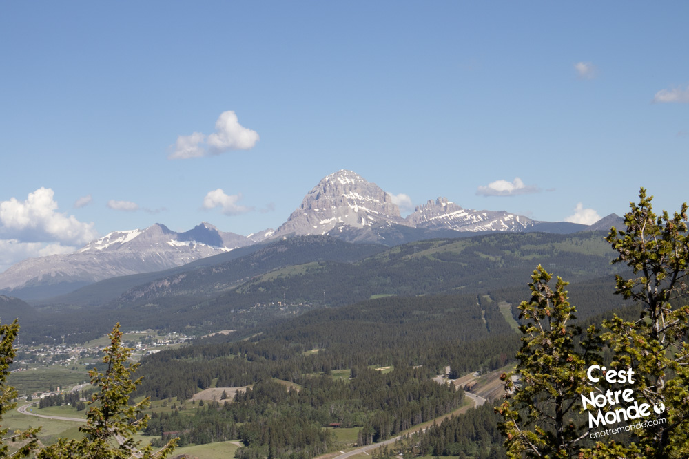
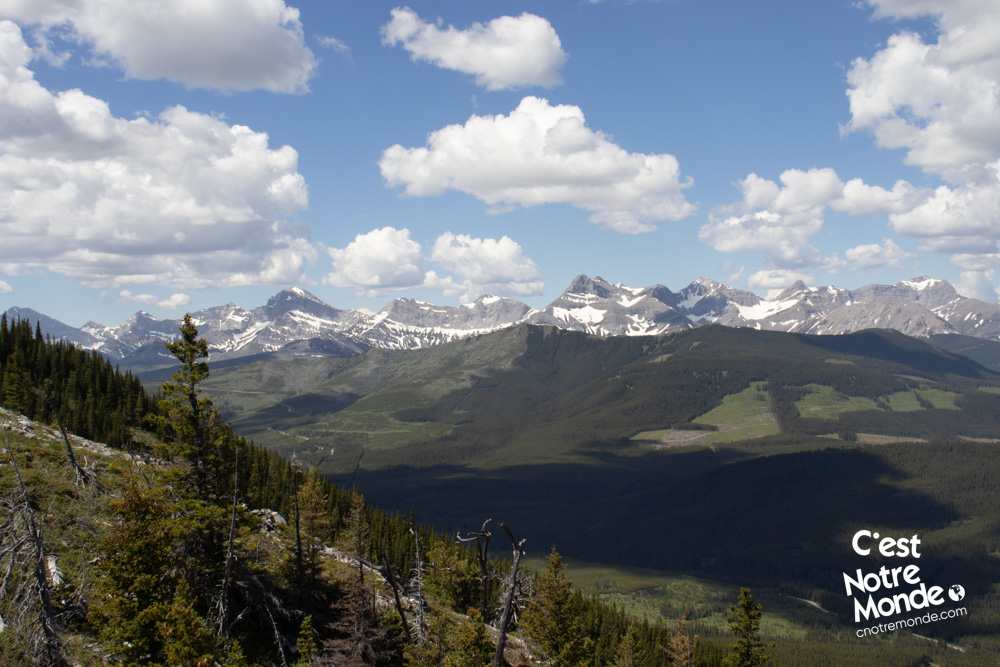
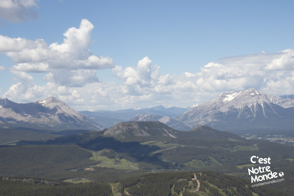
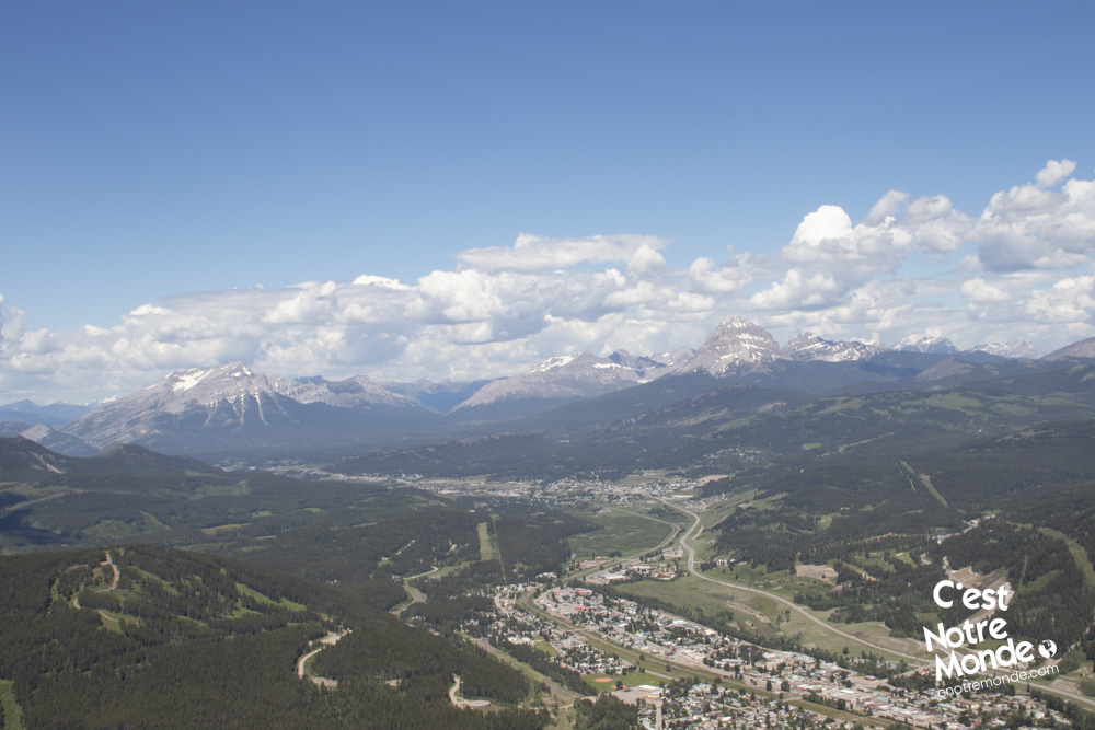
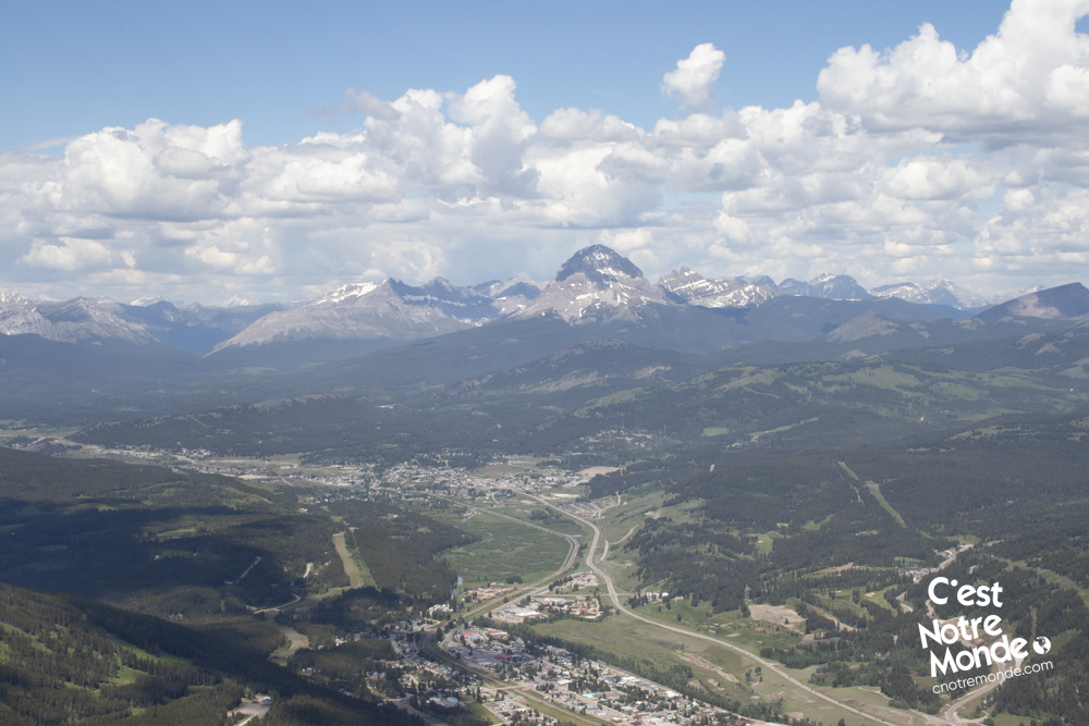
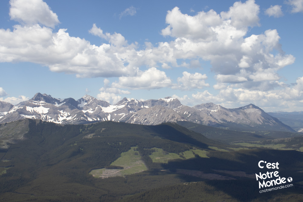
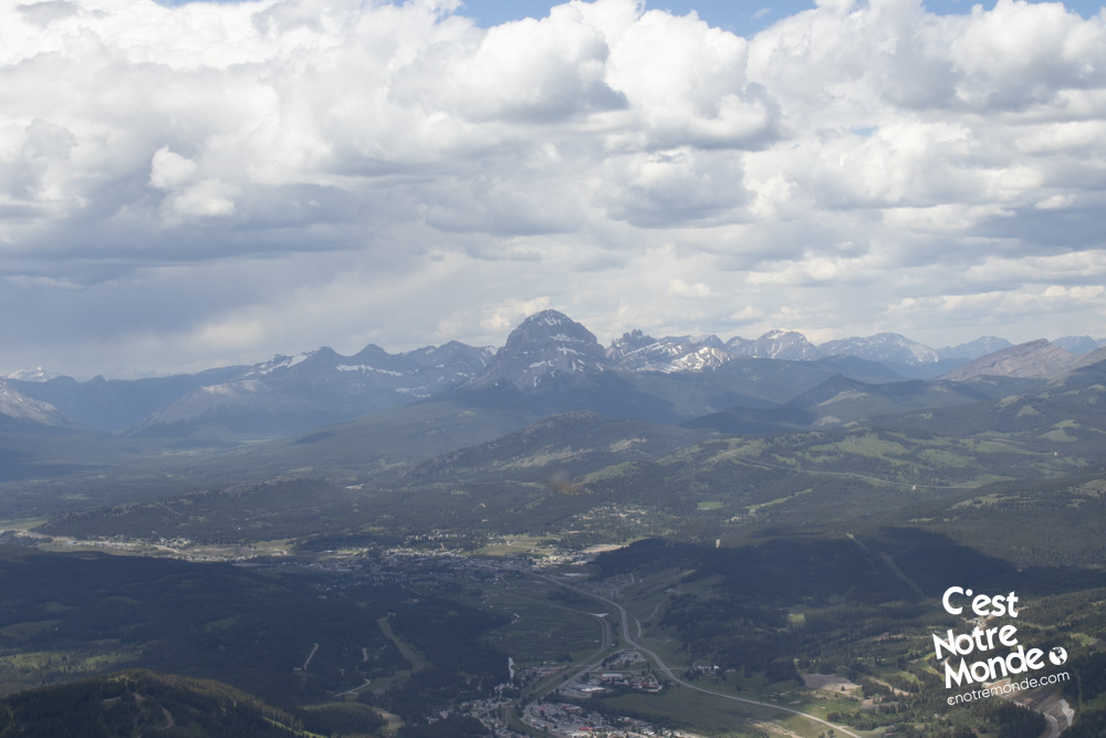
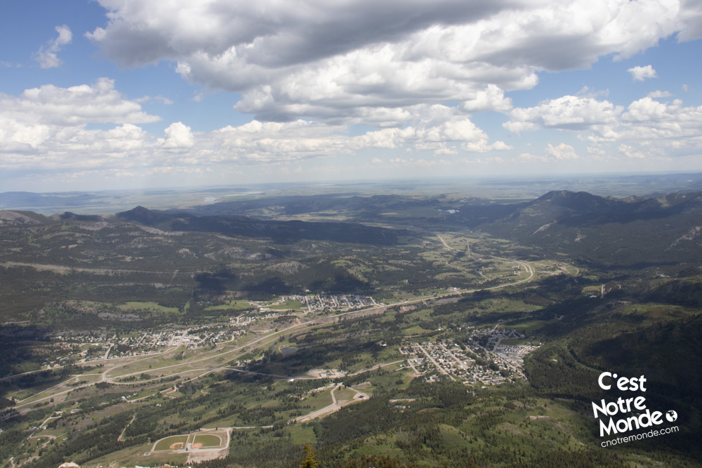
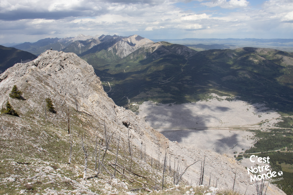
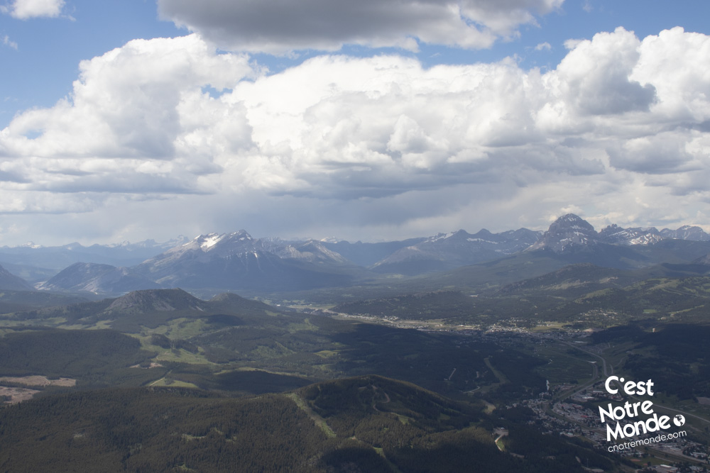
Today, Turtle Mountain is stable and regularly monitored. At 2210 meters high, this difficult hike offers an impressive view of the Frank Slide as well as an amazing 360 degree view of the Crowsnest Pass region. The first part of this hike is steep but without technical difficulties. The second part (the real summit) is an easy scramble that will test your route finding skills.
3D interactive map
Getting to Turtle Mountain
Turtle Mountain Hike Parking Access: https://goo.gl/maps/f8dGiQpQsDFYBwjK8
From Calgary: 220 km – 2h20 driving time
Take AB-22 South toward Crowsnest Pass for 150km (essentially, until it ends). This highway, also called “Cowboy Trail”, follows the Rockies across charming valleys dotted with farms and ranches. Once at the end of AB-22 South, take a right turn toward the Rockies and follow the road for 20km. You will drive through the rock field, a vestige of the 1903 catastrophe, then reach the town of Blairmore. Exit the main road on the left on 20 Ave, cross the town until you reach 15 Ave. There will be a dirt road on the right indicating the direction of the Turtle Mountain trailhead parking lot.
Helpful information
To enjoy your hike, you must:
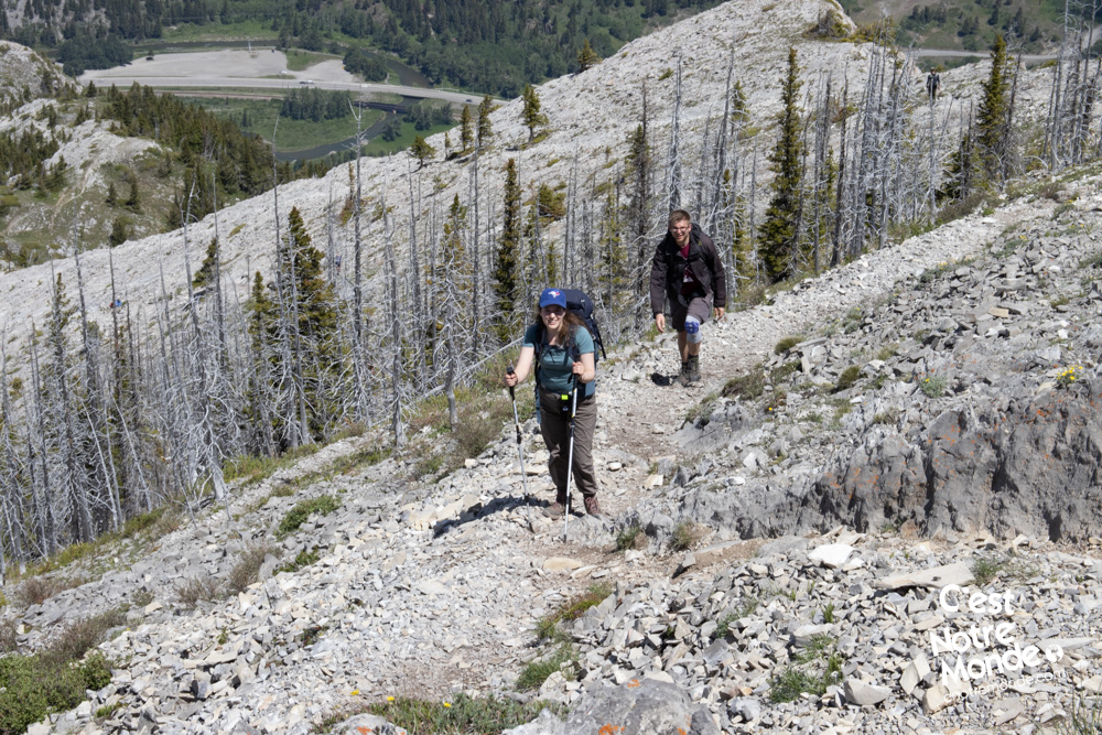
Be Equipped: Hiking boots are a necessity. A steep section of the hike (easy scramble) requires ankle protection. Hiking poles are also recommended on your way down. Grizzlies are present in the area, therefore bear spray should be easily accessible in the case of unexpected encounters. Finally, always bring water and food in sufficient quantities.
Parking: The parking is wide and free.
Information: Turtle Mountain is not part of a National or Provincial park. Make sure to check the weather forecast before starting this hike.
The Hike
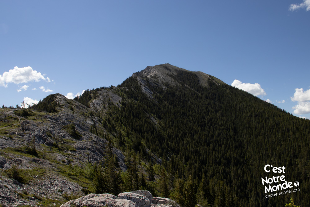
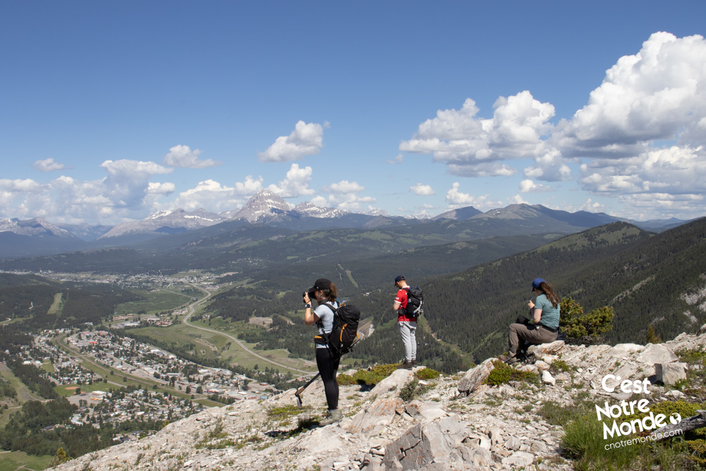
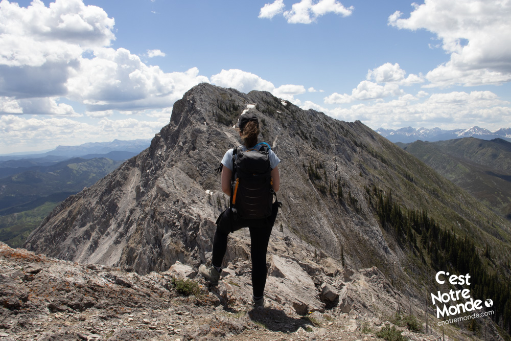
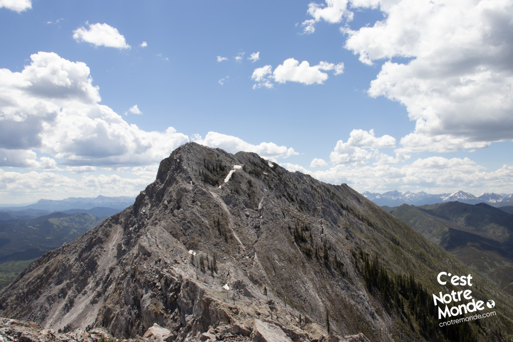
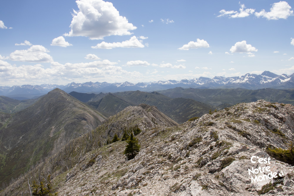
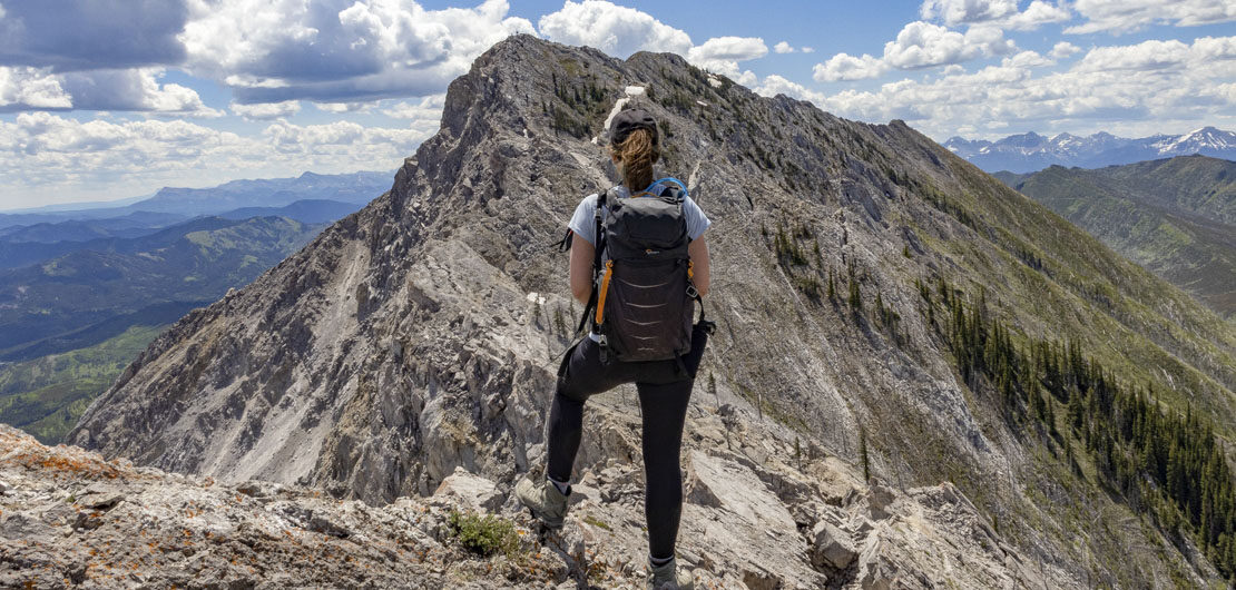
The trail starts in the forest and climbs consistently for 2.7km (1.7mi). After 1km, you will leave the woods and start appreciating the view. You will also notice the first objective of this hike: The north peak. The trail is easy to follow but the climb is steep, especially on the last 200 meters before the peak. At the top, you will be rewarded by a stunning view of the Crowsnest Pass region. You will also notice the second objective of your hike: The real summit of Turtle Mountain. Most hikers stop at the north peak, which is a solid effort already. The summit of Turtle is 1 km further and to reach it there is an easy scramble, but without a clear route, it can test a hiker’s patience.
April 29, 1903, 4:10am. 10 million tons of rock fell down Turtle Mountain and destroyed part of the town of Frank in Southern Alberta. Around 90 people lost their lives that morning in what Canada remembers as the most devastating rock slide of its history.
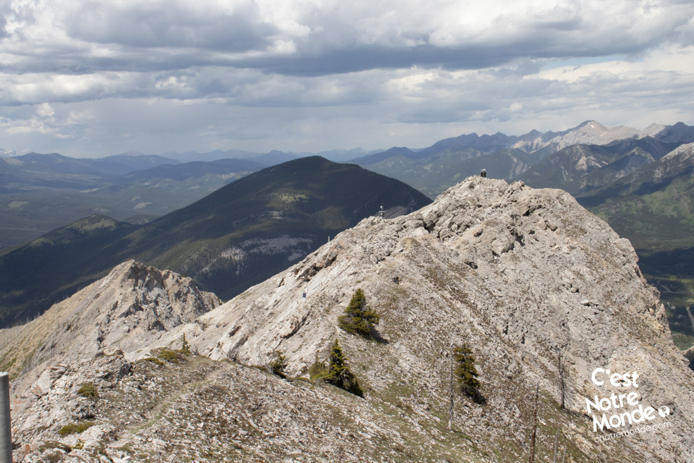
If you decide to continue on to the “official” summit, climb down the North Peak on the exposed rock section facing it. You will need to reach the hollow between the two peaks. The trail is no longer easily identifiable so you will need to explore to find the best and safest route. This section of the hike is located in a maze of unstable rocks, so be prudent. The help of a GPS device or app (such as Fatmap) is recommended (C’est Notre Monde can provide the GPX trace – contact us). You can download the GPX trace here.
Most hikers stop at the north peak, which is a solid effort already. The summit of Turtle is one km further and to reach it there is an easy scramble, but without a clear route, it can test a hiker’s patience.
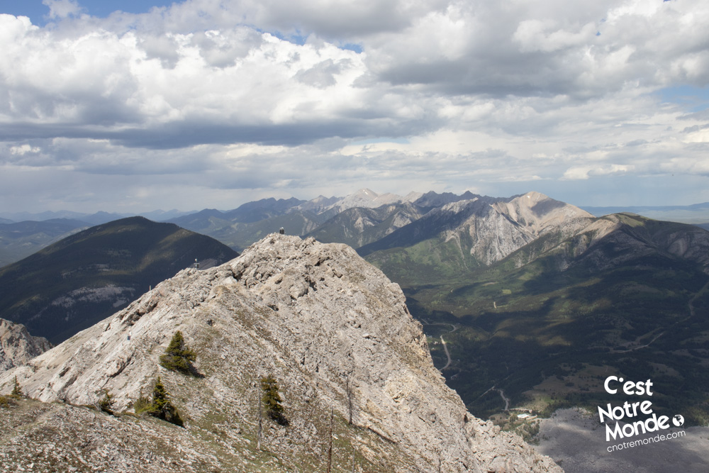
You will reach a ridge with installations of equipment to monitor the movements of the mountain, with informational plaques to learn more about the work being done to gather information and anticipate future rock slides. Continue on the ridge until you reach a wooden helipad. This marks the summit of Turtle Mountain, at 2210m (7250 ft) of altitude. The view is breathtaking.
Retrace your steps to get back to the parking lot.
TO KNOW
Interest
Difficulty
Distance
Approximately 7,5 km / 4.7 miles
Duration
4 hours
Elevation
2210 meters / 7250 feet
Height difference
Around 940 meters / 3085 feet
Useful informations
See on Caltopo (detailed)
See on Google Maps (basic)
Useful links
Website: Not available
Parking: https://goo.gl/maps/f8dGiQpQsDFYBwjK8
Weather forecast: https://www.mountain-forecast.com/peaks/Turtle-Mountain/forecasts/2210
Download GPX: https://www.cnotremonde.com/gpx/Turtle-Mountain-AB-cestnotremonde.gpx