 Alberta
Forgetmenot Mountain
Introduction
Forgetmenot ! How could we? This 2229 meter high mountain does not seem all that impressive at first. Located in Don Getty Wildland Provincial Park (Kananaskis Country), Forgetmenotwill will take you to a non-exposed ridge where the North summit is located, offering a magical panorama of the Rockies and nearby prairies. So follow us along, and get ready to discover this amazing mountain.
3D interactive map
Access to Don Getty Wildland Provincial Park
Access to the parking lot of the Forgetmenot hike: https://goo.gl/maps/4gtJk7r77DYN5Ro48
From Calgary: Approximately 80 km – 1h10 driving time
From the Trans-Canada hwy AB-1 West toward Banff, take exit 118 toward Bragg Creek. Follow the AB-22 South (Cowboy Trail) until the end of the road (for approximately 21 km). Turn right on the AB-66 West and follow this road until you reach a sign that indicates Forgetmenot Pond parking lot, about 28 km away.
Helpful information
To enjoy your hike, you must:
Be Equipped: Hiking boots are a necessity. A steep section of the hike (easy scramble) requires ankle protection. Hiking poles are also recommended on your way down. In spring or summer, you will need to cross the Elbow river. If the water level is high, be ready to get wet. Grizzlies are usually present in the area, therefore bear spray should be easily accessible in the case of unexpected encounters. Finally, always bring water and food in sufficient quantities.
Information: Access to Kananaskis Country is not free. You will need to register your vehicle(s) online on the Kananaskis park website and purchase a daily or annual pass. Note that the fees are per vehicle and not per hiker. So, you can carpool and pay only for one car. Be mindful of the forecast and visit the park’s website before your hike to find up to date information such as last seen wildlife, trail conditions, etc…
The Hike
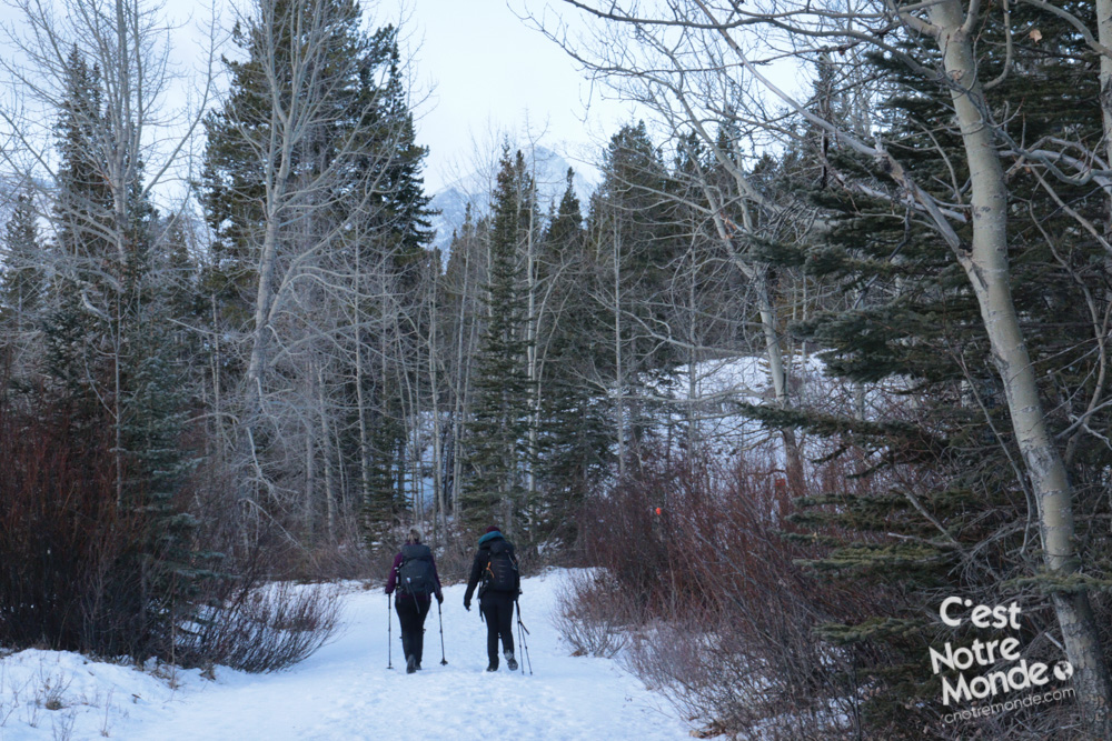
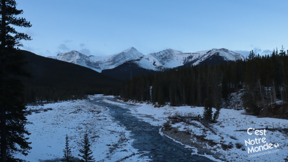
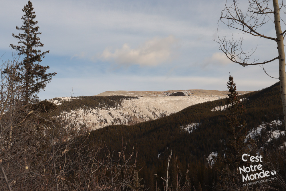
The hike starts by following “Little Valley Camp” road to cross the river on the beautiful Harlod Chapman bridge. You will then take the Big Elbow Trail for a short distance until you reach a large river that needs to be crossed by foot. In winter, the riverbed is dry but in spring/summer, the water level can be high, so be prudent. Once you have crossed the river, you will reach the forest at the base of the mountain.
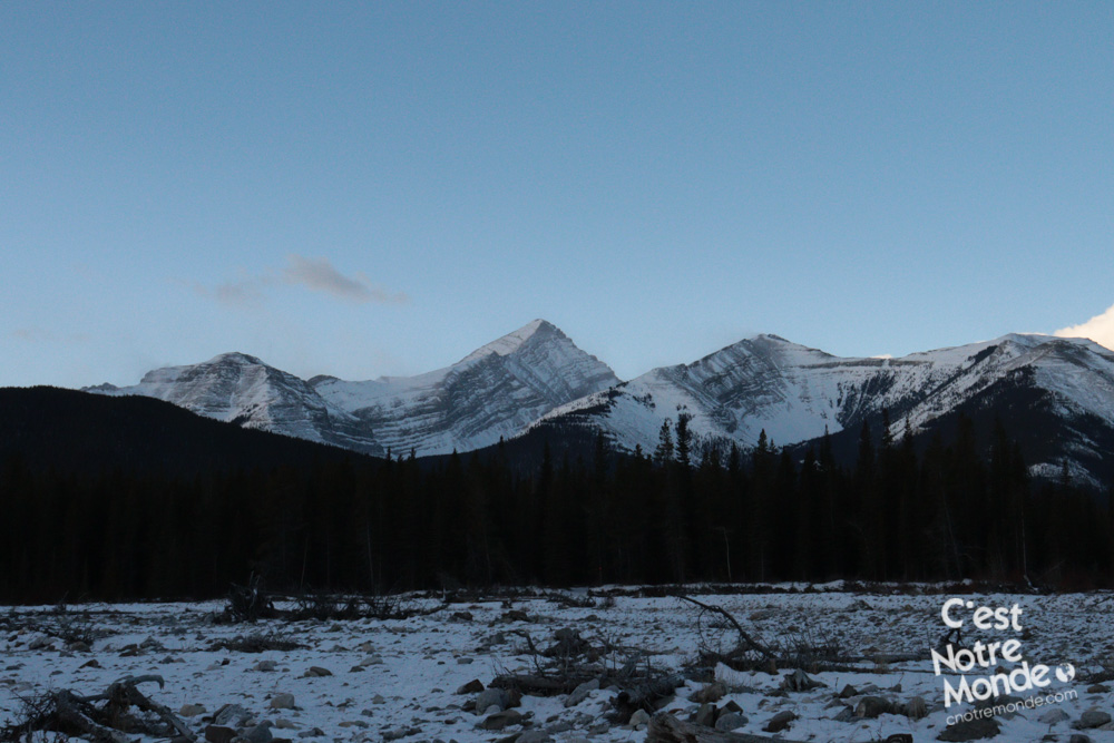
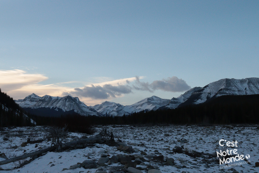
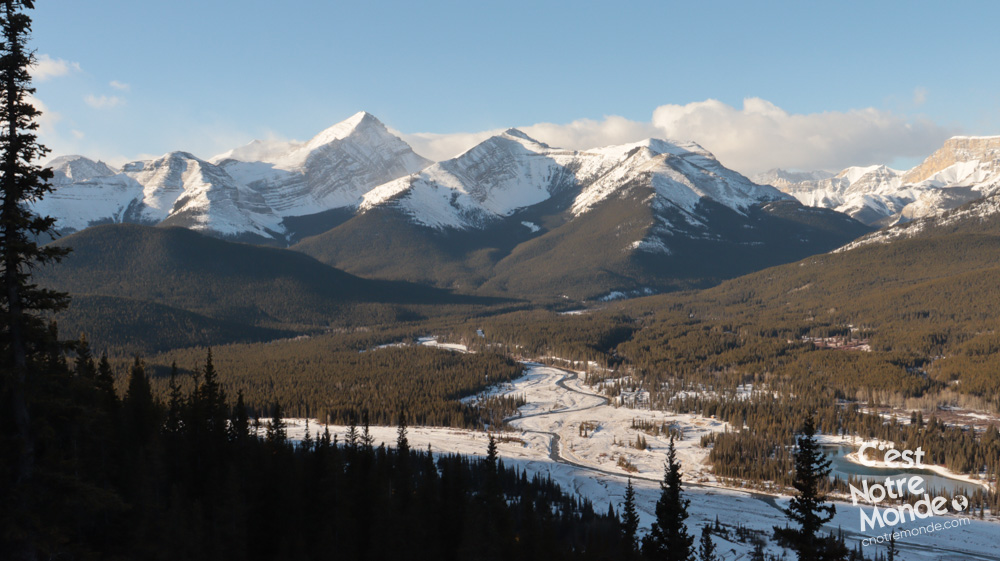
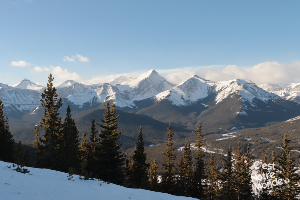
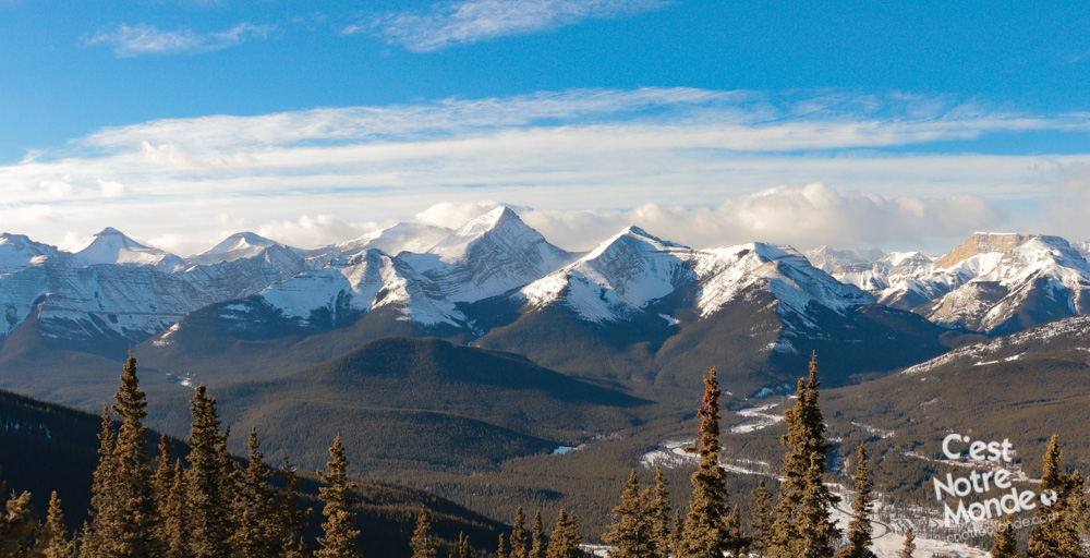
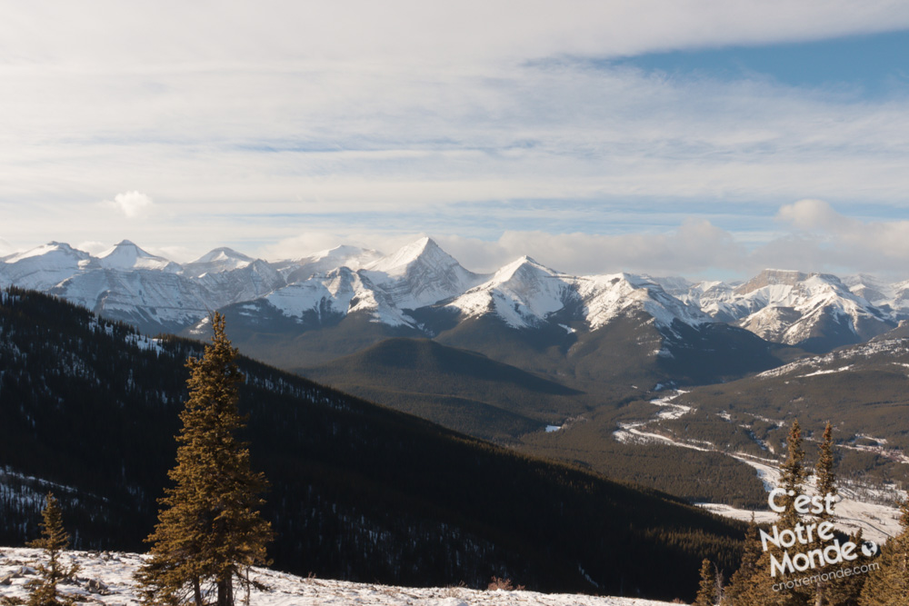
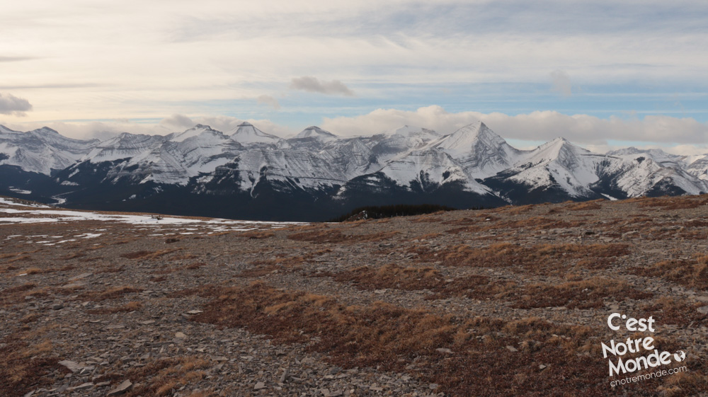
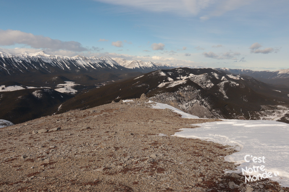
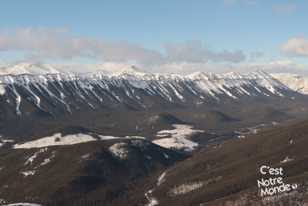
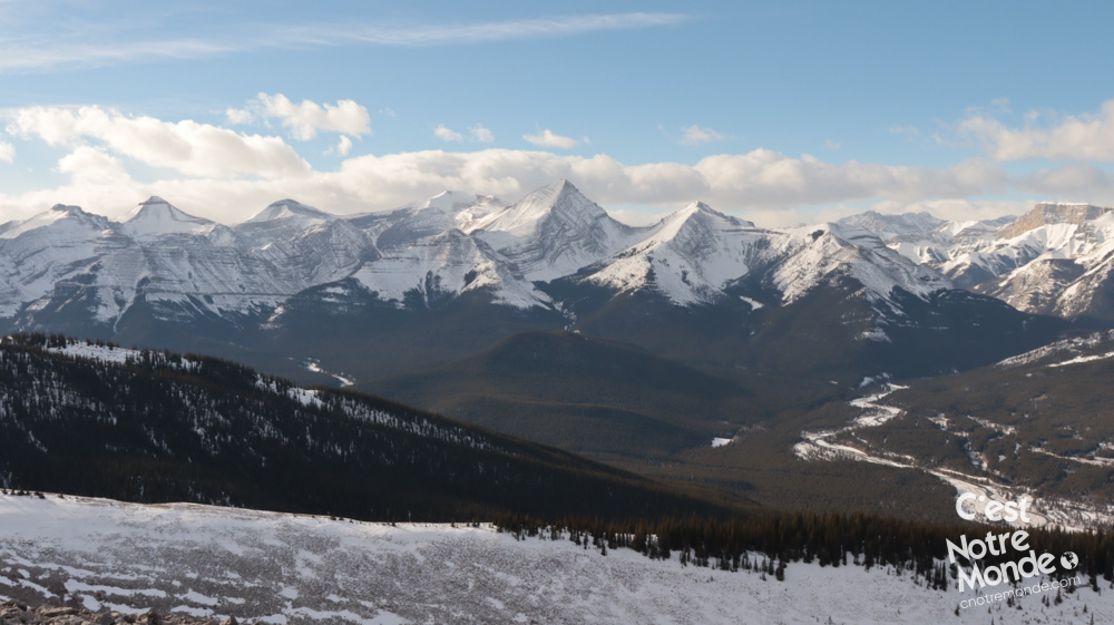
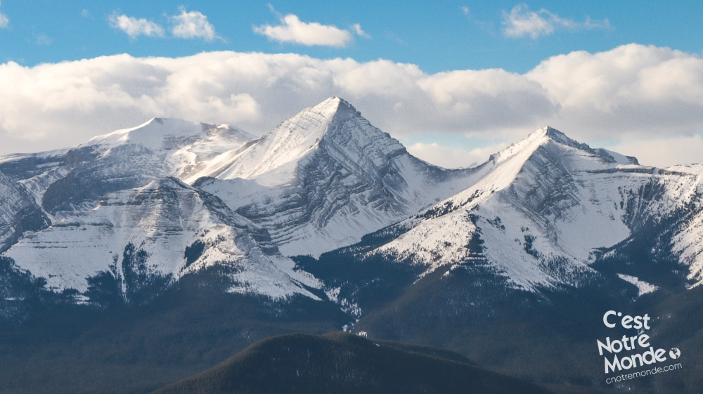
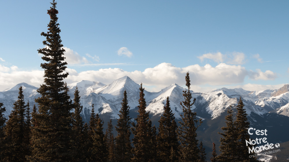
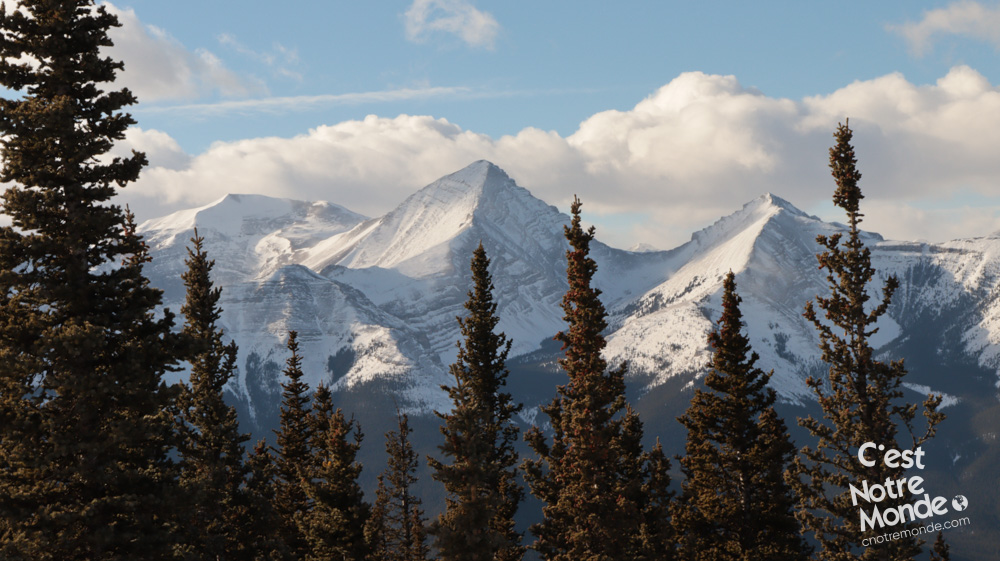
Forgetmenot offers an exceptional panorama of the Rockies and nearby prairies.
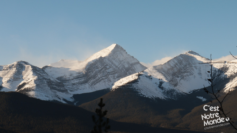
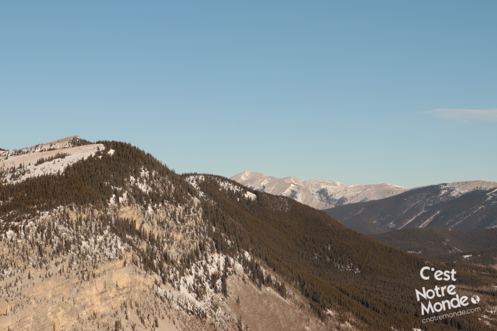
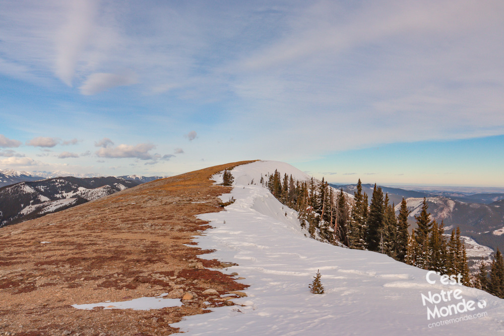
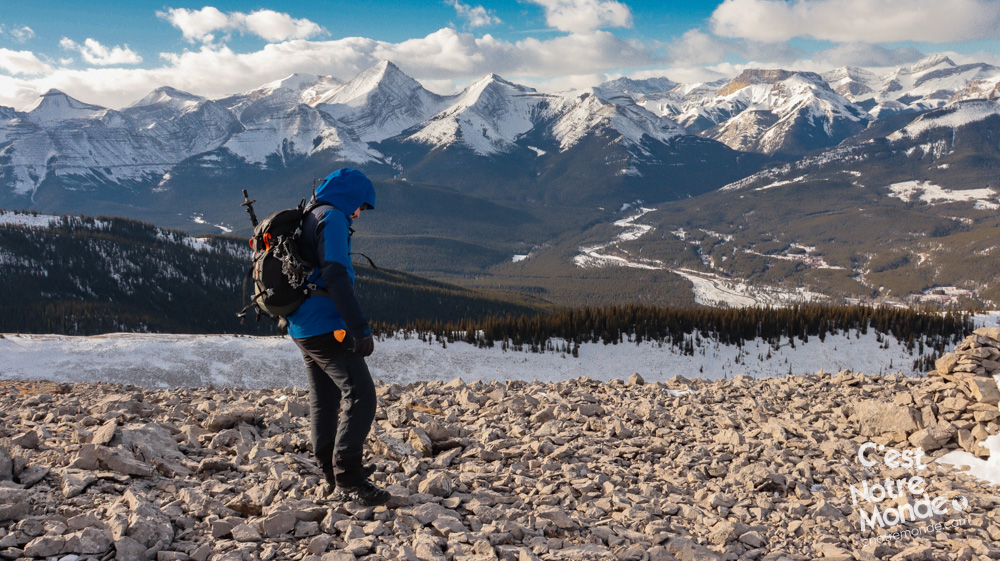
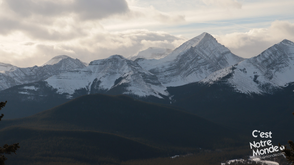
A steep climb greets you, and continues until you reach the ridge, approximately 2.8 km away (1.75 mi). During this climb you will leave the heavy tree cover behind and begin appreciating the beautiful panorama of the Rockies (especially Mount Glasgow – 2935m).
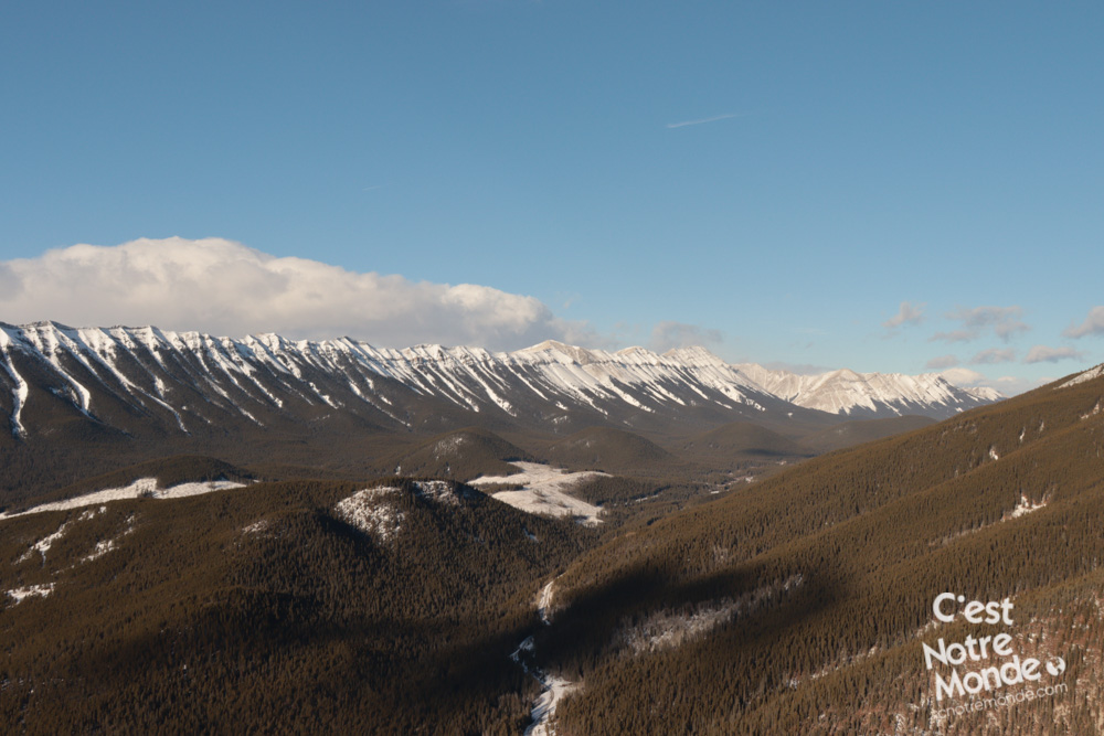
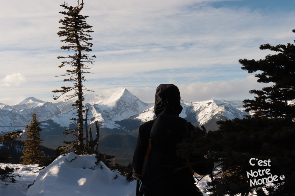
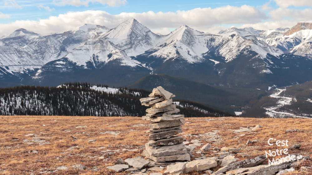
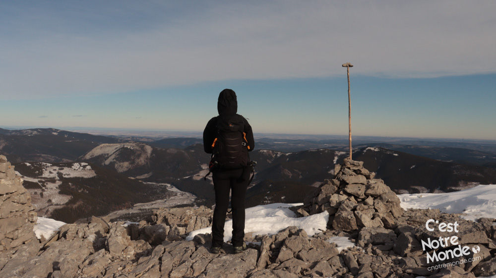
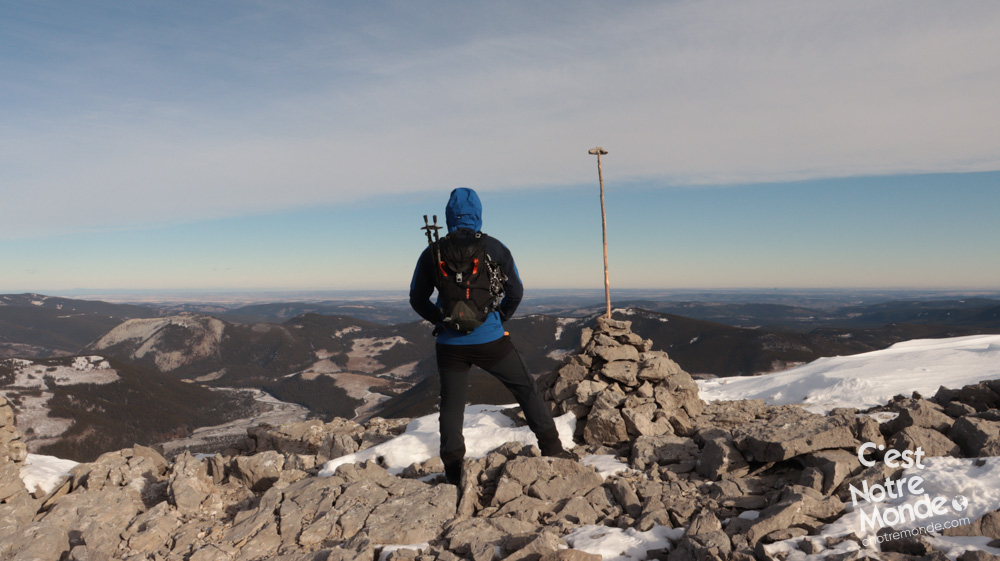
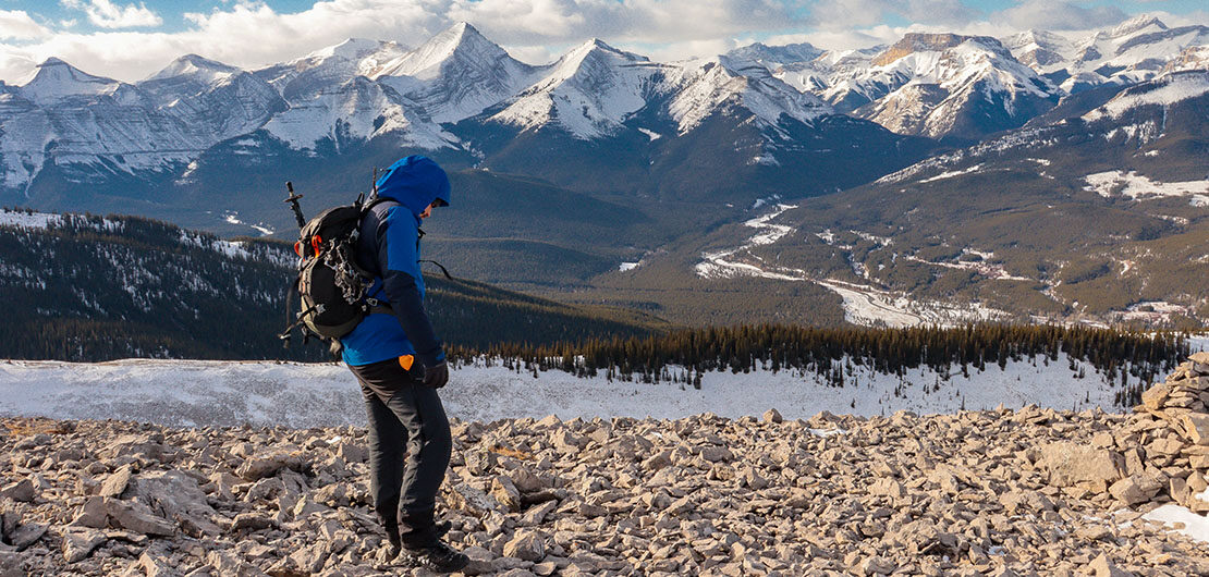
This hike will take you to a non-exposed ridge where the North summit is located.
Once at the ridge, you follow it along your left side for 850 meters (0.53 mi) in order to reach Forgetmenot’s North summit. At the summit, you will find a rock pile and a short wall to protect yourself from the wind. There is also a small box with a notebook inside, to leave messages to fellow hikers. The view from the ridge includes Prairie Mountain and Moose Mountain on the north side, Calgary and the prairies to the east, and of course, the beautiful Rockies to the west. Absolutely breathtaking!
Retrace your steps to return to the parking lot.
TO KNOW
Interest
Difficulty
Distance
Approximately 12.5 km (7.46 miles)
Duration
5 hours
Elevation
2229 meters / 7313 feet
Height difference
Approximately 700 meters / 2296 feet
Useful informations
See on Caltopo (detailed)
See on Google Maps (basic)
Useful links
Website: https://www.albertaparks.ca/parks/kananaskis/kananaskis-country/
Parking: https://goo.gl/maps/Ap8CMnr5oquiBx4v5
Weather forecast: https://www.mountain-forecast.com/peaks/Moose-Mountain-Alberta/forecasts/2437
Download GPX: https://www.cnotremonde.com/gpx/Forgetmenot-Mountain-AB-cestnotremonde.gpx