 Alberta
Opal Ridge
Introduction
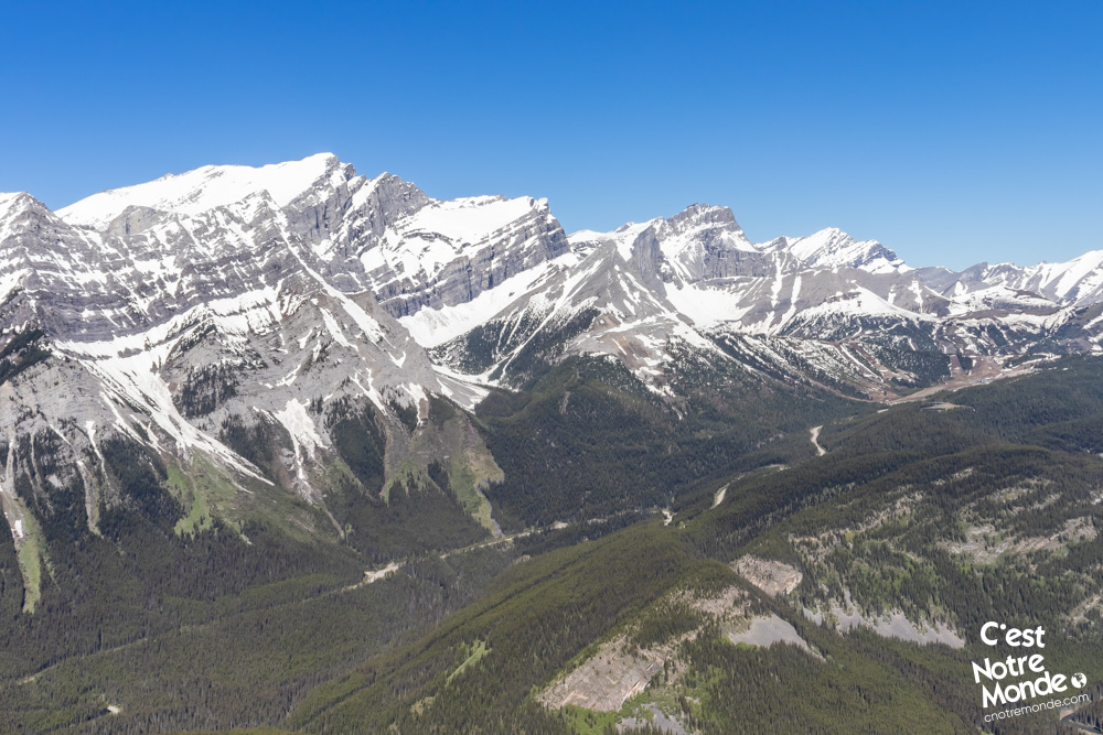
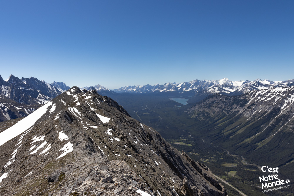
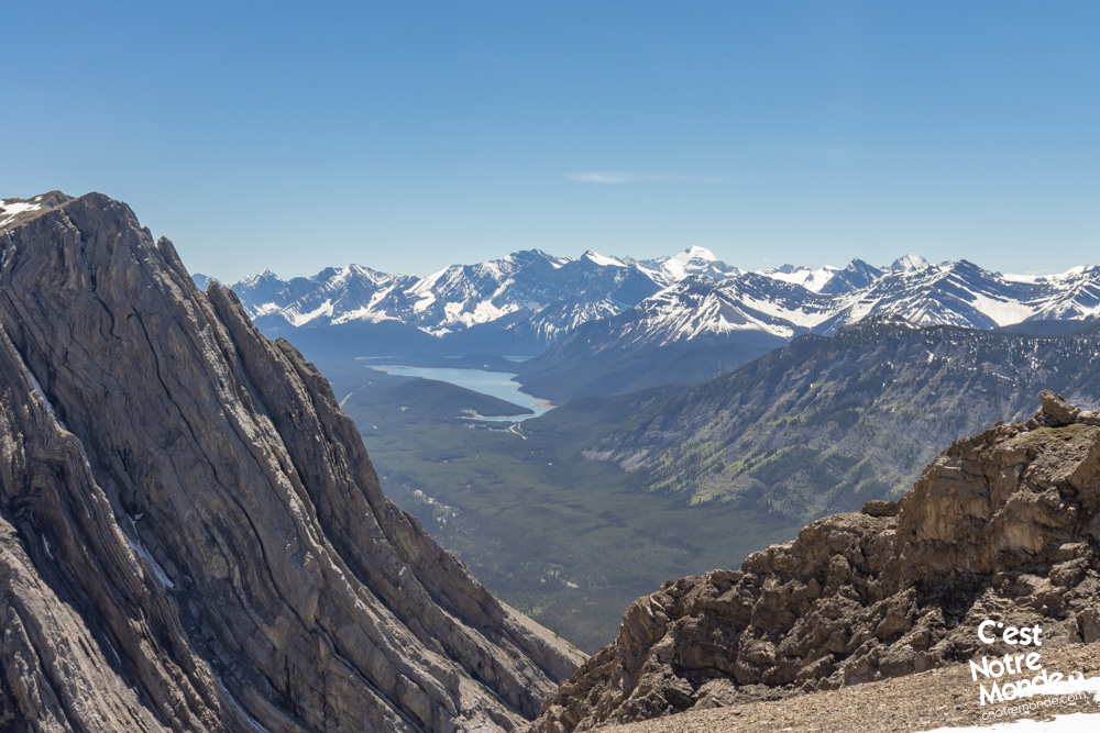
Opal Ridge is a 2575-meter-high mountain located in Kananaskis, Alberta. This difficult hike is a real favorite for C’est Notre Monde. We suggest the whole loop for those who have experience in scrambling and bushwacking. The loop crosses a panoramic and slightly exposed ridge, a beautiful spot to appreciate the surrounding peaks and the magnificent Upper and Lower Kananaskis Lakes. If you just want to reach the top (where the view is also incredible), it will be a shorter round trip. In any case, this hike is a must in our opinion! So go for it!
3D interactive map
Getting to Elbow-Sheep Wildland Provincial Park
Parking access to Opal Ridge hike: https://goo.gl/maps/JBd4W8MmjoHaz8a27
From Calgary: 116 km – 1h20 driving time
Take the Trans-Canada hwy AB-1 West toward Banff for 50 km until the 118 exit toward Kananaskis Country. Follow the AB-40 South for 42 km. Then turn left to enter the “Fortress Junction Service Center”. The trailhead is located on the far left end of the gas station. There is plenty of space for parking.
Helpful information
To enjoy your hike, you must:
Be Equipped: Hiking boots are a necessity. A steep section of this hike (easy scramble) requires ankle protection. Hiking poles are also recommended on your way down. Bears are present in the area, therefore bear spray should be easily accessible in the case of unexpected encounters. Finally, always bring water and food in sufficient quantities.
Information: Access to Kananaskis Country is not free. You will need to register your vehicle(s) online on the Kananaskis park website and purchase a daily or annual pass. Note that the fees are per vehicle and not per hiker, so carpooling is an option. Be mindful of the forecast and visit the park’s website before your hike to find up to date information such as last seen wildlife, trail conditions, etc.
The Hike
From the parking lot, take the path climbing away from the road. After 200 meters you will join a wide service road. Turn left and follow it for 300 meters until you reach a trail on the right. It will take you all the way up to Opal Ridge Summit. The trail begins to climb rapidly through a small forest. The vegetation quickly becomes scarce as the panorama of the valley appears.
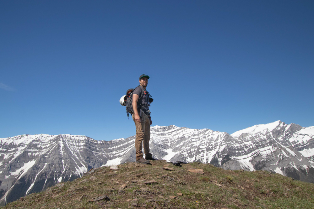
Opal Ridge is a 2575-meter-high mountain located in Kananaskis, Alberta.
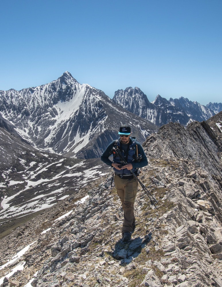
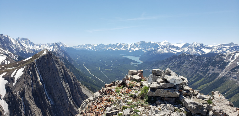
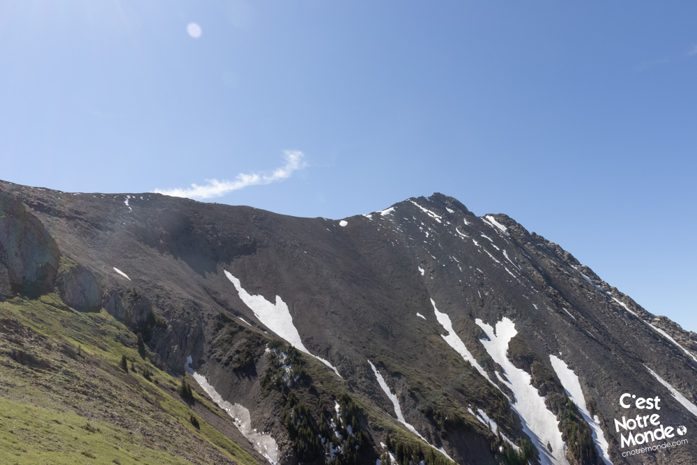
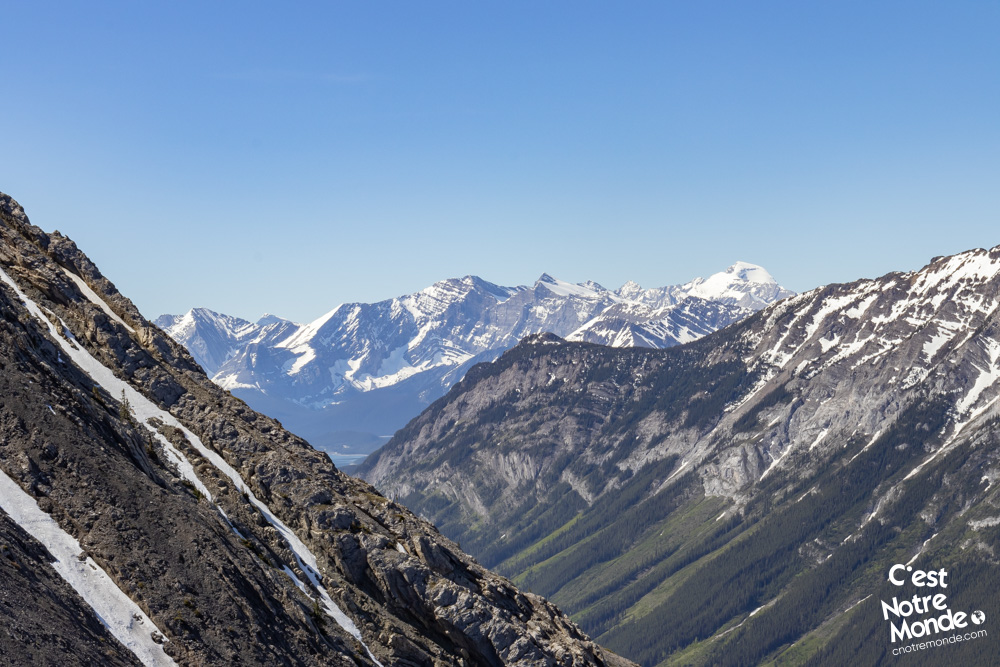
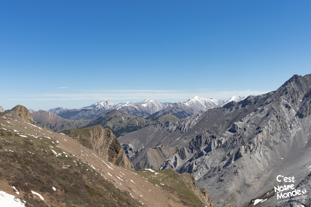
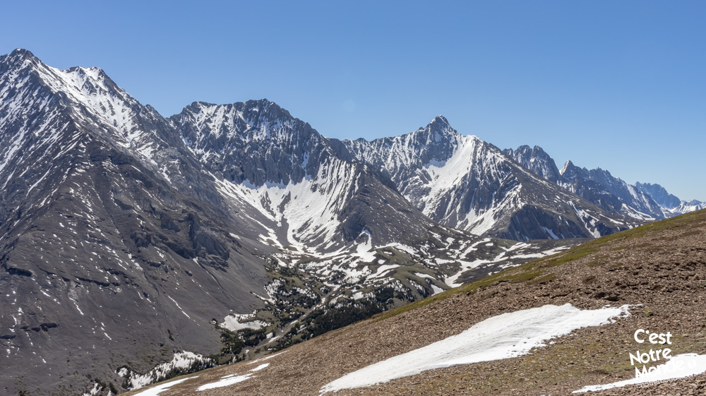
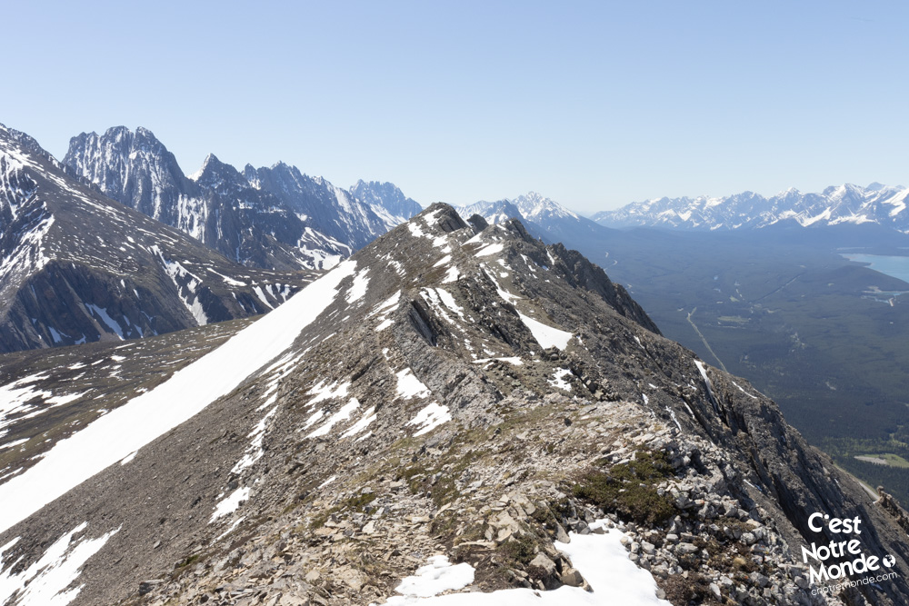
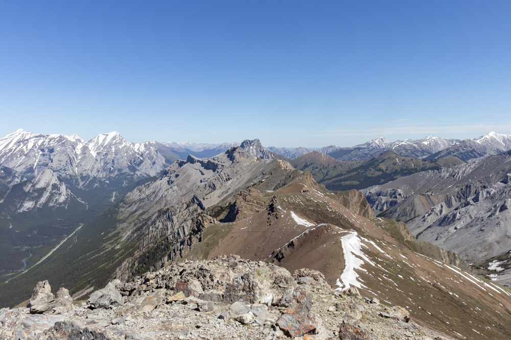
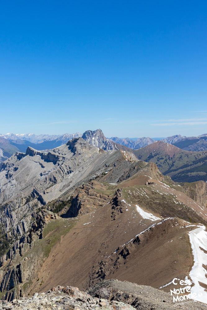
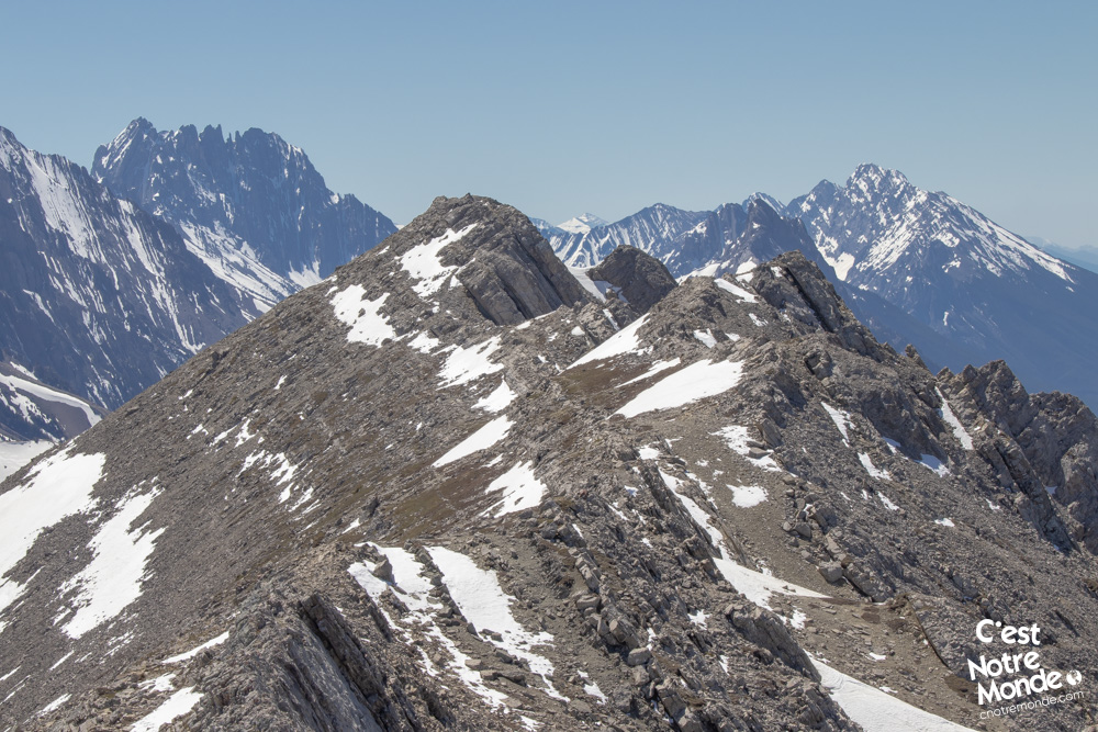
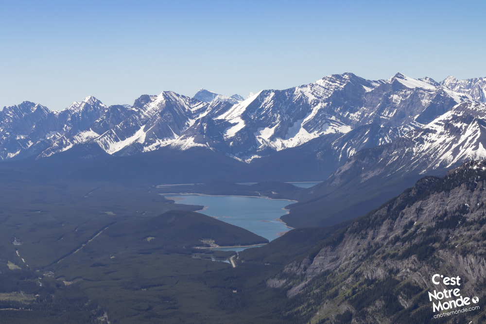
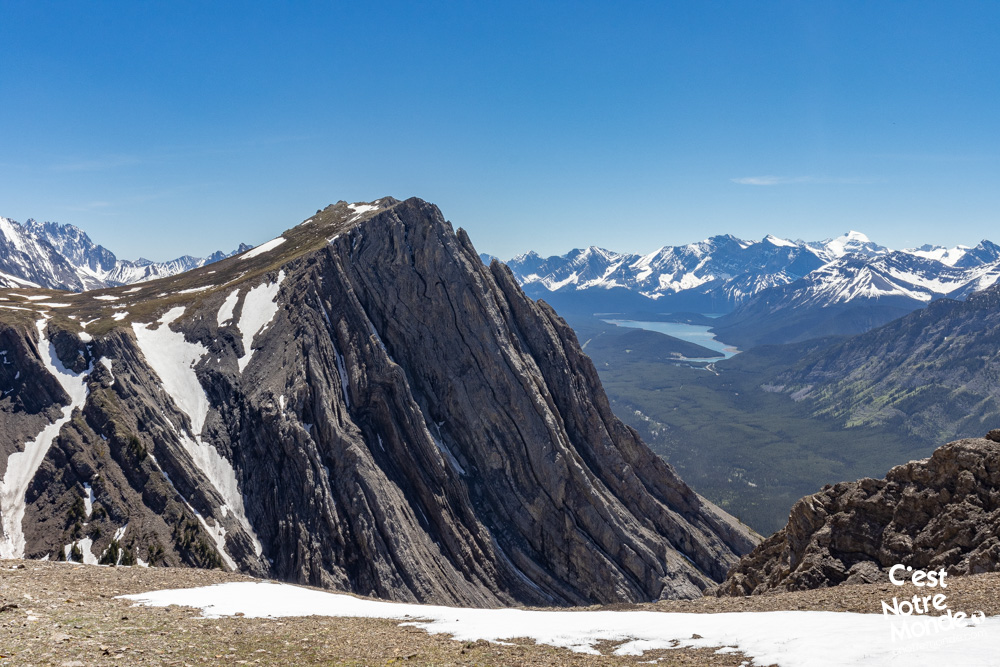
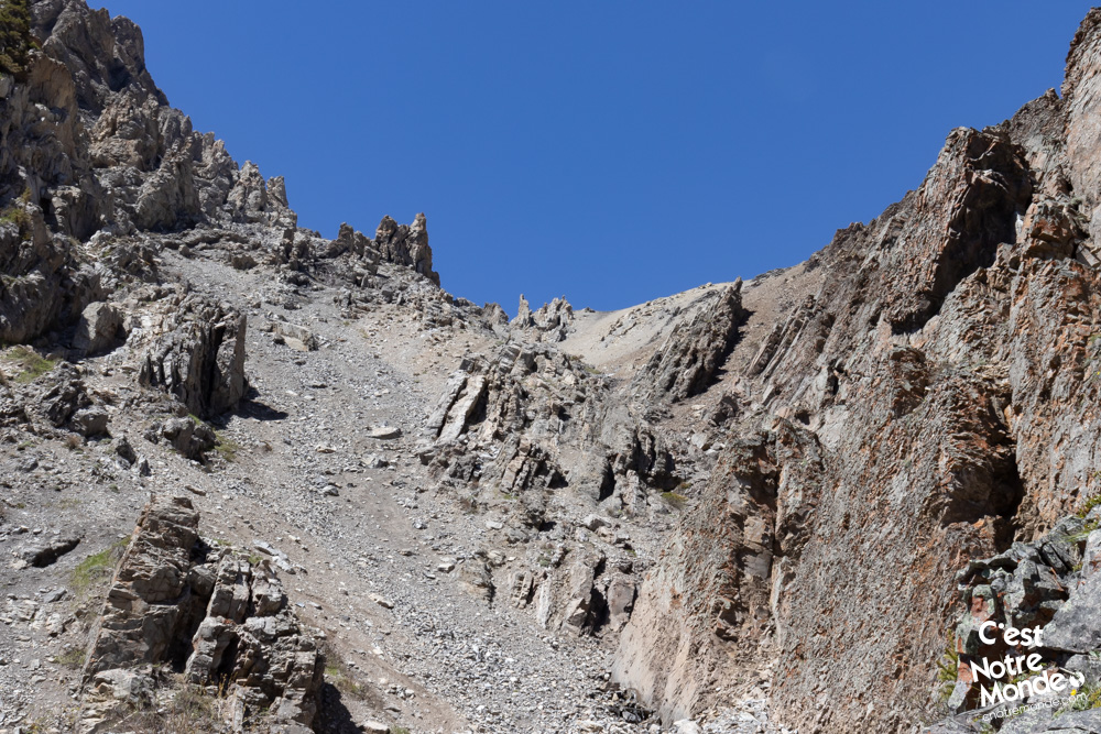
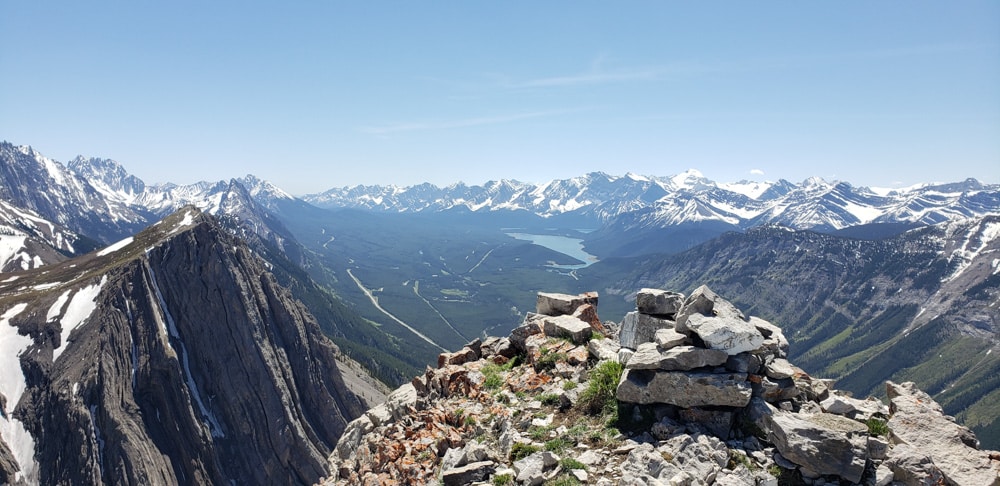
During the climb, you will pass through some easy scrambling sections where you will have to use your hands. The landscape will also alternate between meadows and rocky terrain. After 1.6km and 600m of elevation, you will reach a beautiful plateau with a view of your path to the summit ridge. This last part is quite steep. But once on the ridge, there will be 700m of walking and a hundred meters of elevation left to reach the highest point of Opal Ridge. The summit offers a 360-degree view of the region, including Opal North Peak, Grizzly Peak, South Lawson Peak and the Kananaskis Lakes. Absolutely breathtaking.
The Opal Ridge hike will take you to a panoramic summit, with breathtaking views of the Kananaskis Lakes.
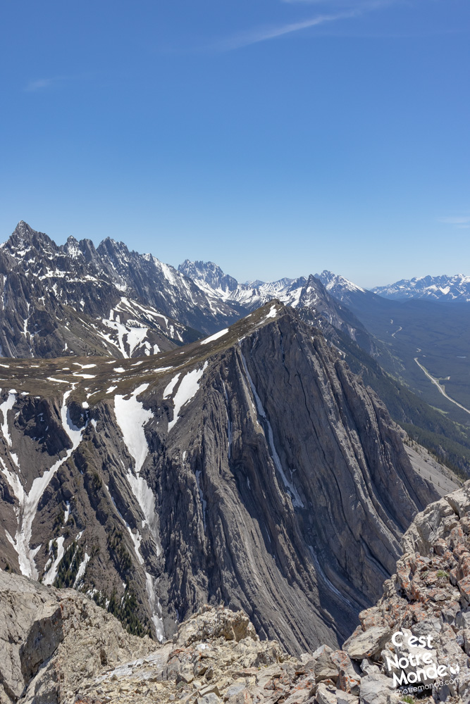
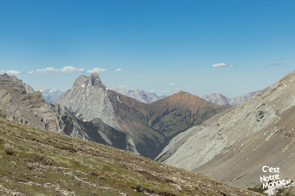
You can then decide to retrace your steps to reach the parking lot (3.6 km, 2.2 mi), or go for the complete loop. The latter (for experienced hikers) consists of following the low-exposed ridge for about 1.7 km (1.1 mi). We liken it to walking on air! Once reaching the end of the ridge, descend in the opposite direction of the road to reach a plateau below and enter the valley between Opal Ridge and Grizzly Peak, which then leads back to the road.
The Opal Ridge loop is a difficult hike involving some scrambling and bushwacking sections.
Once you have reached the plateau, there is a small path (difficult to identify in places) that will take you through several scree sections on the mountains. Be careful! These sections are very poorly maintained and require a lot of bushwacking (route finding). We do not recommend this part to inexperienced hikers. After 2.3 km (1.4 mi), you will reach a service road, following the AB-40 road. Follow this for 3 km (1.9 mi) to reach the parking lot.
TO KNOW
Interest
Difficulty
Distance
Round Trip: 7.15 km / 4.4 miles
Loop: 11.75 km / 7.3 miles
Duration
Around 4 or 8 hours
Elevation
2575 meters / 8448 feet
Elevation gain
Round Trip: 970 meters / 3186 feet
Loop: 1050 meters / 3445 feet
Useful informations
See on Caltopo (detailed)
See on Google Maps (basic)
Useful links
Website: https://www.albertaparks.ca/parks/kananaskis/kananaskis-country/
Parking: https://goo.gl/maps/JBd4W8MmjoHaz8a27
Weather forecast: https://www.mountain-forecast.com/peaks/Mount-Evan-Thomas/forecasts/3098
Download GPX: https://www.cnotremonde.com/gpx/Opal-Ridge-AB-cestnotremonde.gpx