 Alberta
Grizzly Peak
Introduction
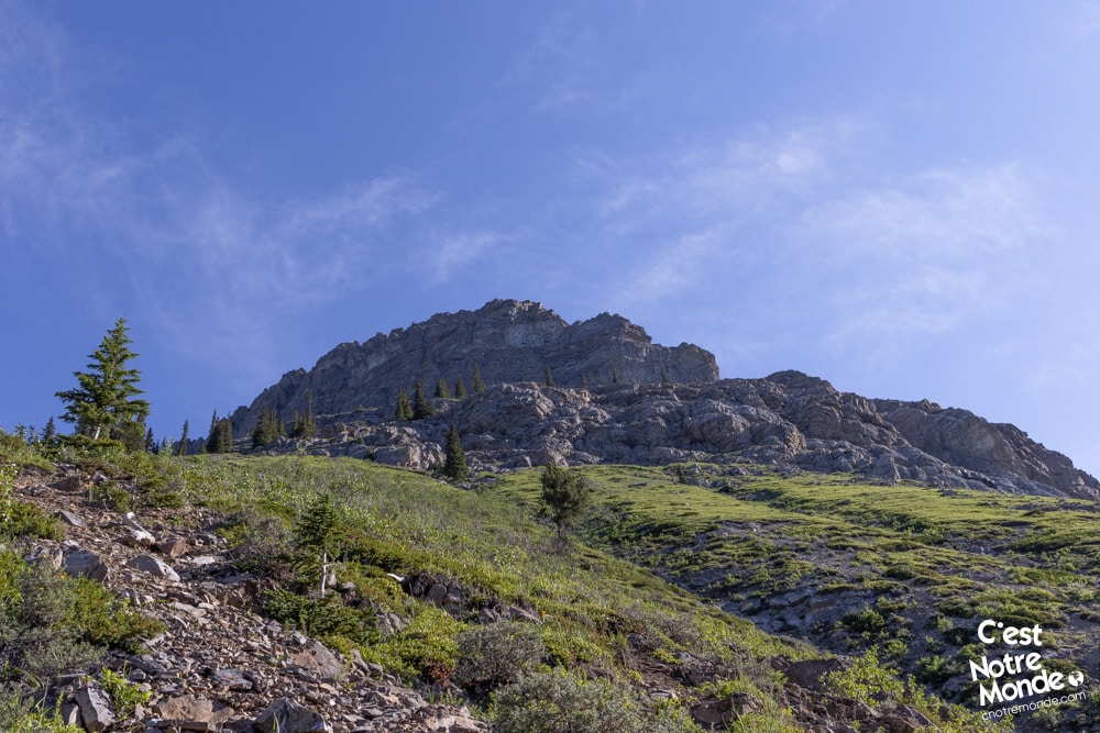
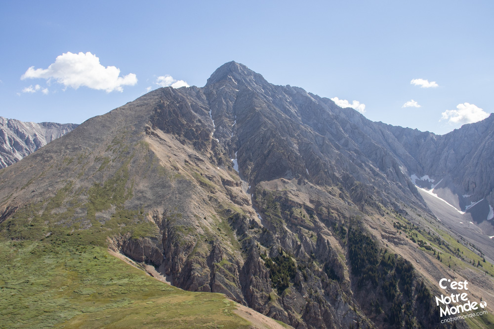
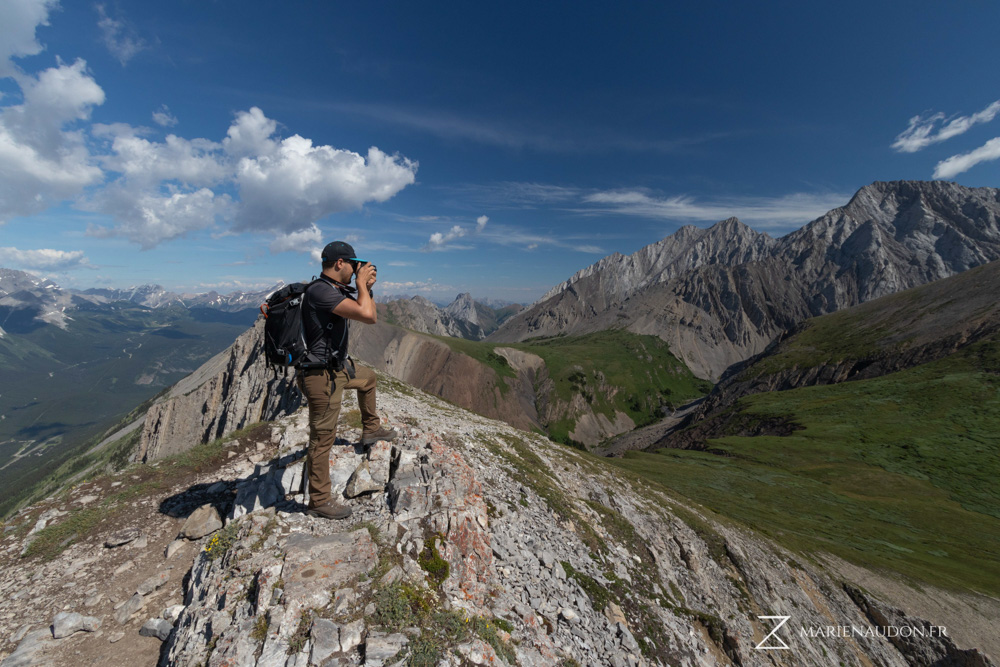
Grizzly Peak is a 2545 meter-high (8350 ft) mountain located in Peter Lougheed Provincial Park in Kananaskis country (Canadian Rockies). The trail taking you to the top is short but steep. Therefore, this hike shouldn’t be taken lightly. There are some easy scree sections that also contribute to the intensity of this scramble. The views at the top, however, are worth the effort. C’est Notre Monde considers this hike a favorite and invites you to discover this beautiful mountain!
3D interactive map by our partner FATMAP – the outdoor adventure platform for web and mobile
Getting to Cascade Mountain trailhead
Parking access to Grizzly Peak hike: https://goo.gl/maps/nZLvb2u5KiK6TbEy9
From Calgary: 120 km – 1h20 driving time
Take the Trans-Canada hwy AB-1 West toward Banff for 50 km until the 118 exit toward Kananaskis Country. Follow the AB-40 South for 45 km. There is no parking lot, but you can park alongside the road. No clear sign indicates the trailhead, make sure to note the exact location on your GPS.
Helpful information
To enjoy your hike, you must:
Be Equipped: Hiking boots are a necessity. A steep section of the hike (easy scramble) requires ankle protection. Hiking poles are also recommended on your way down. Bears are usually present in the area, therefore bear spray should be easily accessible in the case of unexpected encounters. Finally, always bring water and food in sufficient quantities.
Parking: You can park alongside the edge of the road (mountain side).
Information: Access to Kananaskis Country is not free. You will need to register your vehicle(s) online on the Kananaskis park website and purchase a daily or annual pass. Note that the fees are per vehicle and not per hiker, so carpooling is an option. Be mindful of the forecast and visit the park’s website before your hike to find up-to-date information such as last seen wildlife, trail conditions, etc.
The Hike
From your very first steps, it is going up! Departing from the road, you will find a well-worn trail going up on the left of Grizzly Creek. This hike is mostly clear of trees (which is more motivating than walking in the forest). After a steep rocky section (easy to pass), the vegetation becomes scarce and gives way to meadows with wildflowers as far as the eye can see. Also, a few short flat sections allow you to catch your breath.
Grizzly Peak is a mountain located in Kananaskis Country, Alberta. While this amazing hike is difficult, the views at the top are spectacular.
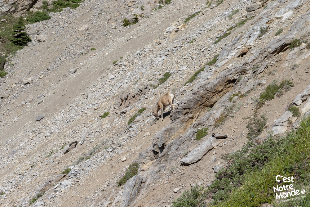
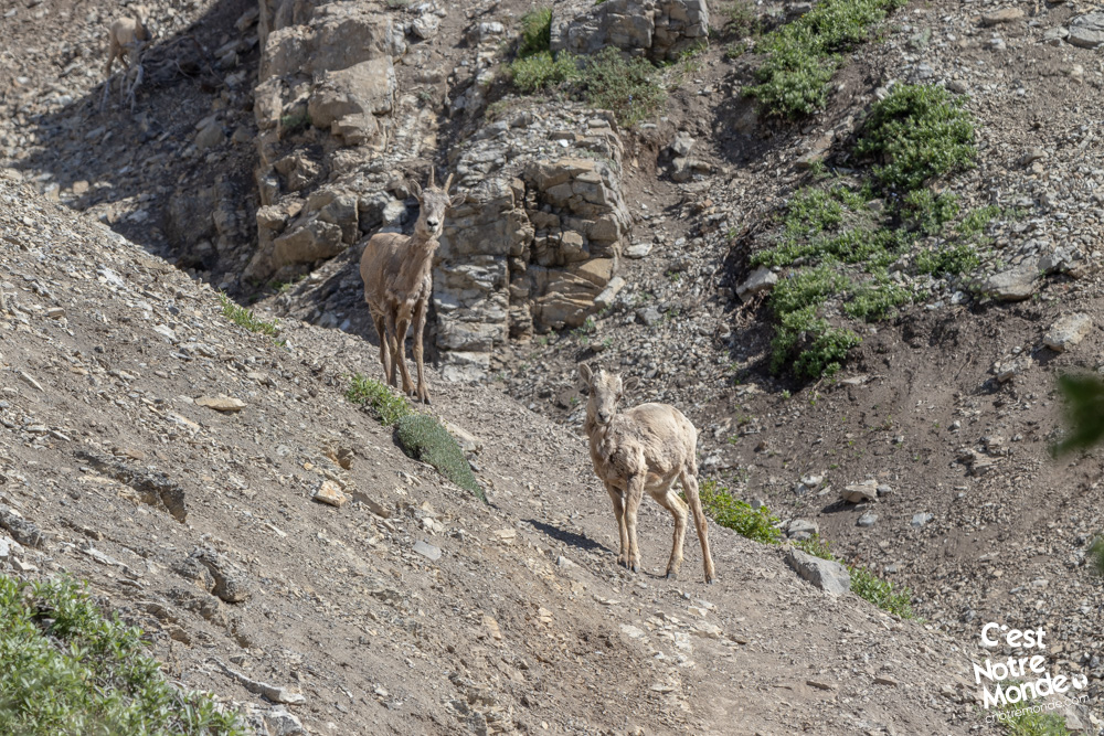
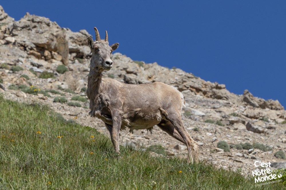
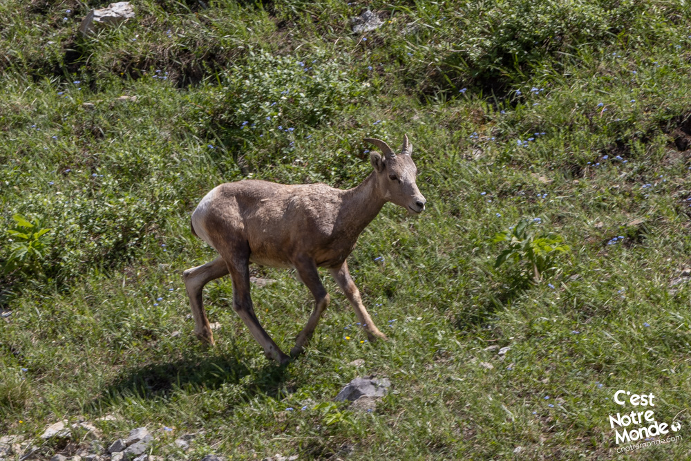
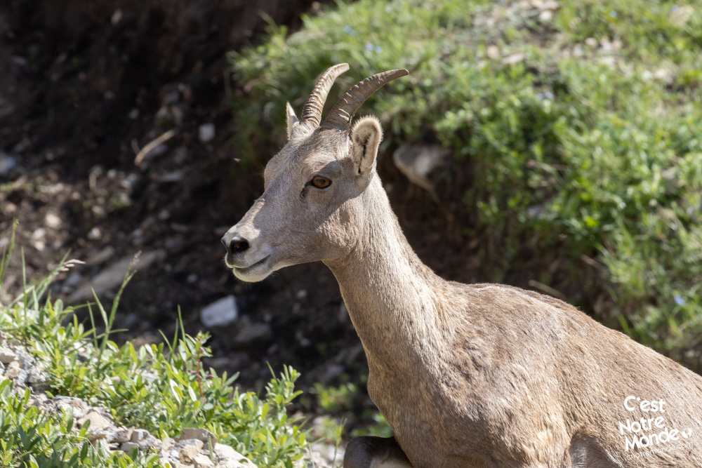
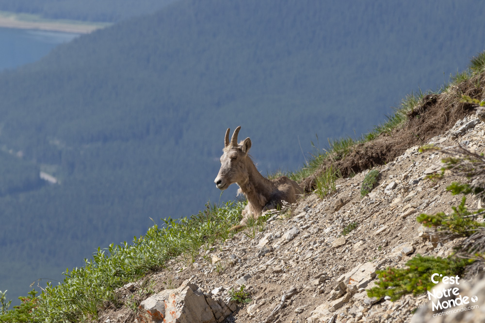
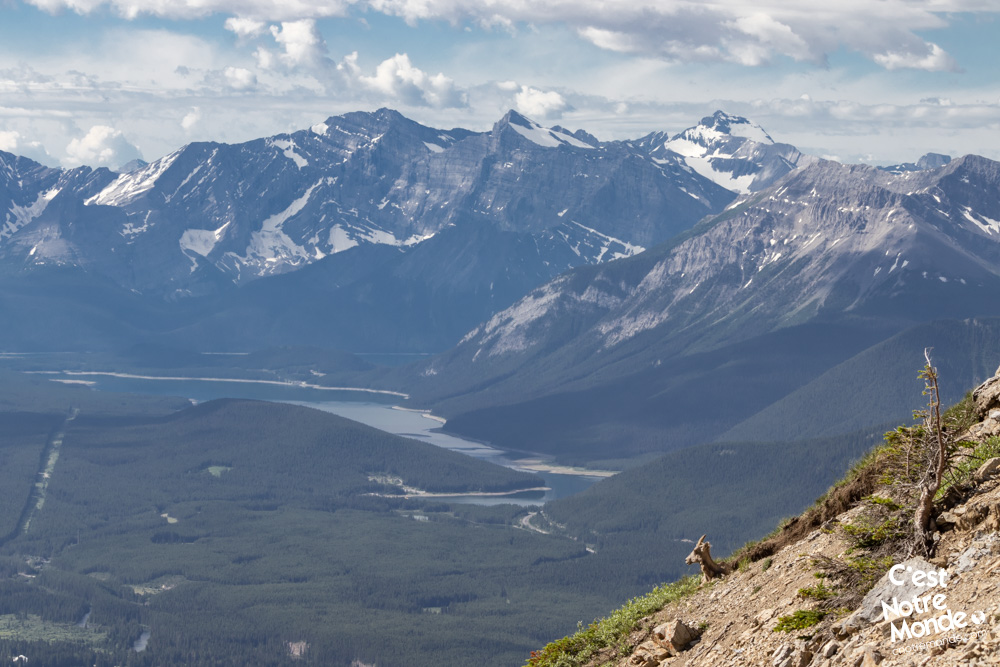
After 1.6 km (1 mi), the trail takes another turn that we will call “more vertical”. The next 700 meters (0.44 mi) are indeed quite steep with fairly unstable sections of small rocks giving you the impression of retreating while advancing. Take your time, this passage is the most challenging part of the hike in our opinion. During our ascent, we were lucky enough to encounter a herd of wild mountain goats! Be careful, these charming creatures can trigger rock falls tumbling at full speed toward you. Do not hesitate to wear a helmet to protect yourself.
This hike shouldn’t be taken lightly. There are some steep scree sections that also contribute to the intensity of this scramble.
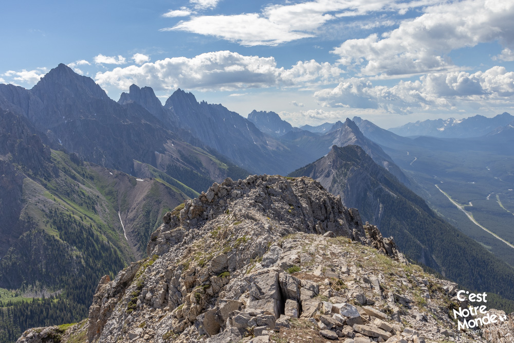
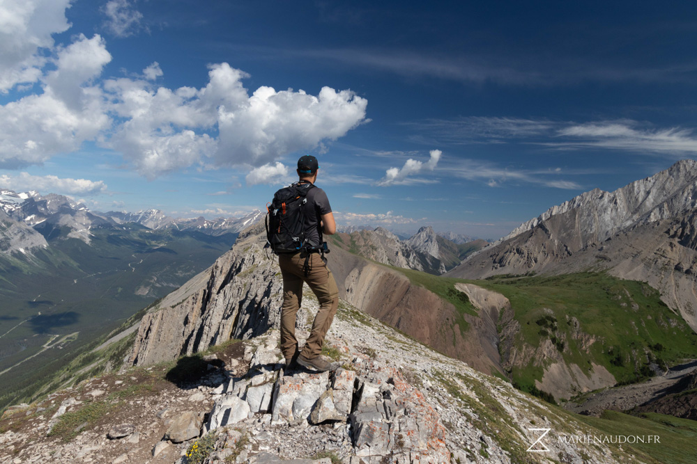
Finally, after this short but exhausting steep section, you will arrive at a magnificent plateau covered with wildflowers. This idyllic and calming area is one of the most beautiful places in Kananaskis in our opinion. The summit of Grizzly Peak is on the left. Just 400m of distance with one final climbing section to reach it.
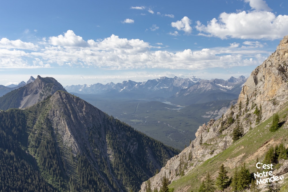
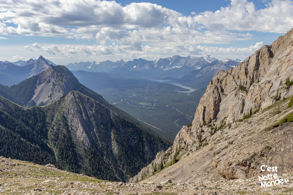
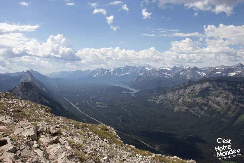
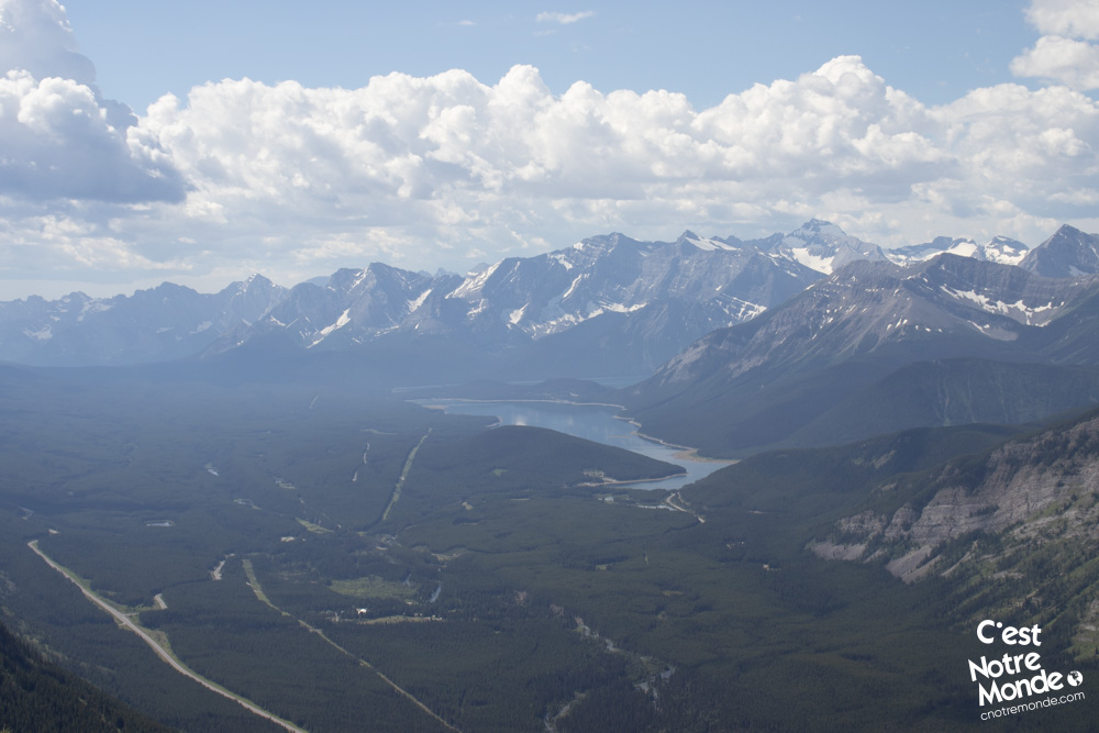
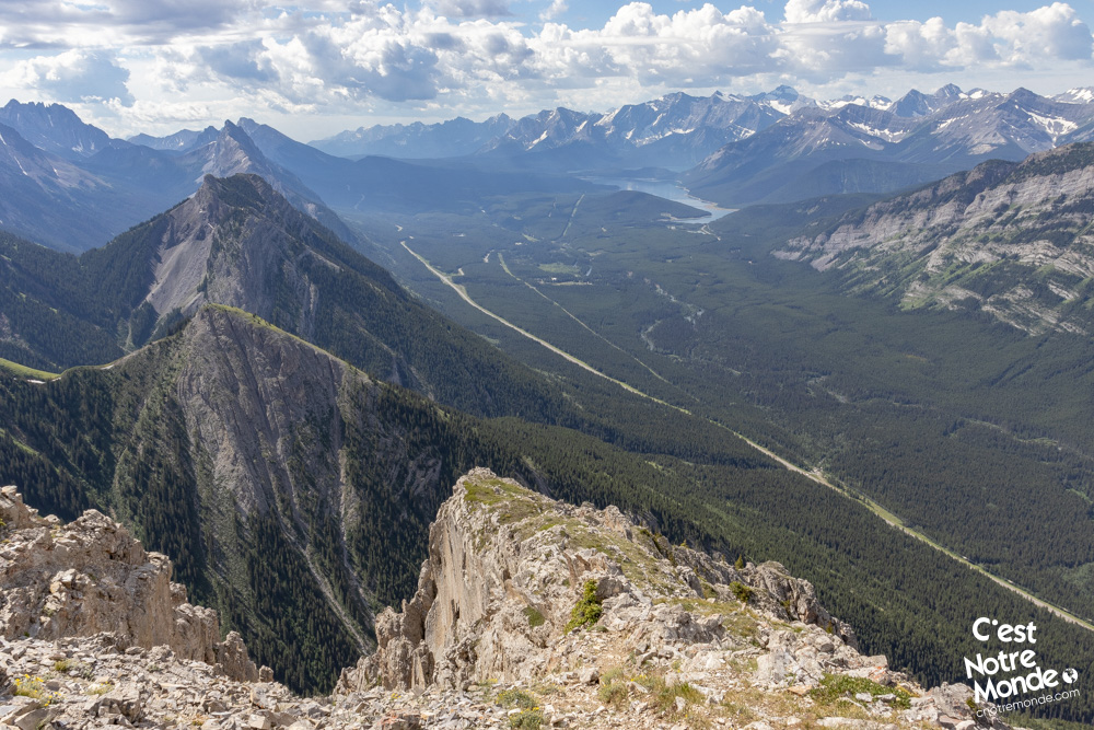
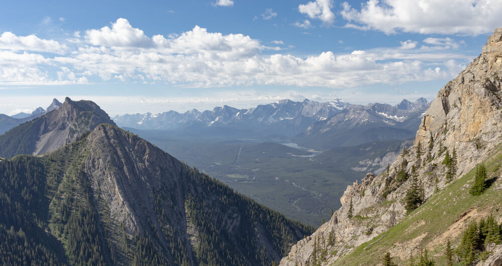
The view of Lower and Upper Kananaskis Lakes is incredible. You may also notice South Lawson Peak, King Creek Ridge and Opal Ridge surrounding you.
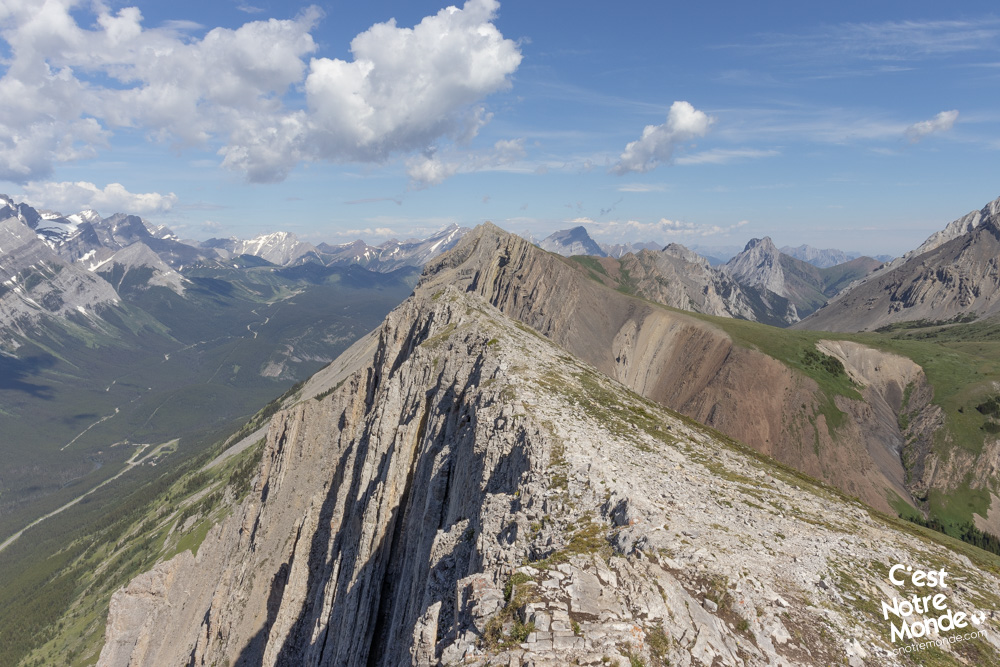
Once at the summit (2545m), you will find yourself at the top of a cliff, overlooking the AB-40 road. You’ll be able to see where you parked your car, 870m below. Quite vertiginous !Retrace your steps to return to your car. Note that walking sticks are very useful for keeping your balance on steep sections. If you are not afraid of heights, you can walk along the summit ridge. The view of Lower and Upper Kananaskis Lakes is incredible. You may also notice South Lawson Peak, King Creek Ridge and Opal Ridge surrounding you.
Retrace your steps to return to your car. Note that walking sticks are very useful for keeping your balance on steep sections.
TO KNOW
Interest
Difficulty
Distance
Approximately 5.8 km / 3.6 miles
Duration
Around 4 or 5 hours
Elevation
2545 meters / 8350 feet
Elevation gain
Around 860 meters / 2120 feet
Useful informations
See on Caltopo (detailed)
See on Google Maps (basic)
Useful links
Website: https://www.albertaparks.ca/parks/kananaskis/peter-lougheed-pp/
Parking: https://goo.gl/maps/nZLvb2u5KiK6TbEy9
Weather forecast: https://www.mountain-forecast.com/peaks/Mount-Packenham/forecasts/3000
Download GPX: https://www.cnotremonde.com/gpx/Grizzly-Peak-AB-cestnotremonde.gpx