 North Saskatchewan River
Vision Quest
Introduction
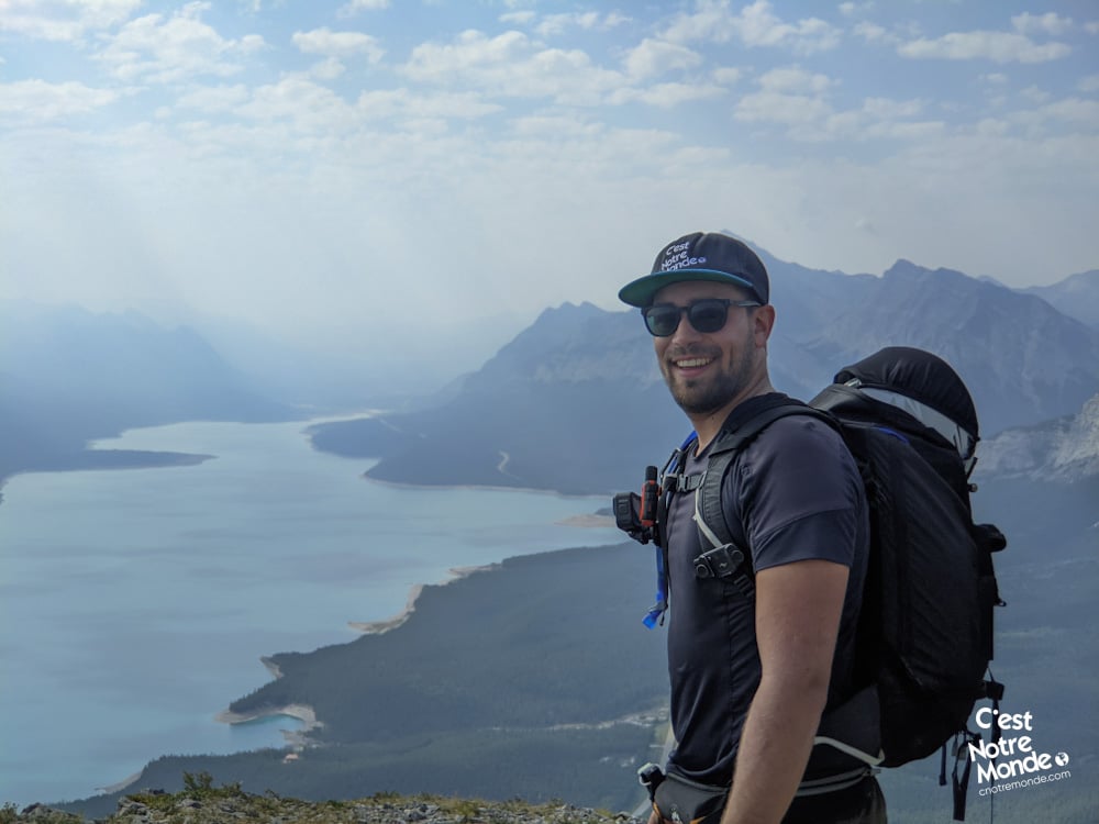
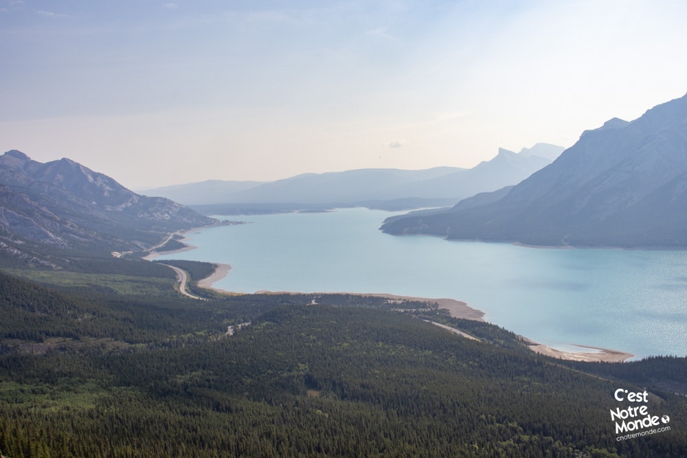
Vision Quest rises proudly above the shores of the iconic Abraham Lake, located in a popular public land use zone in Alberta. Standing at 2135 meters, the summit of Vision Quest offers hikers a stunning panoramic view of the turquoise lake and the surrounding peaks of the Canadian Rockies.
Reaching the true summit of Vision Quest involves a moderately challenging hike with some exposed sections. However, you don’t need to complete the scramble to enjoy incredible views. A first ridge summit is accessible via a regular hiking trail, making it a great option for those seeking a scenic experience without technical climbing.
Whether you’re a seasoned adventurer or simply looking for a rewarding day hike, Vision Quest is a must-do trail in Alberta. The combination of dramatic landscapes and sweeping panoramic views over Abraham Lake makes this one of the most memorable hikes in the Canadian Rockies.
3D interactive map
Getting to Vision Quest Trailhead
Parking access to the Vision Quest hike: https://maps.app.goo.gl/Mk8xEWbu3AYGEUaQ7
From Calgary: 310 km – 3h30 driving time
From downtown Calgary, take the Trans-Canada Highway (AB-1 West) for 176 km, then exit onto AB-93 North toward Jasper. After passing the Parks Canada toll gate, you’ll join the iconic Icefields Parkway, which connects Lake Louise to Jasper. Follow this scenic route for 75 km until you reach Saskatchewan Crossing, then turn right onto the David Thompson Highway (AB-11 East). Continue for 47 km until you reach the Vision Quest parking lot, located on your left at the end of a short gravel road.
Helpful information
To enjoy your hike, you must:
Be Equipped: Hiking boots are no longer optional — they’re essential. A steep section through a rocky scree slope requires solid ankle support. Trekking poles are also highly recommended, especially for navigating the rocky descent. If you plan to tackle the scrambling section, a climbing helmet is advised for protection against potential rockfall. Grizzly bears are known to frequent the area, so carrying bear spray is strongly recommended as a last resort. And of course, don’t forget to bring plenty of water and food to keep your energy up.
Parking: The parking lot is located at the end of a dirt road and offers plenty of space.
Information: Vision Quest is located outside of national or provincial parks, within a Public Land Use Zone (PLUZ). This means there is no official trail marking or infrastructure. Be sure to check trail conditions on social media or local hiking community forums before heading out.
The hike
Vision Quest Hike: A Short But Steep Adventure
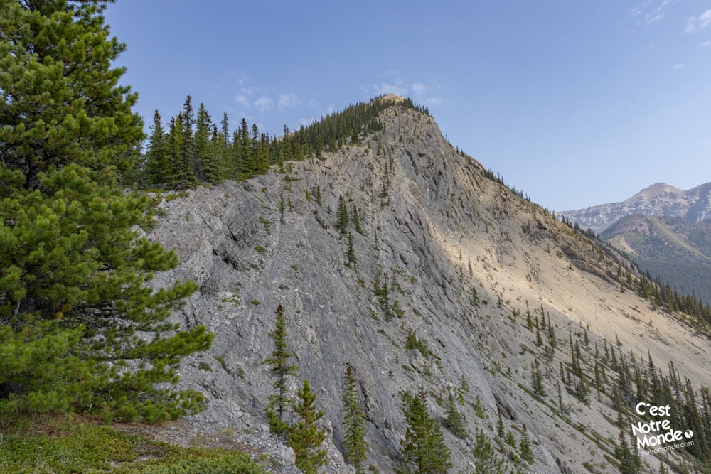
The Vision Quest hike is a straightforward yet intense trail that climbs steeply from start to finish. With just one well-defined path, there’s no room for hesitation — it’s uphill all the way.
The trail begins in the forest and quickly ascends toward the summit without any switchbacks. Be ready for a sustained physical effort, as the hike gains 670 meters (2,200 ft) of elevation in only 1.8 km (1.1 mi). It’s a steep climb, but the rewards come fast.
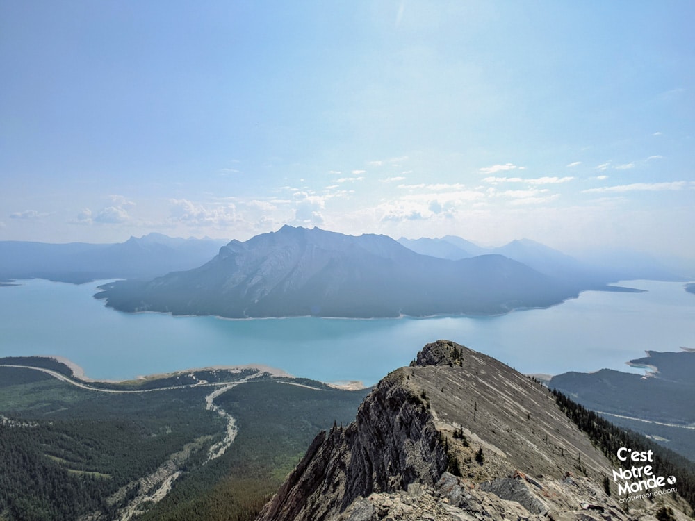
As you gain elevation, breathtaking views begin to unfold — especially of Abraham Lake and the scenic North Saskatchewan River Valley. At times, the trail disappears into rocky sections, and you’ll need to pick the most logical route to keep ascending. The terrain can be loose and slippery, so careful footing is essential.
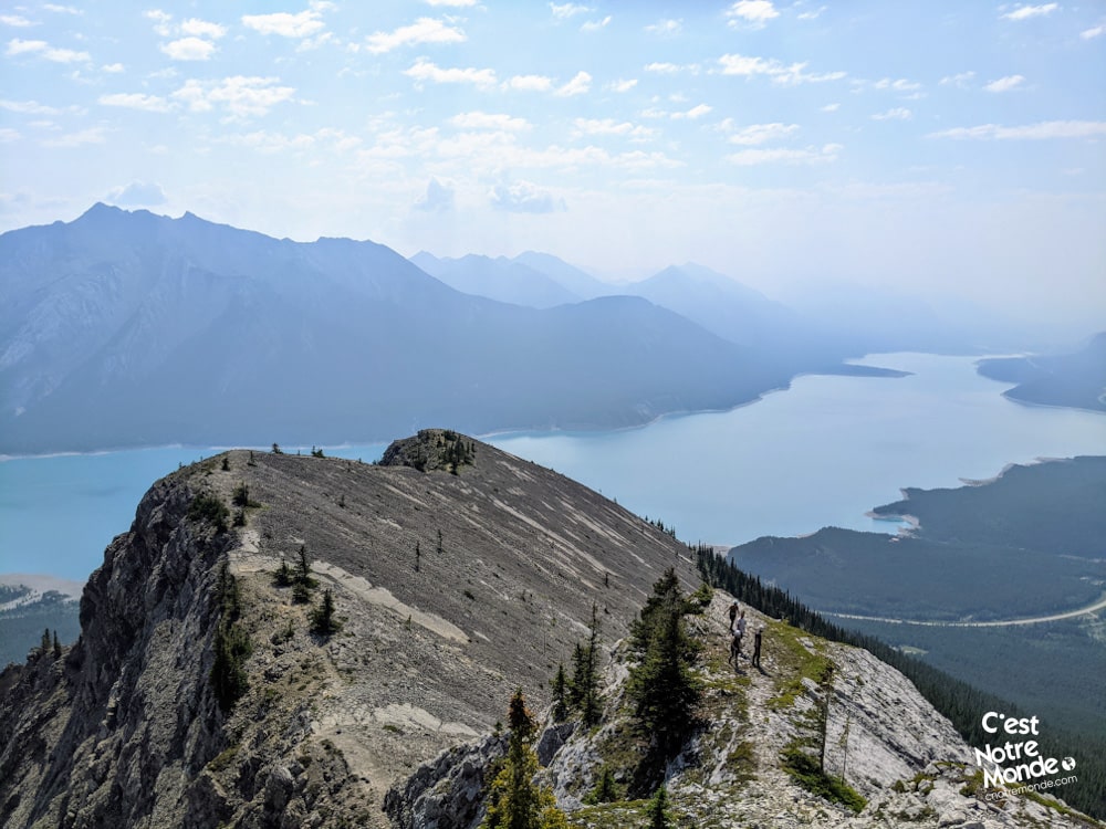
Vision Quest Ridge Summit
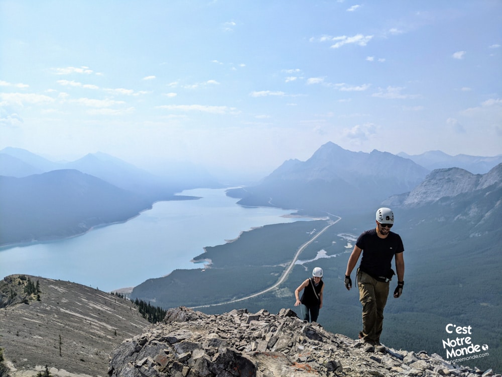
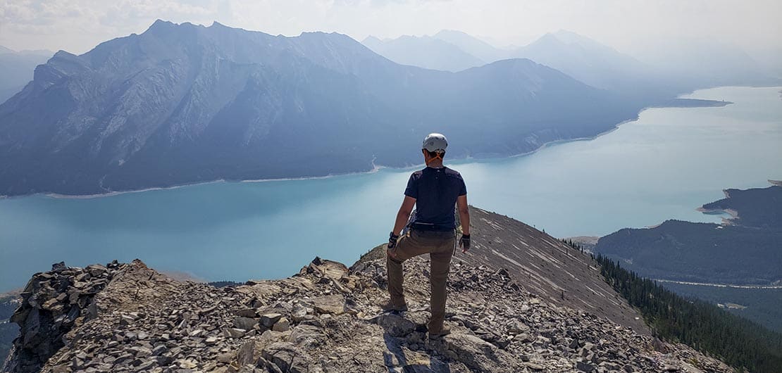
After the steep climb, you’ll reach the Vision Quest ridge summit, the first main viewpoint. From here, the views over Abraham Lake are spectacular — especially on sunny days when the lake turns a striking turquoise. This spot alone makes the effort worthwhile.
At this point, you have two choices:
- Head back down the same way.
- Or continue on to the true summit of Vision Quest, via a moderate but slightly exposed scramble.
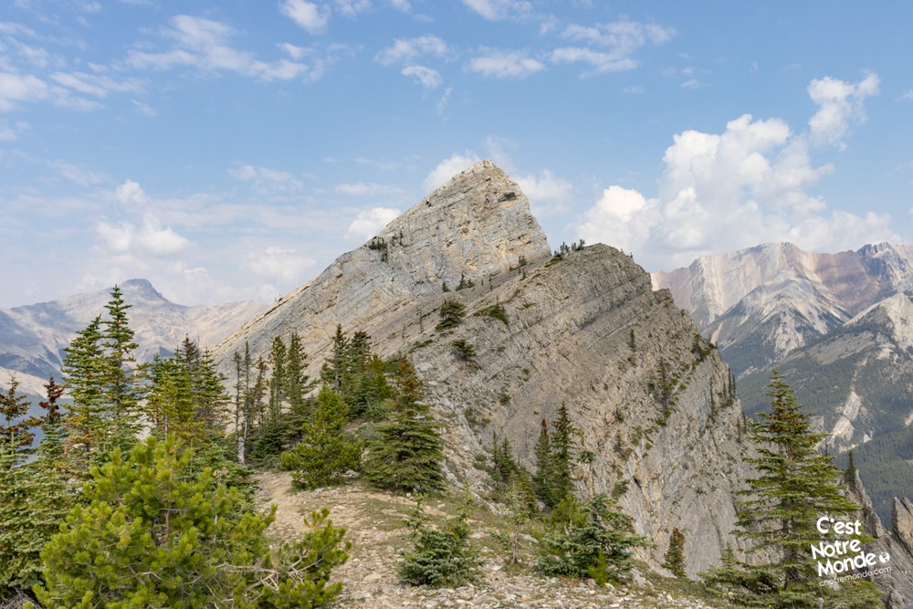
Reaching the True Summit of Vision Quest
To continue, follow the ridge to the left from the viewpoint. After a short traverse, you’ll come face to face with a steep rock wall. While it may look intimidating, it’s not fully vertical and offers solid hand and footholds. We recommend wearing a helmet here due to the risk of falling rocks.
After this section, you’ll face two smaller vertical steps that are slightly more technical. These can be tricky, especially in wet conditions. In 2023, climbing anchors were spotted in this area, allowing experienced hikers to use protection if needed. That said, hikers confident in scrambling can likely manage without gear — just take your time.
Once past these obstacles, you’ll reach another ridge leading to the true summit of Vision Quest, marked by a cairn. The views here are just as stunning as from the ridge summit, offering a sweeping perspective of the surrounding peaks and valleys.
Descending Vision Quest
The descent follows the same route. Be mindful on the way down — the scrambling sections that were fun to climb can feel more exposed and technical in reverse.
TO KNOW
Interest
Difficulty
Distance
Approximately 4.6 km / 2.9 miles
Duration
3-5 hours
Elevation
2135 meters / 7005 feet
Elevation gain
Around 750 meters / 2460 feet
Useful informations
See on Caltopo (detailed)
See on Google Maps (basic)
Useful links
Parking: https://maps.app.goo.gl/Mk8xEWbu3AYGEUaQ7
Weather forecast: https://www.mountain-forecast.com/peaks/Mount-Michener/forecasts/2545
Download GPX: https://www.cnotremonde.com/gpx/Vision-Quest-AB-cestnotremonde.gpx